New Zealand Weekend Forecast, July 14th – A Couple Of Light Snowfalls Amidst The Strong Westerly Flow
Mountainwatch | The Grasshopper
Written early Friday 14thJuly, valid to Sunday 16thJuly
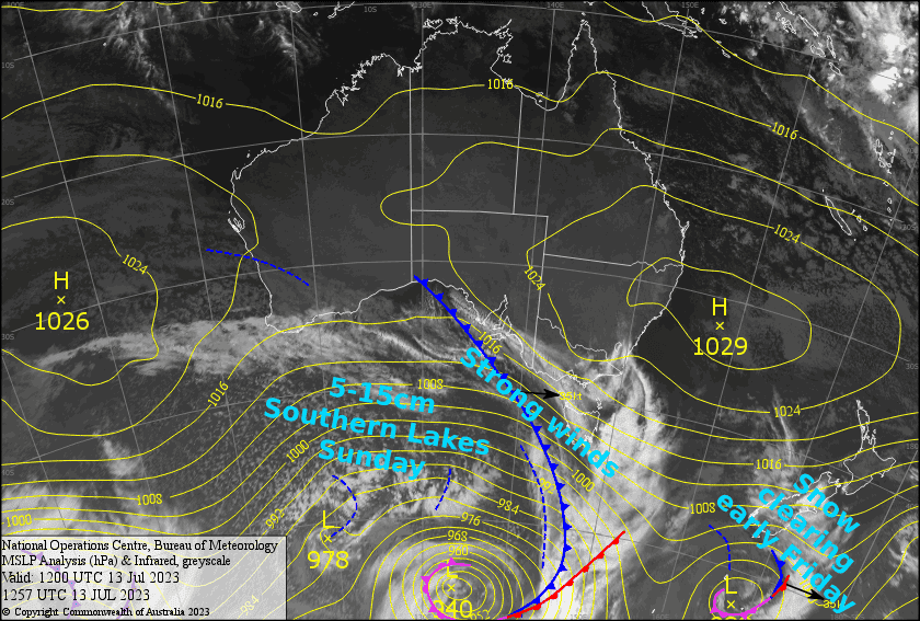
A strong, disturbed westerly flow will continue to blow over New Zealand the next several days. We call it “disturbed”, not because it will rattle your windows and whip the froth off your flat-white, but because passing fronts embedded in the flow will in fact tilt the winds northwest, then southwest, and bring about periods of rain/snow, as well as sunshine if you happen to be east of the Main Divide like all the ski resorts are.
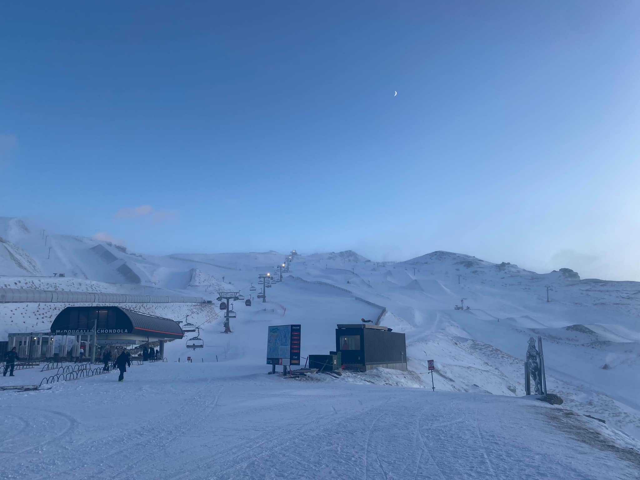
The first of such fronts is smack-bang over the South Island at the time of writing, with just a wee top-up expected on mid-upper slopes of the Southern Lakes, and a skiff for the Canterbury club fields.
The second front will pass over the South Island early Sunday, with 5-15cm of snow expected for the Southern Lakes, although temps are marginal down low so it’ll a fine line between snow and rain there.
We’ll hardly notice the fronts passing on Ruapehu, not just because they’ll be weak by the time the reach the mountain, but also because they’ll just blend in with the general bleak, super windy, persistent rainy/snowy conditions there.
Friday 14th
Overnight snow on mid-upper slopes and rain down low will have cleared the South Island by dawn for a mostly fine day. However, there’ll be plenty of cloud through the afternoon and westerly winds will still be strong in exposed areas, but they’ll start to abate during the arvo, especially in Canterbury.
It’ll be a day for the hardy on Ruapehu, as strong-gale SW winds continue to blow in light showers, which will build into more persistent, slightly heavier falls for the afternoon, thankfully falling as snow on mid-upper slopes.
Saturday 15th
A partly cloudy/sunny day for the South Island. A lot of it will just be high cloud though, especially in Canterbury. NW winds rising to gale.
On Ruapehu, light snowfalls on mid-upper slopes, falling as drizzle/light rain down low, will clear during the afternoon with increasing sunshine as the cloud disperses. However, SW winds will remain fairly strong.
Sunday 16th
The Southern Lakes will have a period of snowfall around dawn, about 5-15cm of it, but it could be the wet stuff on the lower slopes. Conditions will then quickly improve for a partly cloudy day with cold westerly winds.
In Canterbury there’ll be severe gale NW winds as rain develops during the morning. A light, cold S-SW change during the afternoon will clear the rain from the club fields, but bring snow showers to Mt Hutt and Porters Pass.
Another rough day on Ruapehu with gale-severe gale westerlies. Light rain/drizzle during the morning, will build through the latter half of the day into more persistent rainfall, falling as snow about the upper slopes.
Extended Forecast
Strong winds from the winds will continue early next week, with Ruapehu receiving a top-up of snow Monday as front number two brings a cold change there, while just scattered snow showers blow over the Main Divide of the South Island.
Then next Wednesdayand Thursday will see a low-pressure system passing up the country, firstly bringing strong northerlies and heavy snowfall to at least mid-mountain, then followed by a cold southerlies and snow to low levels.
That’s all from me today, folks. See you again Monday.
Grasshopper


