New Zealand Weekly Forecast, July 18 – Weather Eases in South Tomorrow, Messy Mid-week of the North
Mountainwatch | The Grasshopper
Some wild weather in the South Island today with resorts closed due to wind, snow/rain. Looking ahead it will be messy mid-week, gradually giving way to southerlies as a low quickly deepens to the east. A promising high for the South Island on the weekend, and likely bringing a better weekend for the North Island than we’ve seen of late.
Tuesday 19th July
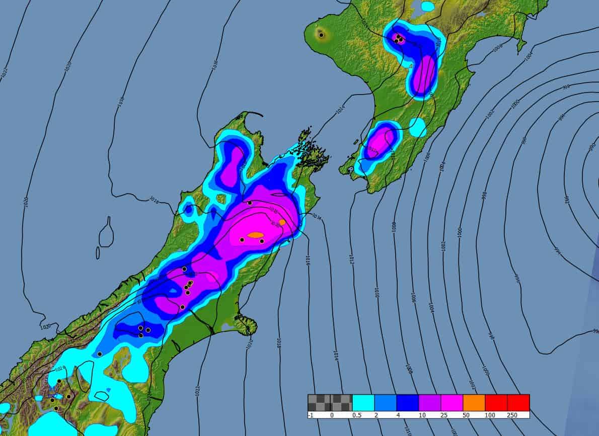
The big nor’west rain for the South Island ought to be easing away today. This should have brought respectable totals for higher parts of most ski-fields, but the very lowest parts may have been a bit more marginal with a sleety mix. A southerly sneaking in behind this brings snow to lower levels, but with lesser amounts (likely 10cm at most). This should only make it about halfway up the island – if that – by the end of the day.
Readers won’t be shocked to hear that Tuesday is hardly vintage for the volcanoes, as the northwest frontal system moves onto the North Island. It’s not a complete write-off though, with the possibility of up to 20cm for the higher slopes, though the lower reaches are quite likely to be stuck in rain yet again.
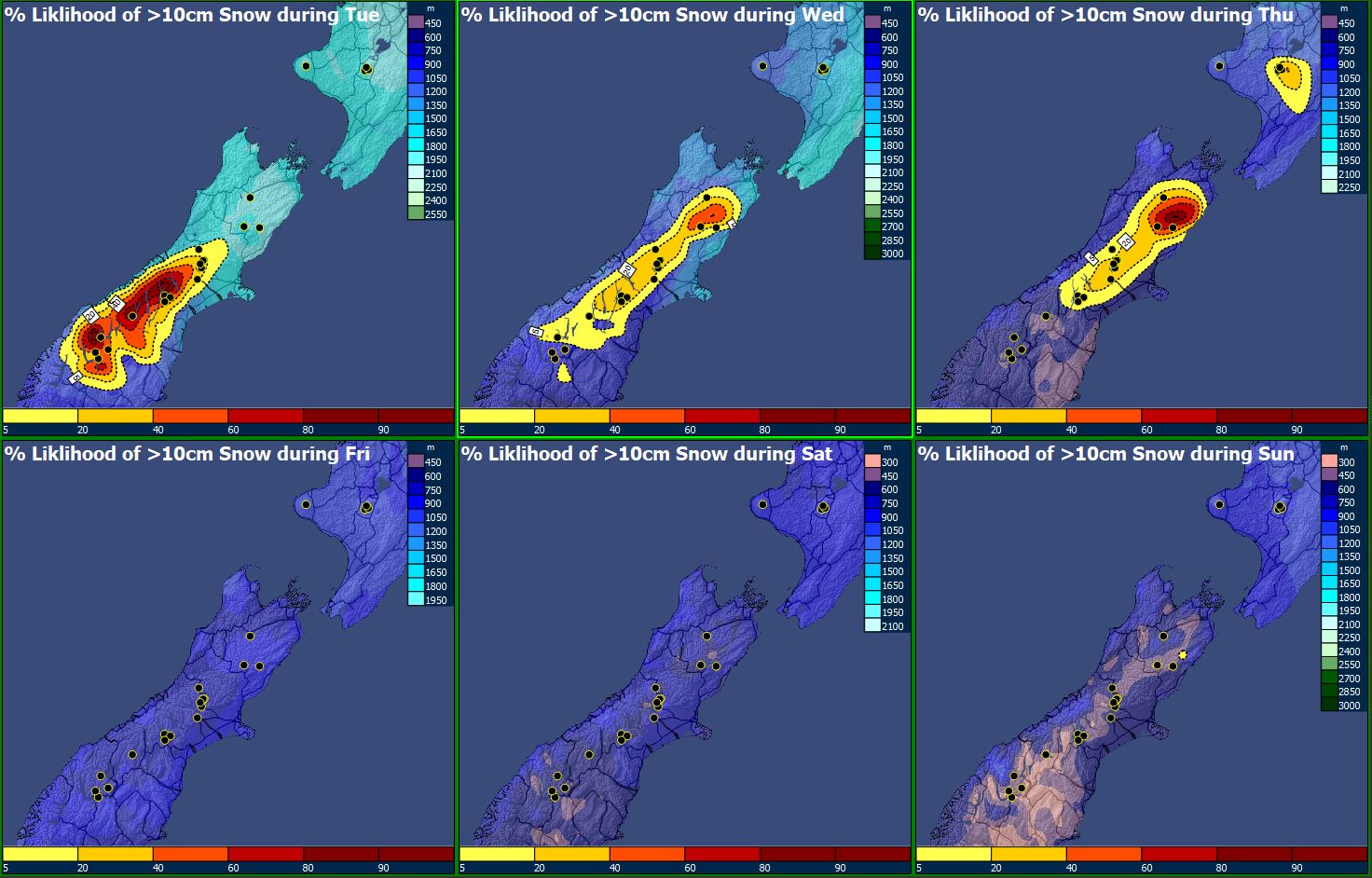
Wednesday 20th July and Thursday 21st July
The North Island remains firmly on the naughty step as a series of fronts stall in the area and multiple low pressure centres form. It’s all starting to sound a bit familiar, and with a warmer airmass than Tuesday, the chances of any meaningful snow look dubious. The low should lie to the east on Thursday, allowing colder air to move in, and finally bringing snow to most levels. Southwest gales as looking likely though with the low deepening, so it’s a day to stay off the slopes.
Various lows are swarming the country like sandflies and the South Island won’t “miss out”. With cold air advancing further on Wednesday and the low reinvigorated out to the east, this could make for a good snow making situation, mainly for the Canterbury fields. Up to half a metre is possible in north Canterbury. Expect southerly flurries for Wanaka and Queenstown fields.
There may be a gradual improvement from Thursday – the best bet is for those furthest south. This could pan out pretty well for Queenstown, and especially Wanaka. Winds should not be a problem on Wednesday but watch out as they pick up quickly on Thursday, especially in the northern half.
Friday 22nd July and Saturday 23rd July
Some good signs for Friday as a fairly quiet southerly flow covers the whole country. Don’t count on bluebirds galore – there may be some clag and flurries around, especially for Canterbury – but winds should be easing everywhere, though only slowly for the North Island.
Saturday – a decent looking high over the South Island could make this the best day of the week. Meanwhile, easterlies over the North Island. This should make the volcanoes quite windy, with variable amounts of cloud – Whakapapa should be most sheltered.
Sunday 24th July
This is shaping up to be a ditto day. Not bad again for the South Island – the high may start getting “dirty” but all the more reason to get up high and try to escape any valley cloud. Meanwhile easterlies continue for the North Island without really picking up much, and likely remaining dry.
Extended Outlook
Someone needs to swap out the scriptwriter. The North Island rehashes its theme of “low from the north making a real mess of things” for yet another series. These situations can enhance a blocking set-up in the atmosphere, which means that the South Island could get a decent run under a high that may not go anywhere fast.


