SNOW SEASON OUTLOOK 2014 – Australia
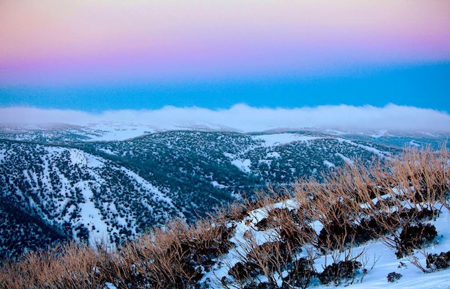
Another year, another snow season. After the winter of 2013 it won’t be hard to improve this year, but here’s hoping it’s a marked improvement Image:: Falls Creek/Hocking
Australian Seasonal Snow Outlook | The Grasshopper
Brought to you by ESS Boardstores
Here we are releasing the first snow outlook for the 2014 season and they’re still showing cricket on the telly. Kind of appropriate, because making forecasts based on the present weather situation feels like facing bouncers from Lillee at one end and wrong’uns from Warney at the other. But I’m padded up and ready to whack a few misconceptions to the boundary, so let’s take guard
The first thing you need to know about this season is your climate catchphrase for 2014, and that is “El Nino”. Over the next few months you’re going to continually hear about a strong El Nino event brewing in the Pacific Ocean. Journalists all over Australia will be combing Wikipedia or the Bureau’s website for the quickest, easiest things they can say about El Nino, and they are going to repeatedly tell you to get ready for drier and warmer conditions.
Yeah, nah… Maybe
Here’s my advice for you, snow lovers. Block out the noise. You’re not going to get any useful information from a journo who didn’t take science past year ten and has been ordered to write at the comprehension level of a ten-year-old. All you’re going to get is dumbed down analysis, cobbled together from bland internet sources and vanilla press releases that tell you nothing useful about what it all means for the Aussie Alps. Lucky you’ve got Mountainwatch looking out for you then eh?
Let’s not get carried away
To be fair, there are some pretty reliable observations of sea surface temperature coming in right now that suggest an El Nino event is on its way to the Pacific. This is backed up by climate models that have become more and more confident over the last few months that we will be in the midst of a full blown El Nino by August. And it is true that on average El Nino events generally end up with below average precipitation across the south-east of Australia. Daytime temperatures are on average warmer, but this is on average balanced out by cooler overnight temperatures. In other words, mean temperatures over a whole day don’t change much, but temperatures vary more through the day, and there can be more opportunity for snow making at night.
However, there are two very important caveats to all this:
1) We can’t be certain yet that we’re going to get an El Nino.
2) Even if we do get an El Nino event, we can’t be sure that we will get an average response.
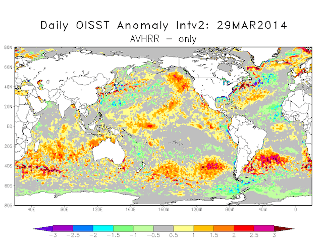
Sea surface temperatures are starting to push above average along the equator.
We need to talk about climate models
Specifically, we need to talk about how climate models struggle to see past the April/May period to what’s going to happen on the other side. This is the time of year when temperature variations from west to east across the Pacific Ocean even out, and the eastern Pacific usually returns to a normal state. There’s much less variation at this time of year than at others. This means that the real temperature anomalies across the Pacific are about the same size as the forecast errors of the models one to two months ahead, and so these errors are more likely to send the climate models off on a tangent. This is close to the worst time of year to trust the models four months out – although they do still have _some_ skill.
Be that as it may, there’s a pretty overwhelming signal from the models that we’re heading for an El Nino by August, and this is being backed up by observations on the ground – or in the ocean as the case may be.
So what could go wrong? Well, we were in a similar position back in June 2012, with a very promising El Nino on the way, only to see it crash and burn between September and November. The problem is that at this stage we can’t rule out a repeat failure-to-launch.
One name, many flavours
The other key issue we have to stare down when forecasting this far in advance is the tremendous variation between individual El Ninos. In the winter of 1982, the world was heading into an El Nino event to remember, and Australia got a ski season to forget, with Spencer’s Creek reaching a measly peak snow depth of 91cm.
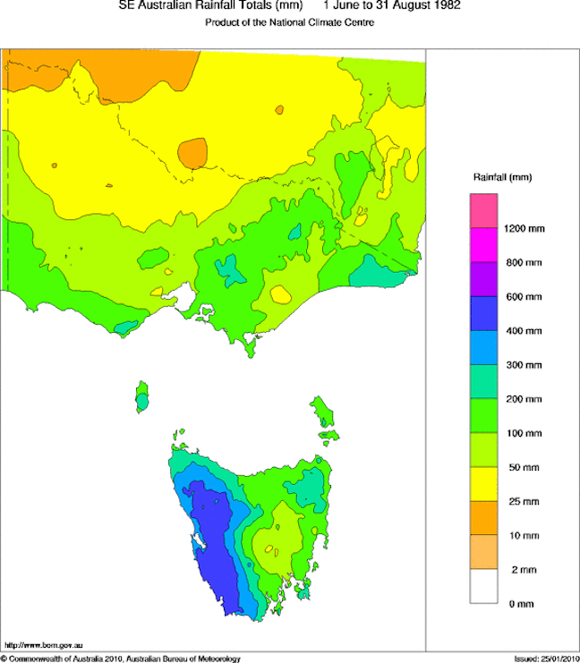
Image::BOM
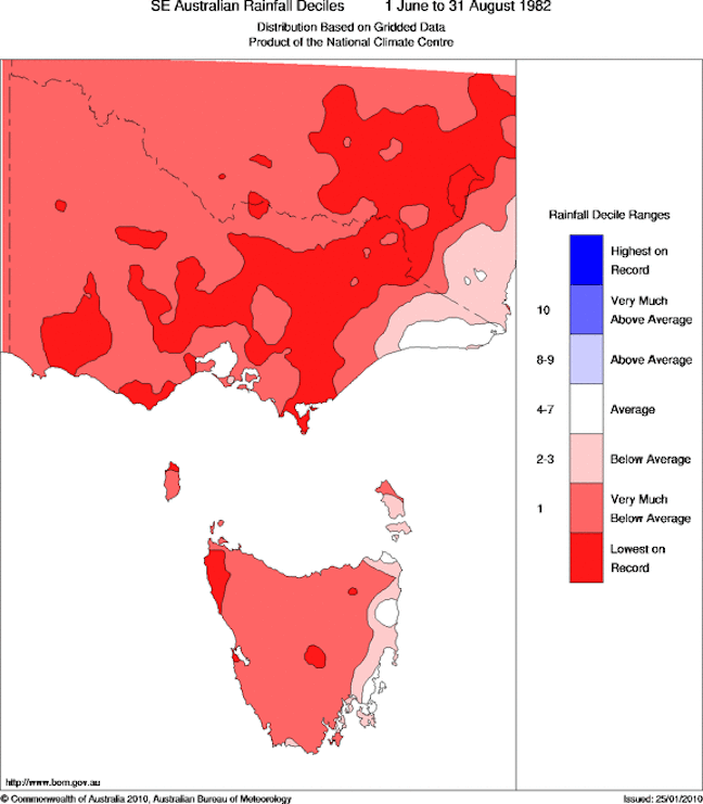
Winter 1982 was pants. Image::BOM
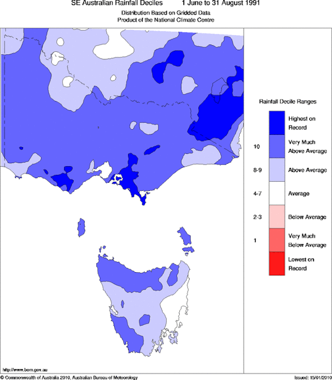
Fast forward to 1991 and a strong El Nino was on the way, but this didn’t stop skyloads of snow falling across the Alps. It was the wettest winter on record for parts of the Australian Alps and Spencers Creek put on a marvellous 285 centimetres, while Hotham managed over three metres. Reggae is still talking about it, but as long as he’s buying the beers I don’t mind listening.
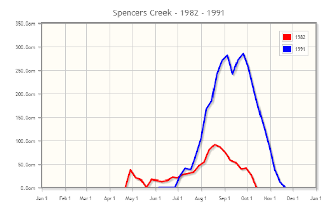
Image::Snowy Hydro
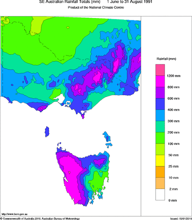
Image::BOM
Winter 1991 made me want to take off my pants Image::BOM
Since 1971 we’ve seen the Pacific Ocean exhibit El Nino conditions during winter on 12 other occasions (I’m going to count out 2012 here, as it didn’t fall-apart until September). Sometimes the Bureau officially recognises these events as an El Nino, sometimes they don’t, but I try to avoid cherry picking where possible, because we never know in advance whether an El Nino is going to conform to the textbook.
Anyway, the median peak snow depth at Spencer’s Creek across these 14 winters is 172cm, close to the average of the last 10 years. That means seven El Nino years since 1971 had a peak depth less than 172cm (the oh-no zone), but there were also seven years above 172cm (sweetsville) and six years above two metres (woohoo territory).
The seven dwarves
The driving factor of those seven crappy El Nino winters is apparent in the image below, showing that on average, we saw much higher surface pressures sitting in the most inconvenient place possible and acting as a shield to snow-bearing fronts. The lower pressures that might help us out are stuck down to the south of New Zealand.
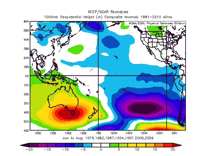
These are the El Ninos your mother warned you about. Areas in red are where pressure was higher than average, inhibiting cloud and rain. Image:: BOM
The magnificent seven
The seven El Ninos since 1971 that have thrown up good snow totals have, not surprisingly, come with a completely different surface pressure anomaly pattern. Simply put, there’s no real area of higher pressure in the image below, but there’s an area of lower pressure stretching through the Tasman Sea and across NZ. This is going to mean more frequent and/or stronger westerly winds, and the air in those westerlies is going to be sourced from the southern oceans. We won’t necessarily get more precipitation, but when it does arrive it should be colder, and so more likely to fall as snow. I don’t have a good name for these suckers, so for now let’s just call them wrong ’uns.
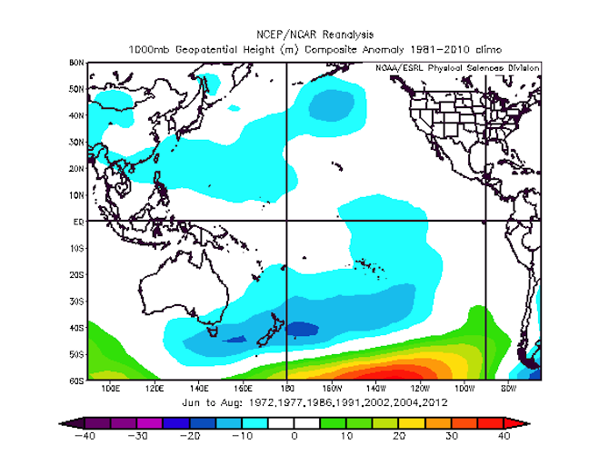
These are the El Nino’s you don’t mind taking home to dad. Image:: BOM
Buttered side up?
So what’s it going to be? The classic El Nino that will push thousands more farmers to the wall and smash the Australian Ski Industry? Or a wrong’un El Nino that spins the other way and turns everything it touches to snow?
Unfortunately, it’s too close to call right now. Some of the climate models are pointing in one direction, some in the other. My job over the next few months is going to be to search for any clues as to which way this could fall.
Until then, my initial call for season 2014 is a peak snow depth of 172cm at Spencer’s Creek, with the first big 50cm+ storm arriving from late June to early July, snow depths hitting the one metre mark from late July to early August.
Would I buy a season pass on this information? If I knew I could get the time off work, then yes. More likely than not we will have a mediocre to above average season and there will be plenty of opportunity for fresh provided you are ready for it. But even if things tend towards the lower end of the scale, my gut tells me we will be compensated by plenty of cool clear nights with copious amounts of snow making to keep the groomed areas looking tip top.
That will do for now. We’ll update this outlook in late-May as the excitement starts to build before opening weekend. In each of the last two years that May update has held some very important information. If you’ve got a different theory on what’s going to happen this winter, or just want to provide feedback, then please hit me up at grasshoppermw@gmail.com or Join the Facebook discussion below.

Perisher forecasts,
snow reports and
live snow cams.
Falls Creek forecasts,
snow reports and
live snow cams.
Mount Buller forecasts,
snow reports and
live snow cams.
Charlotte Pass forecasts,
snow reports and
live snow cams.
Hotham forecasts,
snow reports and
live snow cams.
Thredbo forecasts,
snow reports and
live snow cams.
Mount Baw Baw forecasts,
snow reports and
live snow cams.


