Storm Journal May 30-June 1: Cold Storm Drops 40cms, Resorts Opening early
Mountainwatch | Reggae Elliss
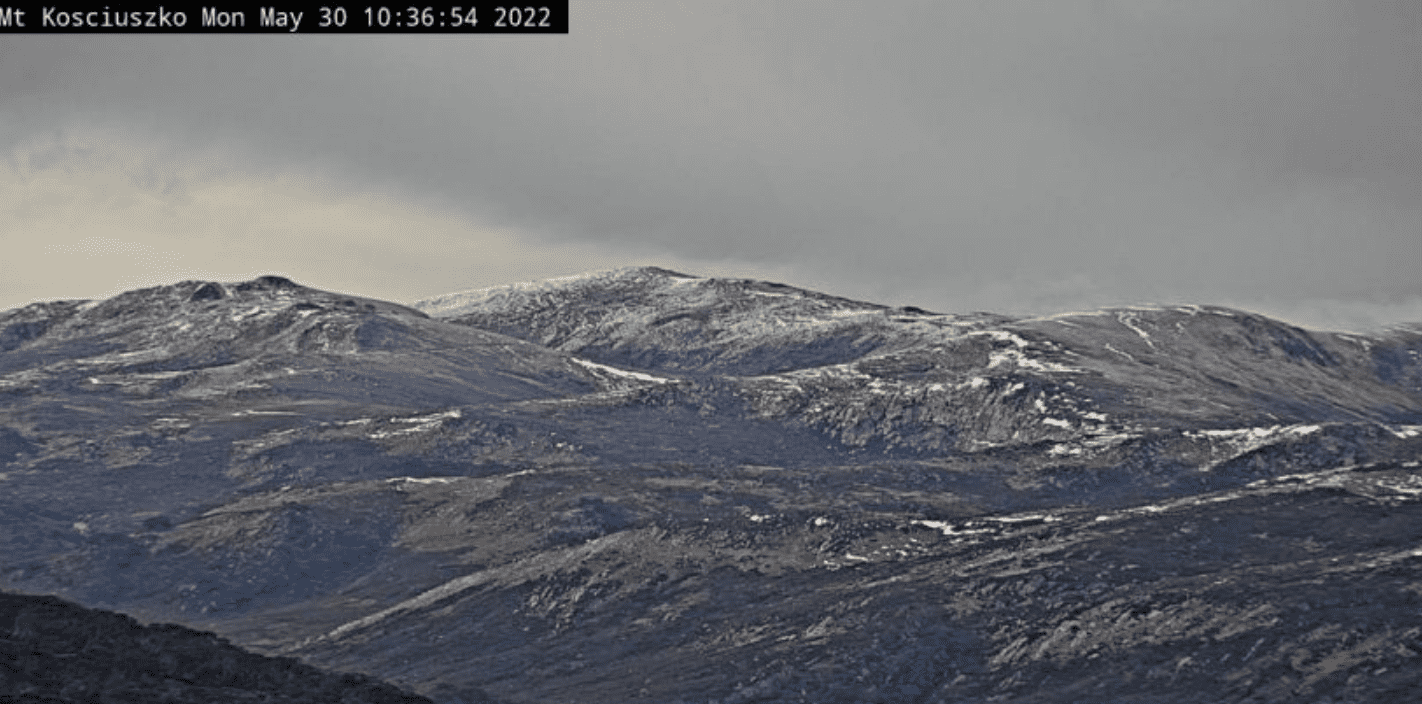
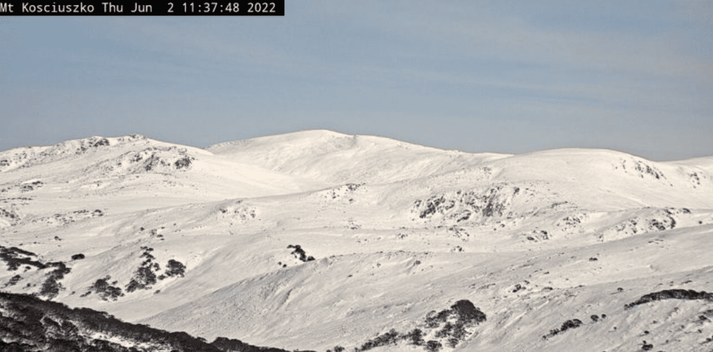
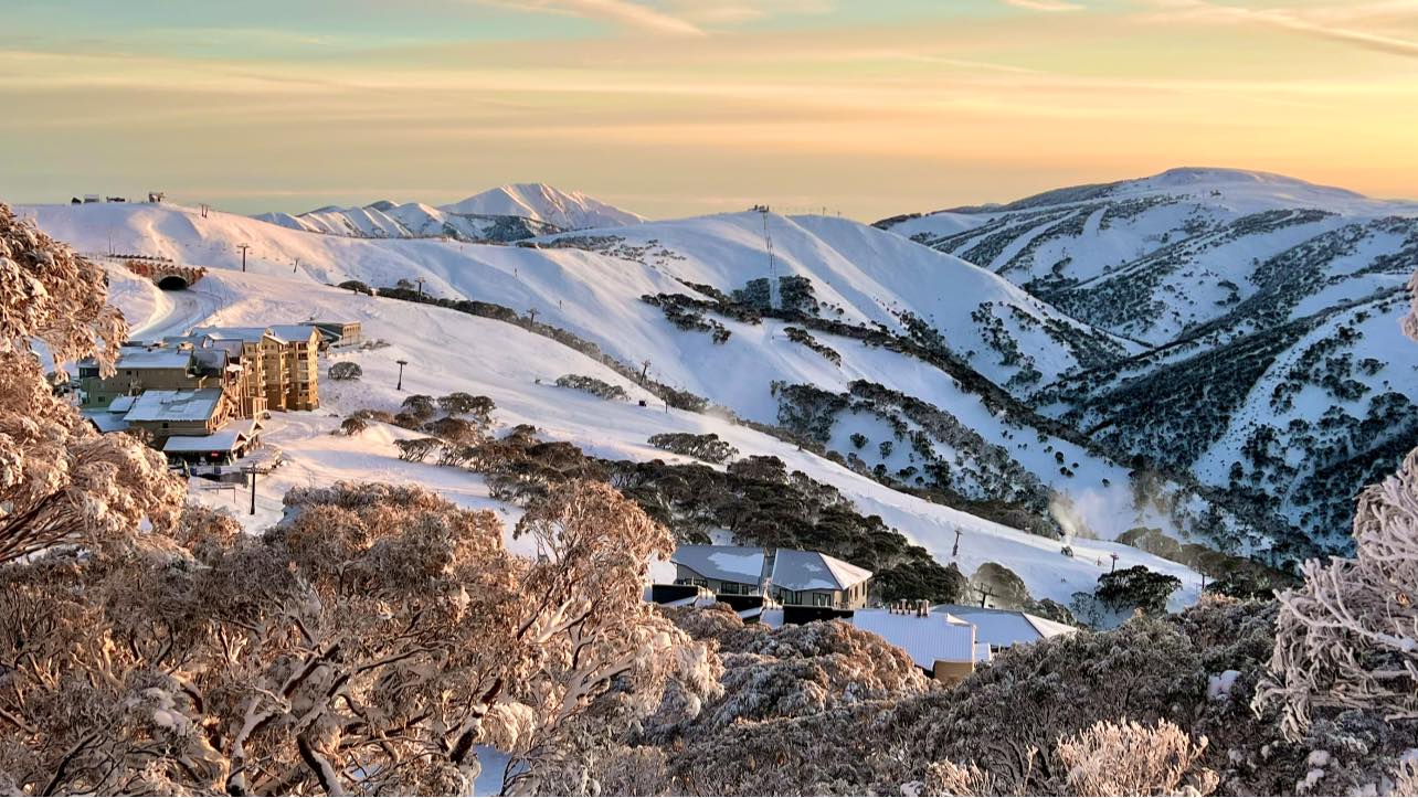
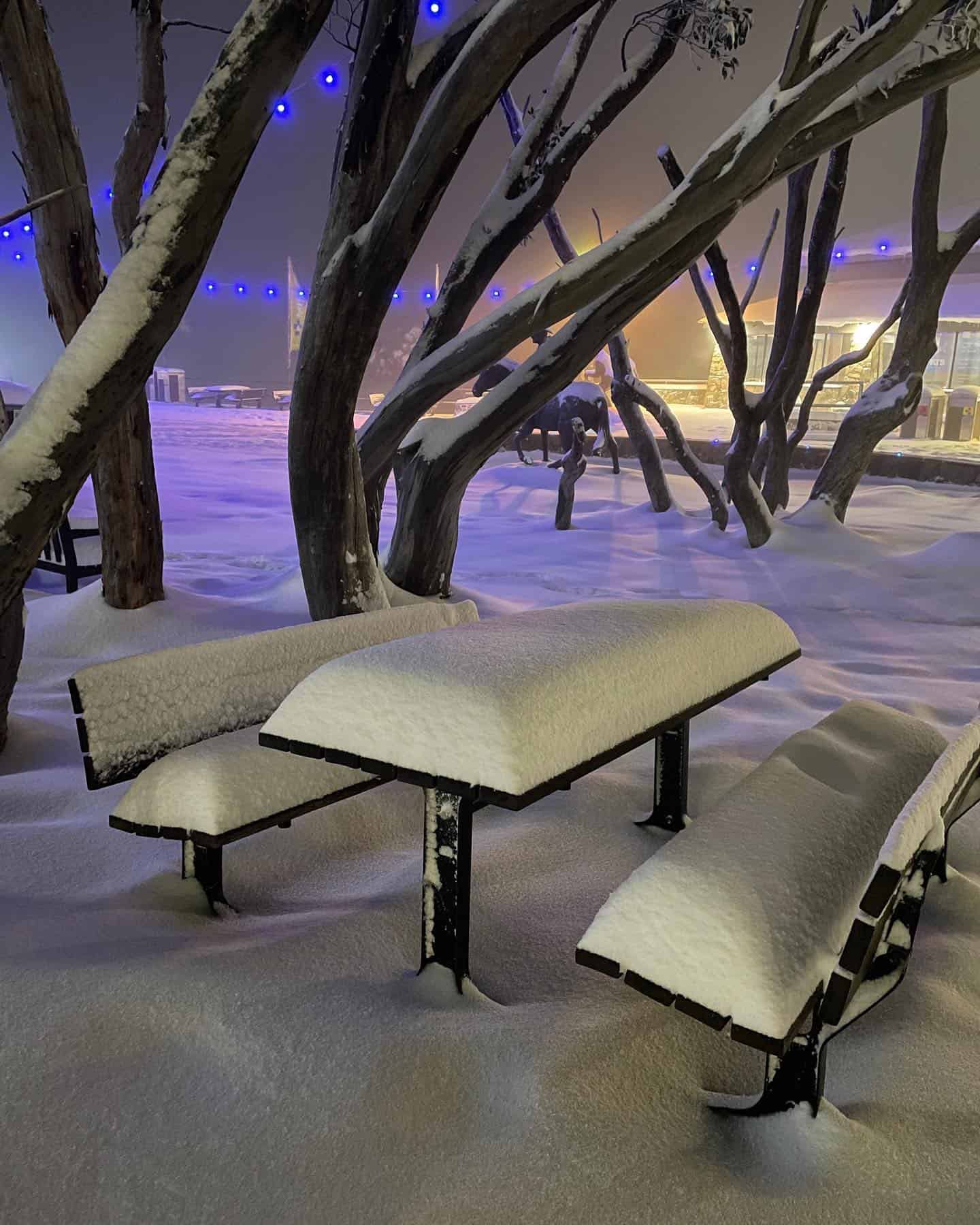
This week’s storm turned into a solid one, a true winter storm with cold temps and moderate winds that dropped 35-50cms of snow across the Aussie Alps over a 48-hour period, Monday through to Wednesday.
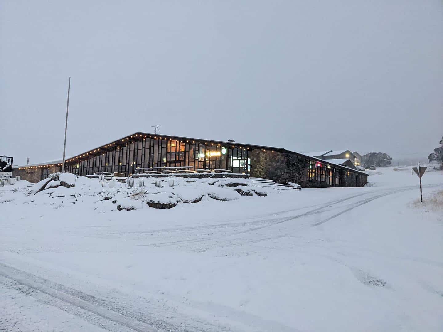
The first snow started falling here in Thredbo late Monday morning, the freezing levels plummeting as the cold front arrived, with snow down to village level (1380m) from the outset. The snow level continued to drop throughout the afternoon, consistent snowfalls resulting in a quick accumulation, Perisher reporting 10cms at the Perisher Centre in just a few hours.
It was a similar story across the Victorian resorts, snow continuing throughout the afternoon and overnight, with Buller reporting 30cms by Tuesday afternoon while Falls and Hotham In Hotham and Falls had 40cms by the time the snow showers eased late Wednesday morning.
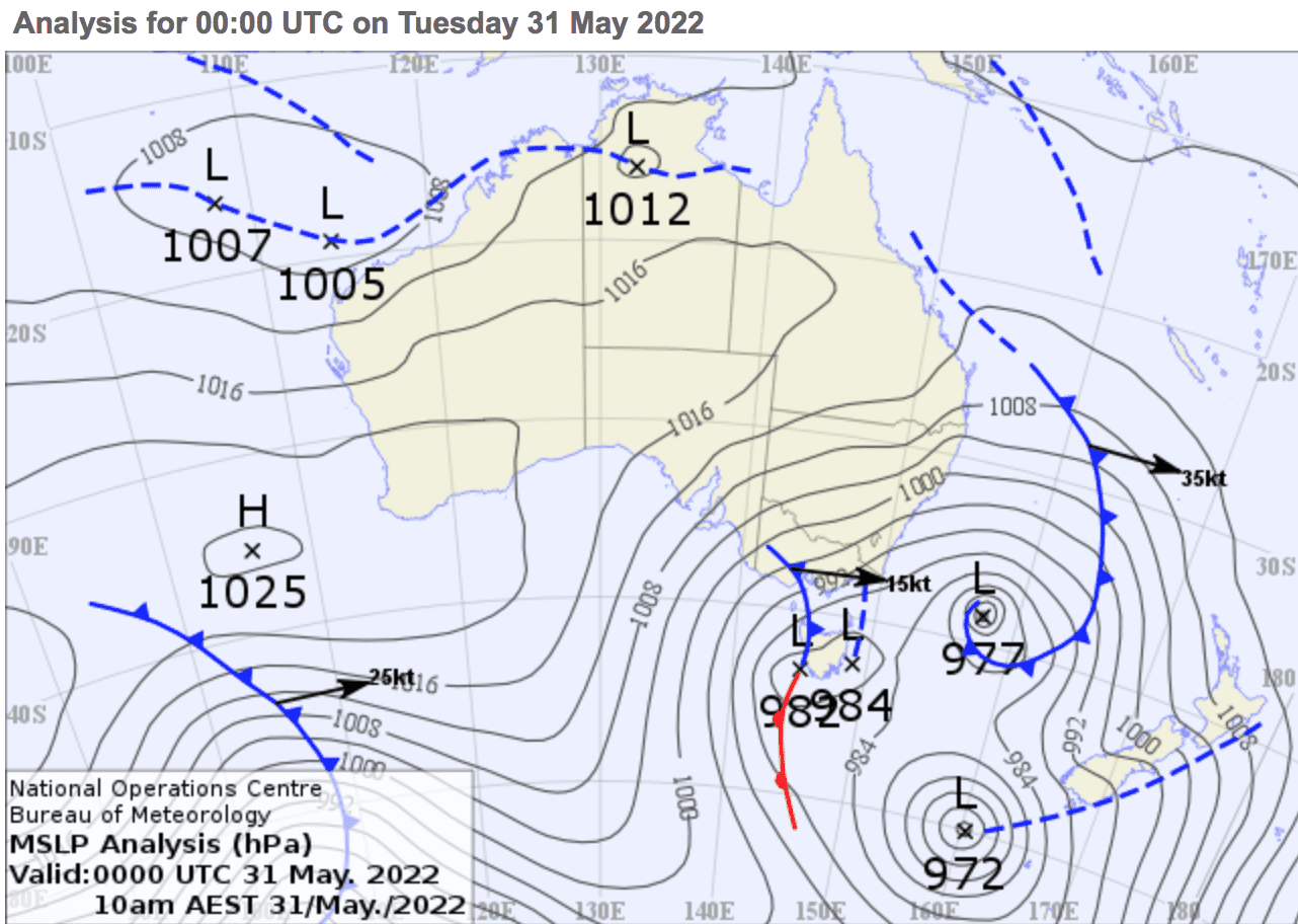
The forecast models were calling good snowfalls on May 24, the Grasshopper saying that while the GFS model was jumping around a bit the EC model was consistent and calling the most snow. By last weekend the various models agreed that a cold winter storm was due on Monday with 35-50cms in the forecast. The storm received widespread coverage in the lead up, with Polar Blast the term favoured by mainstream media. It was definitely cold, temps dropping to -7 while winds peaked at Thredbo top station at 72ks yesterday morning, taking the wind-chill down to -20.3.
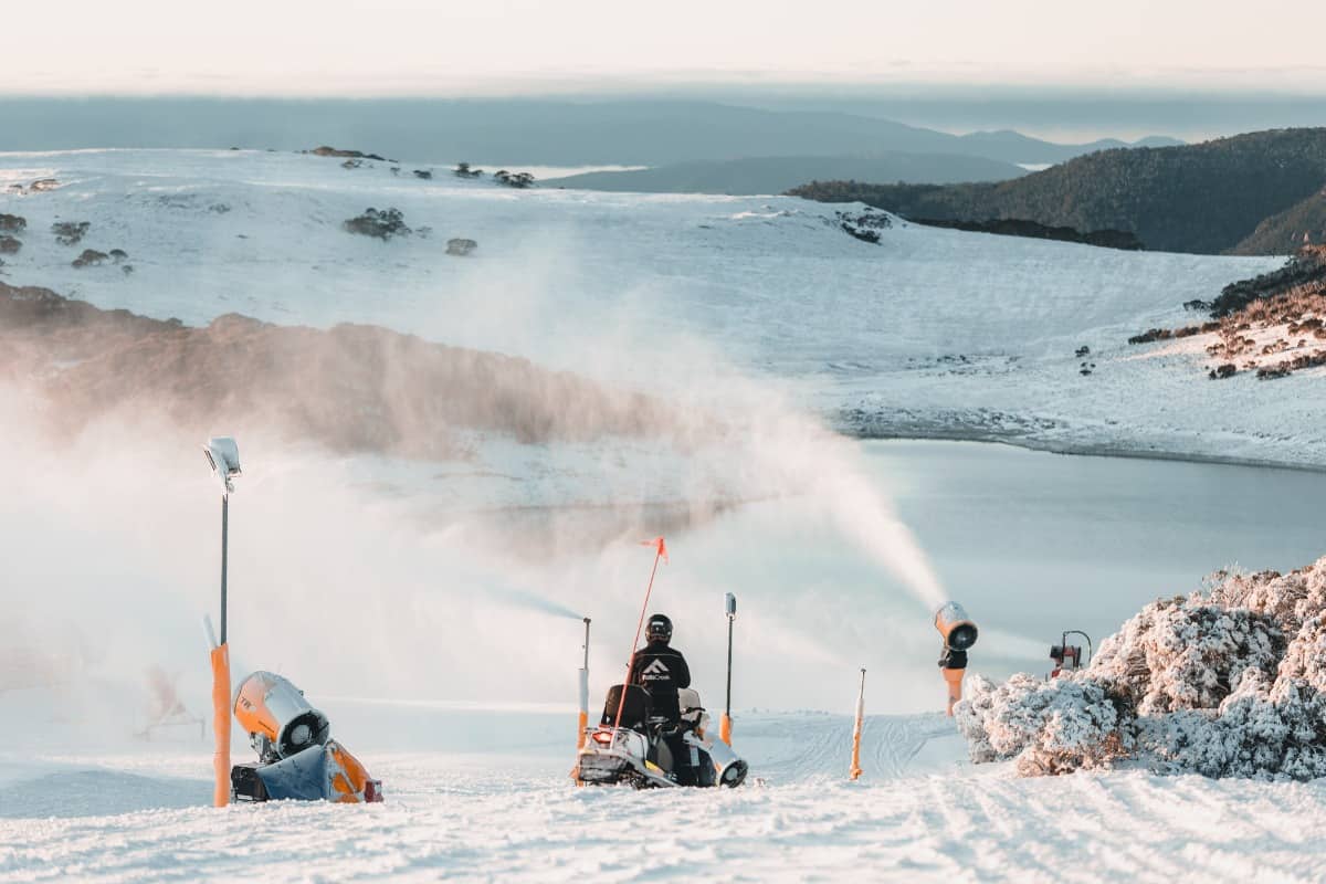
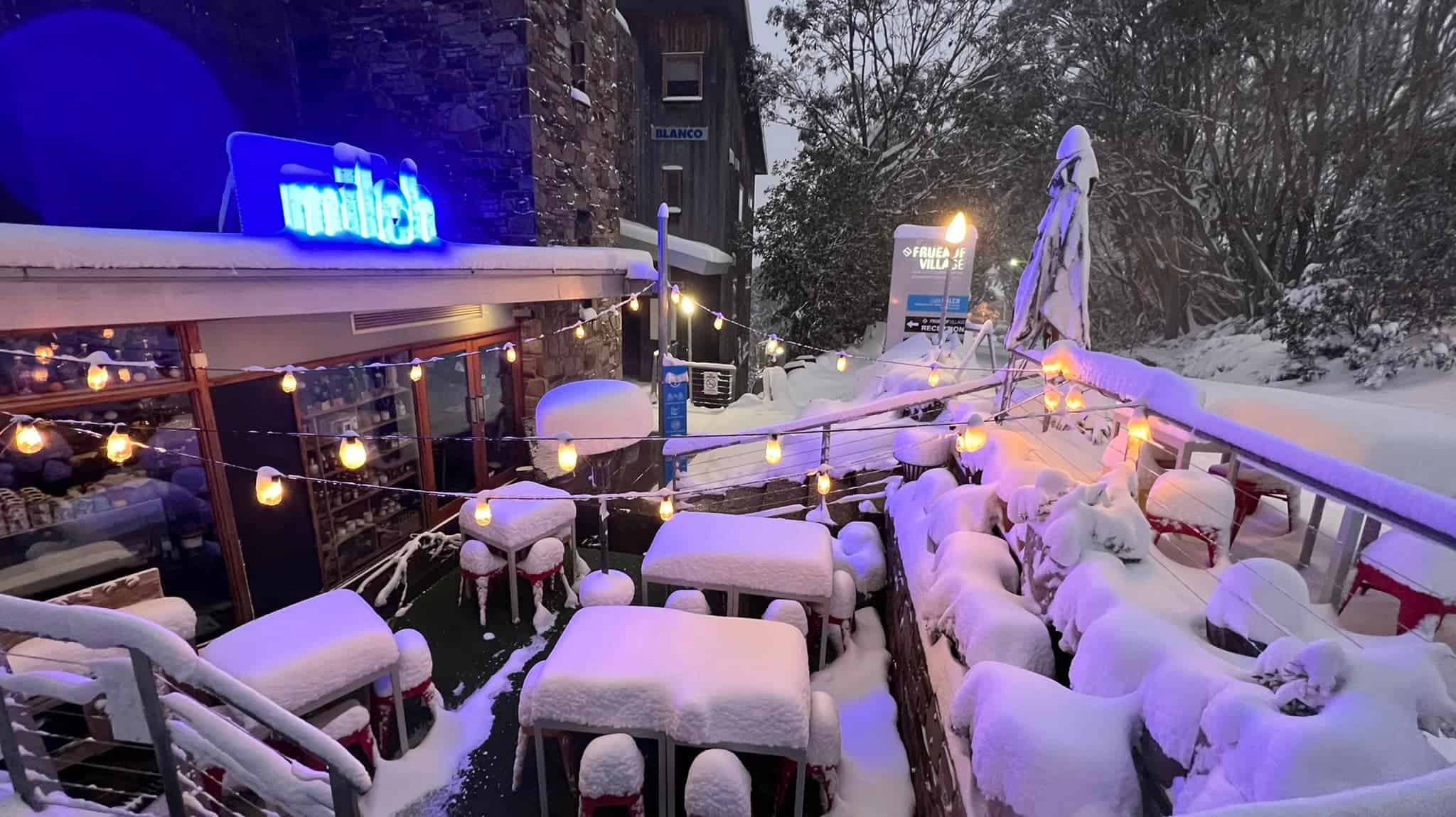
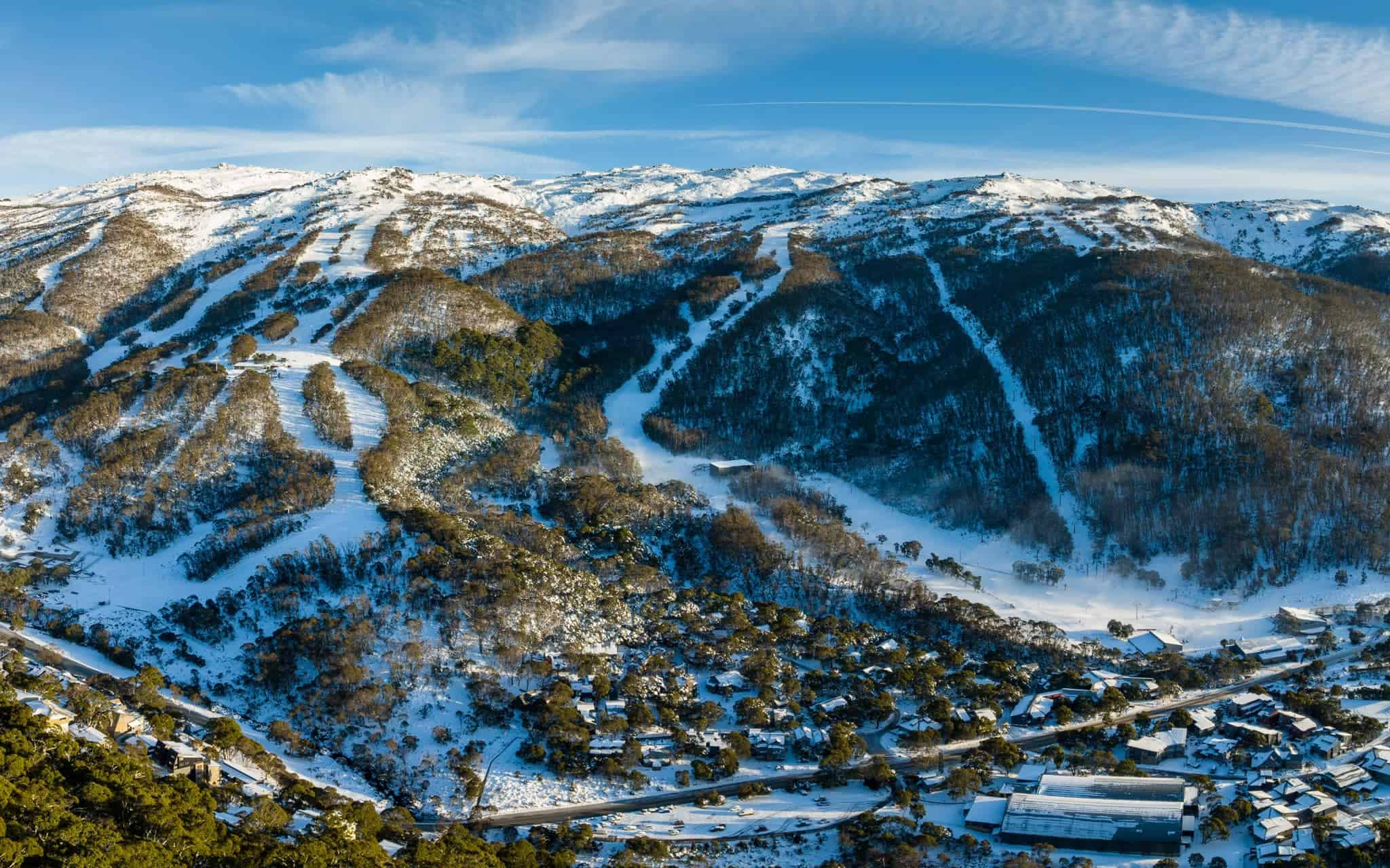
The resorts have taken advantage of the3 cold temps with extensive snowmaking over the past few days adding to the natural snow, leaving a decent cover in some areas. The result is Perisher, Buller, Falls Creek and Hotham, are all opening some lifts this Saturday, June 4, a week earlier than planned. Perisher will have three lifts open on Front Valley, Buller two lifts open on Bourke St, Hotham will have the Summit and Summit trainer open and Falls Creek will have Haley’s Comet and Towers open for those keen on an early slide.
Thredbo will open on Saturday June 11, looking to consolidate this week’s natural snowfalls with snowmaking and given next week forecast is hopeful of opening with a bang with a significant amount of terrain open for the long weekend. Charlottes Pass and Mt Baw Baw are also preparing for a June 11 opening while Selwyn Snowfields is scheduled to reopen on July 2. This is great news as Selwyn has been closed for the past two winters, the resort having to rebuild after the damage caused by the bushfires in January 2019.
In another excellent piece of weather-timing, another storm is on the way, a cold front due on Sunday and it is looking like another solid multi-day storm, the Grasshopper writing in his season outlook that: “Snow is then likely to fall Sunday through Tuesday, and possibly even into Wednesday (8thJune) thanks to a low-pressure system to the south. The position and movement of this low is uncertain at this point, but all models surveyed are going for it. Snow accumulations look similar or even slightly higher than Storm 1, with snow level also getting as low as 800-1000m.”
Once again, this system will be accompanied by very cold temps, so the snowmakers will also be busy, which should ensure more lifts and terrain open for the “official” opening of the season on June 11. It is great to see a positive start to the winter, especially after the last two Covid-restricted seasons, and no doubt many of you are super keen to up to your favourite resort for a few turns in the crisp mountain air.
Of course, we’ll have all the info you need here on Mountainwatch with our independent on the ground snow reporters filing daily from next Friday while the Grasshopper’s regular forecasts resume on Wednesday June 8.