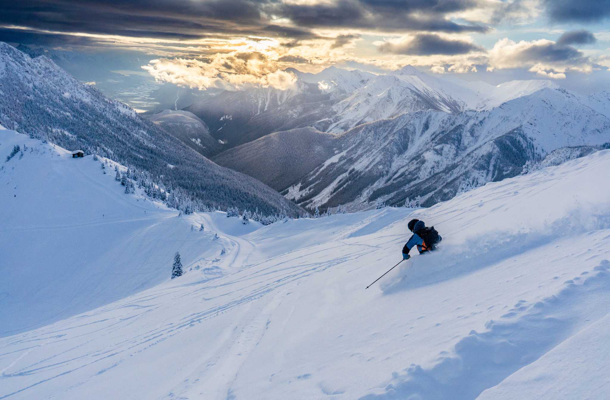
Weekly North America Forecast, December 14th – A Nice Dump For The North & South, But Wet, Warm Southerlies For The Sierras
Mountainwatch | TheGrasshopper
Written late Wednesday 13th December (Pacific Time)
High-pressure will dominate over the next few days, with just the northern and the southern edges of the west picking up some decent snowfalls.
Then, from Sunday onwards, a couple of Pacific low-pressure systems will bring wet, warm southerlies, which will dump dense high-elevation snow on the Sierras, falling as rain on the lower terrain. The high resorts may be grateful, but for others, it’ll be a blight in the history books.
Thursday 14th
Thursday, a big high sitting smack bag of the west, brings dry settled conditions to most, pushing all the action to the northern and south edges.
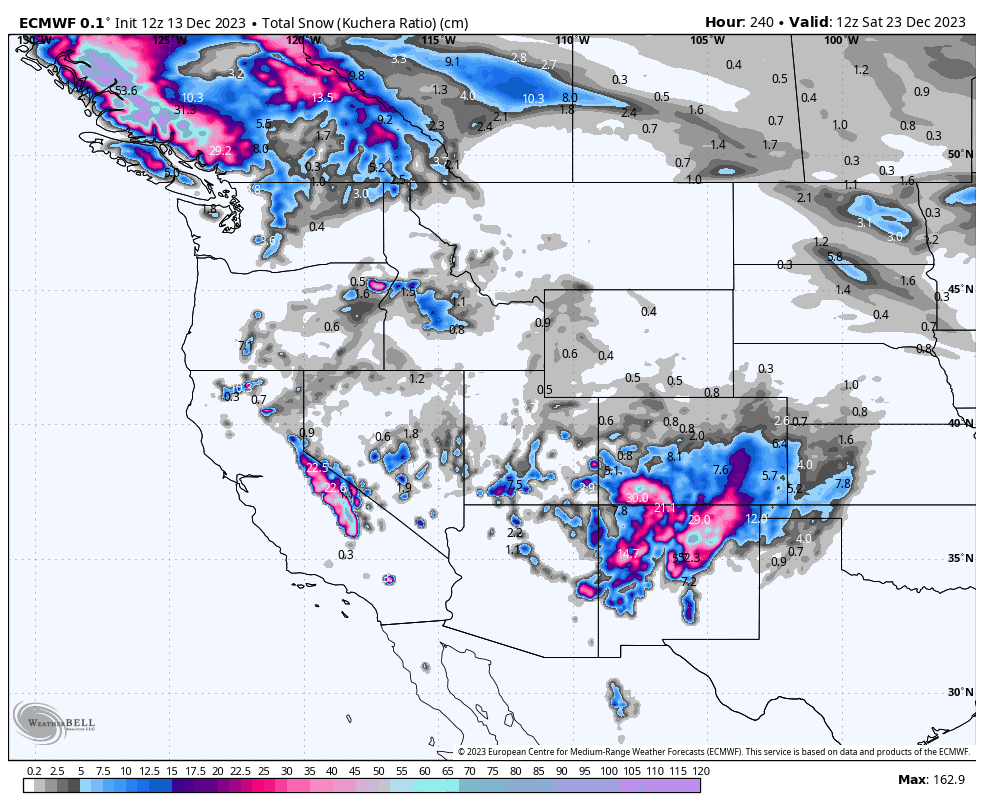
A strong southerly flow that has been bringing heavy snowfall to New Mexico and southern Colorado since yesterday will eventually peter out later in the day leaving storm totals up to 20-50cm for some lucky resorts. Temperatures are relatively mild, so the snow will be much denser than that which comes from the north, but it’ll be perfect for building a base there.
Up north, a stalled cold front will deliver about 20-30cm to the southern Coastal Mountains of Canada (e.g. Whistler), with about 5-15cm reaching the Rockies further inland before the front dissipates into thin air.
Friday 15th & Saturday 16th
It’ll be a remarkably quiet couple of days as high-pressure dominates the entire west. It’ll just be the northern Canadian resorts (e.g. Shames & Powder King) picking up what could be mod-heavy snowfall for a time, as a front develops then dissipates over the area.
Sunday 17th to Wednesday 20th
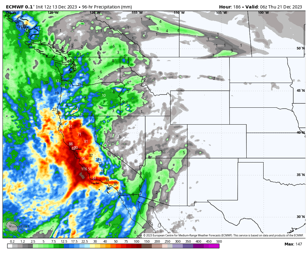
This period will be a blight in the history books, featuring wet, warm southerlies, as a couple of low-pressure systems edge up against the Californian Coastline. This will primarily affect the Sierras, and to a much lesser degree, the Cascades, northern Rockies and Canadian resorts.
Mostly, it’ll be rain, with dense snow only falling on terrain above about 2500m in the Sierras, and around 1500-2000m elsewhere. That doesn’t sound so bad for resorts like Mammoth (base elevation 2424m) as it does for the Tahoe resorts. The Southern Rockies will also see a smattering from later Wednesday. I’ve included a four-day precipitation forecast, which illustrates this period nicely.
Extended Outlook
Next Thursday into next weekend will likely see the second of the low’s mentioned above crossing the south. Again, warm southerlies will bring dense high elevation snow to the Sierras and southern Rockies, but rain about the lower slopes. High-pressure should keep a lid on things further north.
That’s all from me today, guys and gals. Have a great week and I’ll see you next Thursday.
Grasshopper


