Weekly North America Forecast, December 21st – White and Sunny in The Rockies For Christmas, But Sierras Will Have to Wait till After Boxing Day

Mountainwatch | The Grasshopper
Written late Wednesday 20th December (Pacific Time)
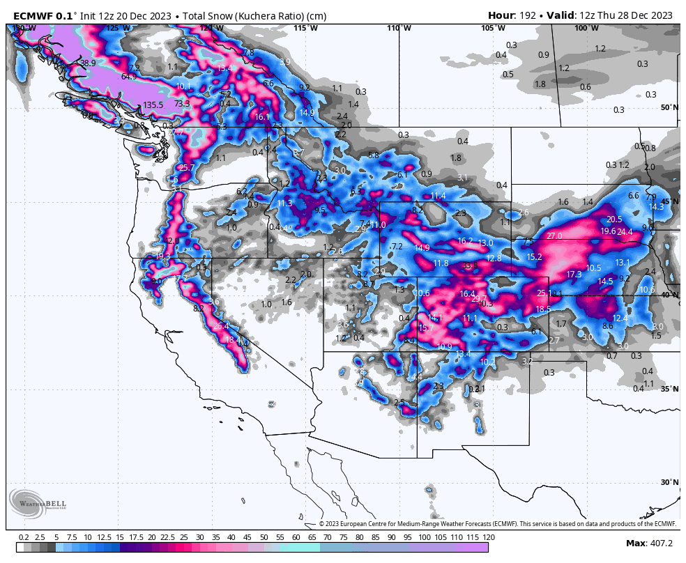
The next several days will see storm systems at the northern and southern ends of the North American west eventually meeting in the middle as they move inland, leaving behind snow for most, with particularly good totals accumulating over Canadian resorts and the central Rockies.
High pressure then settles in for most, bringing lovely, sunny Christmas cheer. However, the Northwest will be much gloomier, as an atmospheric river sets up there, bringing a heavy dose of dense, high-elevation snow. The storm will eventually turn cold next Wednesday, with the Sierras finally getting a look in as it spreads southwards.
Thursday Dec 21st to Dec Sunday 24th
This period will see storm systems at the northern and southern ends of the North American west eventually meeting in the middle as they move inland.
The southern storm will exit the southern Sierras Thursday and enter the southern Rockies Friday. Here, warm southerlies will be the flavor, bringing denser snowfall and elevated snow levels.
The storm in the north will also start out warm, with dense snow falling over Canadian resorts with elevated snow levels, and it’ll be heavy in the north. However, a cold front will sweep down and inland Friday, bringing a brief period of higher quality snowfall through to the Cascades and Idaho.
Saturday, the cold northerlies continue to sweep southwards into the central and southern Rockies, replacing the warmer southerly snowfall from the day before. There’ll be decent snowfall here as the system briefly stalls, while a low spins up over the Great Plains. The low eventually pulls away Sunday, taking the snow with it.
Also, on Sunday, another cold front sneaks in a quick little top-up over the Cascades and Canadian Coastal Mountains, with a little dusting also reaching the Canadian Rockies.
Monday Dec 25th to Wednesday Dec 27th
This period will see an atmospheric river set up in the north during Monday, where warm, moist southwesterlies will pump heavy precipitation over the northern Cascades and Canadian Coastal Mountains. There’ll be a tonne of dense, high-elevation snow, but higher quality light-moderate snowfall will also reach the Canadian Rockies.
This pattern will persist through Tuesday, while elsewhere to the south remains dry and settled under high pressure. Wednesday, the storm will finally turn cold and spread southwards into the Sierras where brief heavy falls are expected late in the day.
Extended Outlook
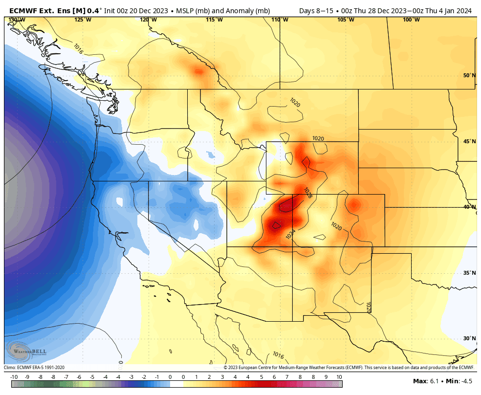
The following 7-day period may see storms disappear from the north and interior, while becoming more active off the U.S. coastline where they’ll likely benefit the Sierras. It’s a fairly classic El Nino set-up – could it finally be kicking into gear?
That’s all from me today. Have a great week, see you next week.


