Weekly North America Forecast, December 28th – A Quiet End To 2023 & An Even Quieter Start To 2024
Mountainwatch | The Grasshopper
Written Thursday morning 28th December (Pacific Time)
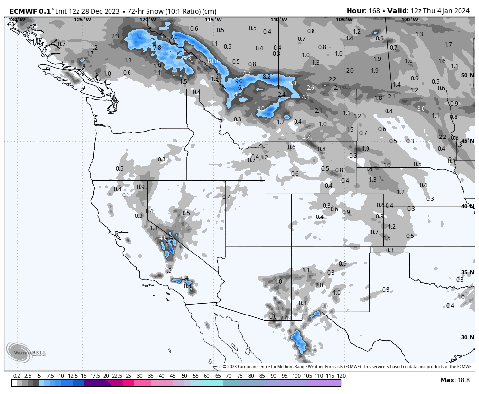
It’s going to be a quiet end to 2023 and an even quieter start to 2024. The next 7-day period will start out wet and warm along the Pacific Crest, but temperatures and snowlines will trend downwards as colder air starts to arrive this weekend, with the Sierras picking up a much-needed top-up of powder.
The place to be over this holiday period, however, will be at one of the many resorts in interior BC or Alberta, where a few rounds of light snowfall will keep slopes there light’n fluffy without all the fuss and palaver of bigger storms.
Thursday Dec 28th & Friday Dec 29th
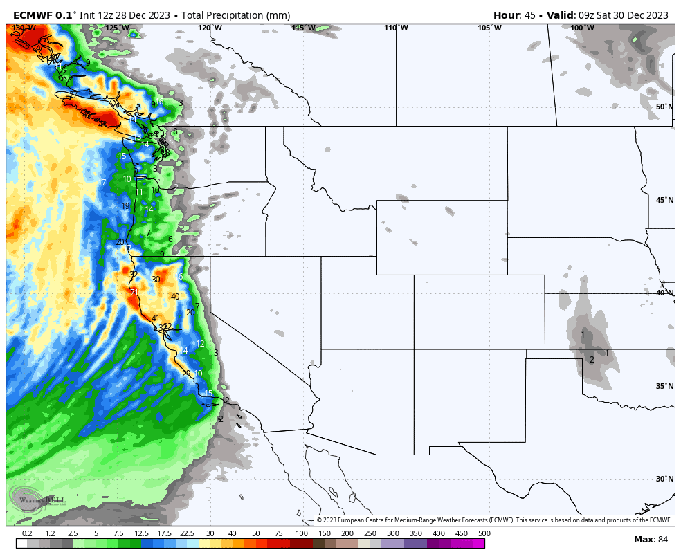
While high-pressure continues to keep everything quiet and calm in the Rockies, a big ol’ low-pressure system sitting off the Pacific coastline will send warm southerlies up along the Pacific Crest where they hit the B.C. Coastal Range head on. Resorts there will pick up a fair amount of precip, but it won’t all be snow unfortunately, with snowlines generally starting around mid-slopes today and gradually lifting to even higher slopes Friday as even warmer air arrives.
Interior B.C. will also pick up some light flurries, but the Cascades will cop some showers of rain.
Saturday Dec 30th & Sunday Dec 31st
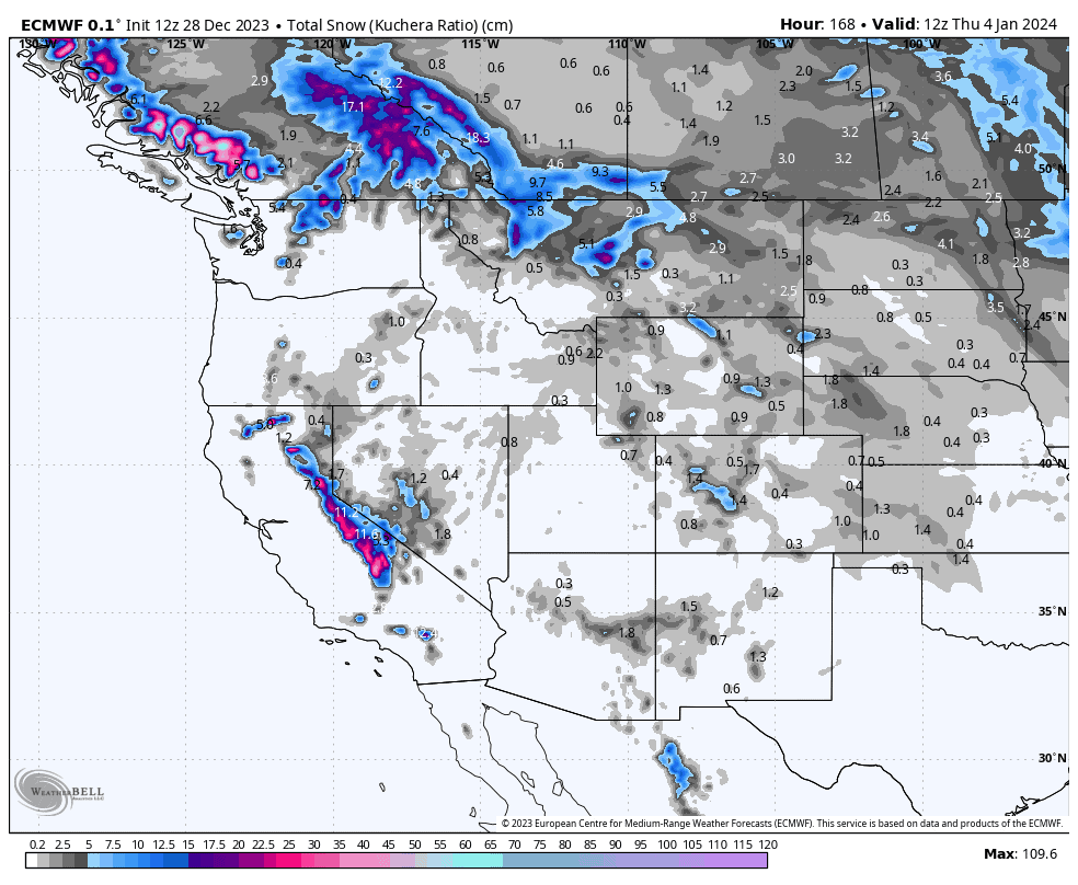
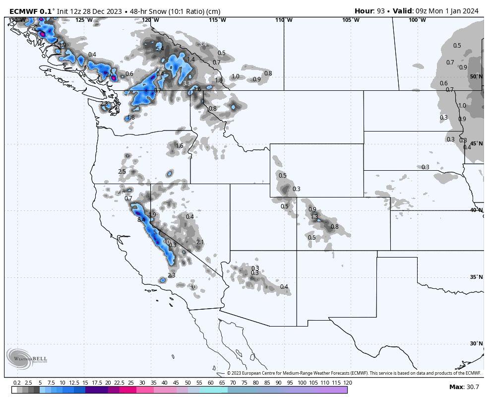
A cold front hits the Pacific Crest in the early hours of Saturday, with resorts in the Sierras picking up something in the ballpark of 10-20cm.
The Cascades and BC Coast Range also bear the brunt of the front, but the lower elevation of resorts there will see most of it fall as rain on mid-low slopes before snowlines get sufficiently low from later on Saturday, by which time skies will be drying up.
The front will continue to push inland while weakening. As a result, resorts in the Canadian Rockies will pick up mostly light snowfall from later Saturday through Sunday, with Wyoming and Colorado also sneaking in a sneaky shot of powder.
Monday Jan 1st to Wednesday Jan 3rd
The Canadian Rockies will again pick up light snowfall Monday as a cold airmass pushes down from the north. Skies dry up there Tuesday, while resorts dotted along the eastern side of the U.S. Rockies receive a light dusting as the airmass continues southwards.
Wednesday, another cold front pushing inland should see Canadian resorts pick up even more light snowfall, while another Pacific low could bring another much-needed top-up to the Sierras.
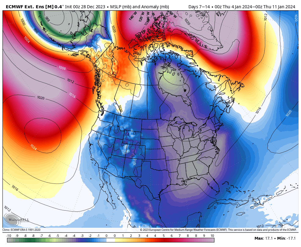
Extended Outlook
The weather looks to become more active during the next 7-day period starting Thursday 4th January. Low pressure and cold temperatures are forecasted to dominate, which could particularly benefit the Rockies. The Pacific Crest may be left a little underdone in comparison, although some snow is expected here too.
That’s all from me today. Have a great week, see you next Thursday.


