Weekly North America Forecast – Warm, Wet and Wild in the North as an Atmospheric River Wreaks Havoc
Mountainwatch | The Grasshopper
Written Thursday morning 25th January (Pacific Time)
You’d be forgiven for thinking it was late spring here in North America as warm temperatures continue to plague resorts this week. It’ll be the north that is worst affected, particularly the Cascades and BC Coast Mountains who’ll see disastrously high snow levels, while buckets and buckets of rain come pouring out of atmospheric river taking aim at the area. Resorts in the northern Rockies won’t fare too well either.
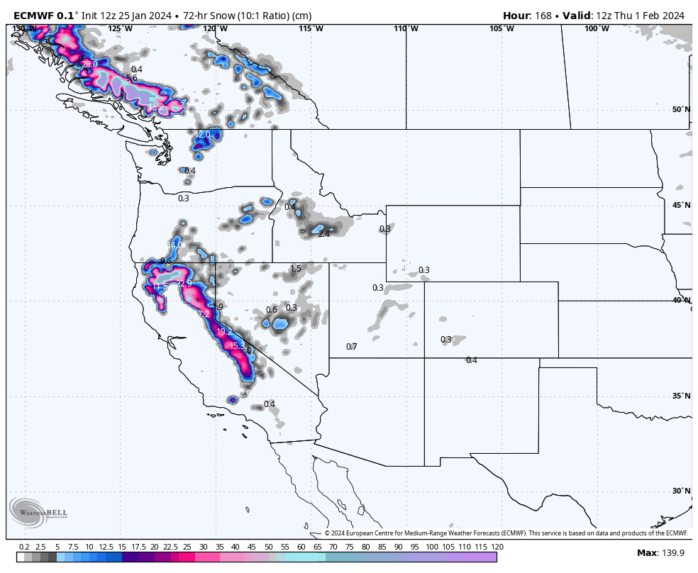
After an initial dusting of snow today, the south will remain quiet under high pressure. It won’t be until the end of this forecast period, Wednesday 31st, that the action begins to spread southwards. Fortunately, this action comes with colder temps and we should see a good dump of powder in the Sierras before the storm moves into the Rockies.
Thursday Jan 25th & Friday Jan 26th
Today, after a dusting in the Sierras early this morning, a trough of low pressure will drag some Pacific moisture over the Rockies where there’ll be mostly light snowfall. Some resorts in the southern Rockies could pick up more moderate-looking falls. Temperatures are mild, however, so snow quality will be a little dense and there’ll be rain or slush mixed in for those resorts with terrain at low elevations. This will all gradually clear up during Friday.
Further west on the Pacific Coast, a front brings light-moderate falls to the northern Cascades and BC Coast Mountains today. Snow levels look sit between 900-1300m, so some wet stuff is expected down low. However, after a short break Friday morning, things will deteriorate through the latter half of the day as an atmospheric river (AR) sets up, with warm humid southerlies bringing heavy precip and climbing snow levels.
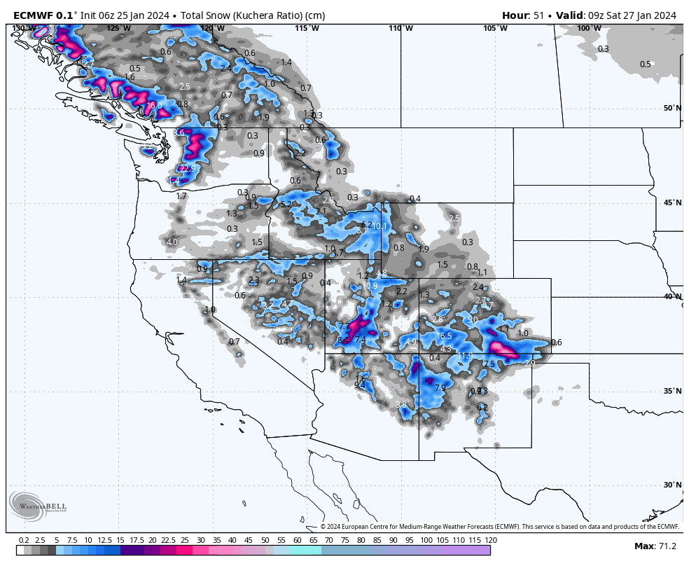
Saturday Jan 27th & Sunday Jan 28th
Most resorts will stay high and dry as the AR continues to impact the northwest with disastrous results. There’ll be heavy precip at times through the Cascades and BC Coast Mountains, and snow levels will get up to around the 2,200m mark, which means rain all the way to the top at a lot of resorts!!!
Some of this moisture will also spill over into the interior where there’ll be light-moderate precip through interior BC, Alberta, Idaho and Wyoming. The northern Sierras will also get clipped. Again, snow levels will get ridiculously high and even the upper slopes will turn wet at a lot of resorts.
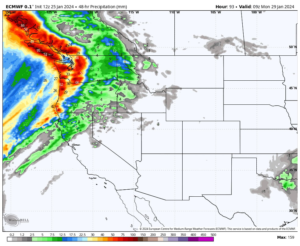
Monday Jan 29th to Wednesday Jan 31st
All the action remains restricted to the northwest during Monday and Tuesday. Heavy rain continues to fall over the BC Coast Mountains and northern Cascades at times, with light-moderate rain spilling over into Interior BC and Alberta, the majority of which will fall during Tuesday.
Wednesday, colder air coming out of the North Pacific will start to nudge the stationary front that has channeled the AR into the northwest over the last several days. Moderate-heavy precip will continue to fall over the Cascades and BC Coast Mountains for much of the day, but snow levels will dip just below the 2000m mark, providing fresh snow for the upper slopes at least.
At the same time on Wednesday, the cold front will push south over the Sierras with heavy snowfall lowering to base levels. By Wednesday night, the precip will have also reached the northern Rockies, although at this time the cold air is somewhat lagging behind and rain will fall to high altitudes.
Extended Outlook
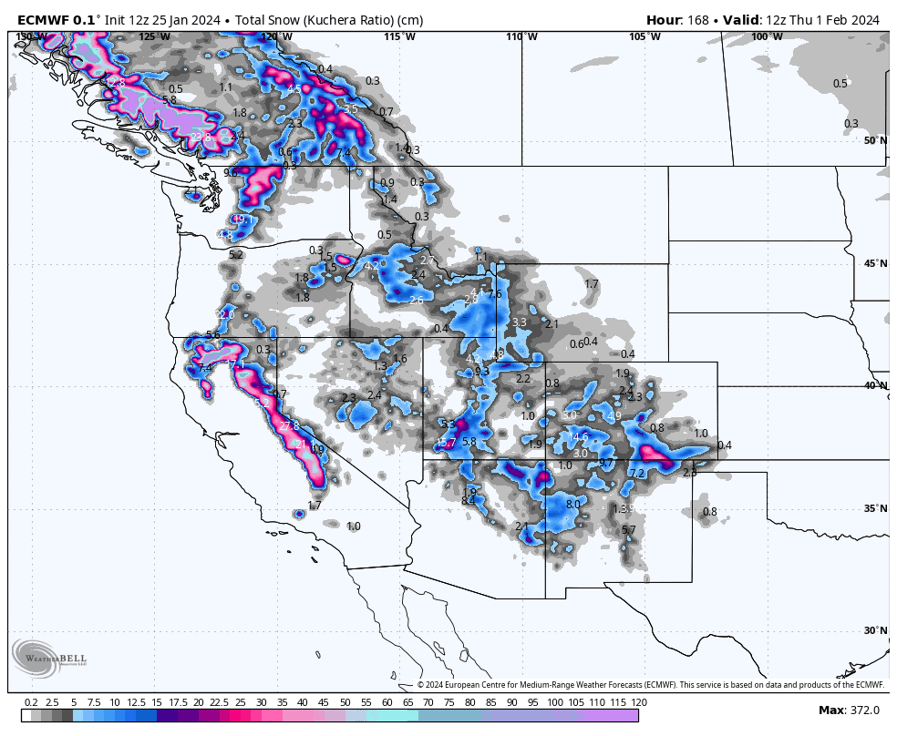
The above mentioned front impacting the northwest and Sierras is expected to continue moving inland with snow falling throughout the Rockies next Thursday through into the weekend. There’ll be moderate to heavy falls, especially in the central-southern Rockies, although snow levels will stay be rather high and it may be wet on the lower and/or mid slopes of some resorts. Lighter precip will also fall along the Coastal Crest, while snow levels continue to lower to more reasonable altitudes.
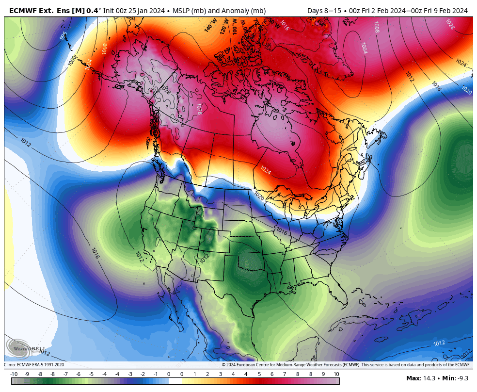
Things look to improve the week starting Monday 5th Feb, with cold storms likely favouring the U.S. through the first half of the week. Good snowfalls during this time will provide a much-needed reset after the recent wet, warm conditions. Things look to calm down through the latter half of the week as high pressure is likely to dominate.
That’s all from me today. Have a great week, see you next Thursday.
Grasshopper


