
2018-2019 North American Snow Season Outlook – Mid-January Update
Mountainwatch | The Grasshopper
Southern Rockies looking good, but a slow-down in store for Cascades and Northern Sierras
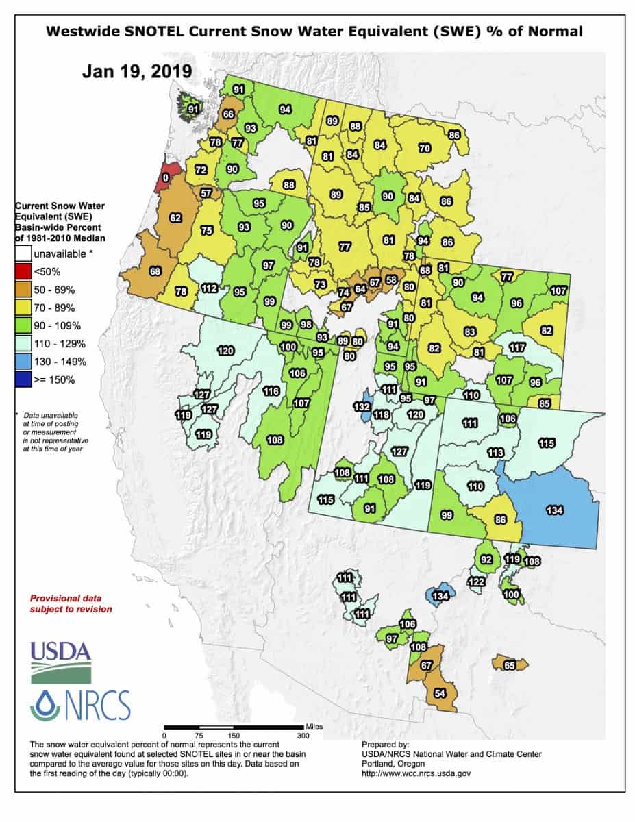
Checking in with our Snotel snowpack chart, we can see that those of you who are kicking around in the land of the free are having a riot of a time. After reports of 1.5m or more of snow falling during the recent storm that rolled off the Pacific, resorts in the Sierras are reveling in deeper than average snow. So too are the southern half of the American Rockies while the snowpack elsewhere is near average or slightly under, which still spells good times when we’re talking about North America. We can expect another 25cm-50cm to fall over the Sierras on Sunday into early Monday, and 15cm-30cm to fall over the American Rockies on Monday into early Tuesday as a low marches eastwards over these parts. After that bonanza, short-range models indicate the tail end of January will be settled with little snowfall. Let’s now look further ahead at the period February through to the end of April, taking us neck-deep into spring.
El Nino has left the building… almost
Although sea surface temperatures are still above average across the tropical Pacific, recent cooling has now brought them near-to-below El Nino thresholds. The atmosphere hasn’t responded to this latest warm episode, a coupling that is essential for a genuine El Nino. Climate models continue to keep these waters warm with a good chance of El Nino thresholds being met throughout the remainder of the northern hemisphere winter, after which the likelihood declines and a neutral phase becomes more likely for the Southern Hemisphere winter. However, it’ll now be hard for the atmosphere to get into El Nino mode due to variations that occur over the tropics at this time of year and any El Nino is likely to be nominal or weak. Although El Nino effects cannot be ruled out entirely, we can now downplay its influence.
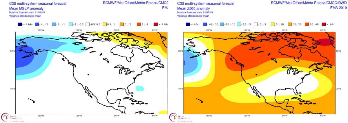
With El Nino all but out of the picture other climate oscillations, such as the Arctic Oscillation (AO), the Pacific North America mode (PNA), or the Madden-Julian Oscillation (I won’t go there), may play a larger role. These are hard to predict beyond the 10-14 day range, but we can get a sneak peak into the future by looking at pressure patterns. High pressures anomalies over the Arctic for the period of February through April could signal a weaker polar vortex, and thus a negative AO. This means freezing air is able to escape the clutches of the Arctic and reach more southern climes. However, lower 500hPa geopotential heights over the North Pacific and southeastern USA, as well as ridging centered over Hawaii and northwest Canada, is synonymous with a positive phase of the PNA and suggests that this cold air will favour the eastern half of North America and possibly the southern portion of the American Rockies, leaving the rest of the west high and dry.
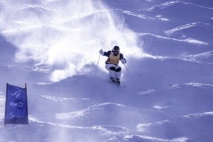
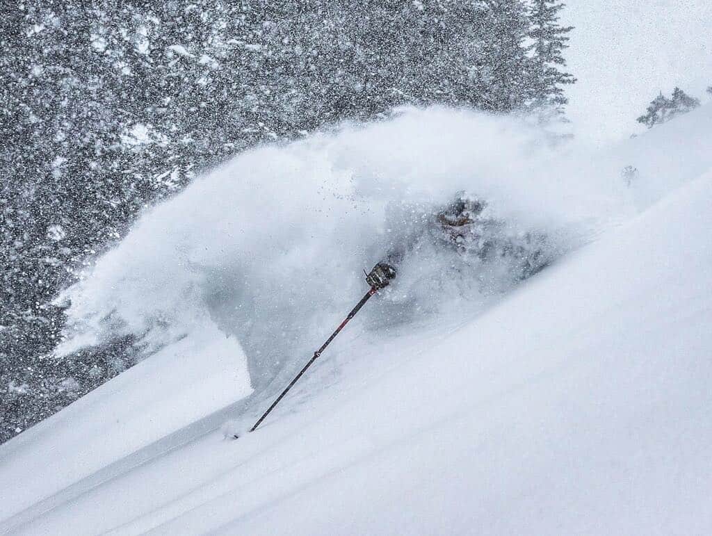
Above: Gabe Taylor ripping through the fresh powder in Mammoth’s last Friday.
This pressure pattern does look suspiciously El Ninoey, and it’s true that positive phases of the PNA are influenced by warm tropical Pacific episodes. We’re looking at seasonal averages here, but in reality the AO and PNA flitter about on times scales of 10 to 20 days, and short-lived variations can leave a lasting impression on our slopes. To add more chaos to the mix, NOAA is predicting temperatures to be more variable than usual, so we may be faced with a climate that is less predictable.
NOAA and MSC outlooks
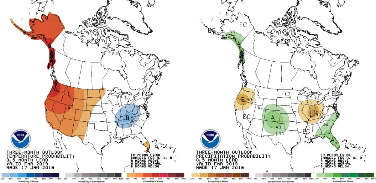
The temperature anomaly during early December exhibited a dipole of cold temps over the east and warm temps in the west. This flipped during late December with good snowfalls out west, but NOAA expects this pattern to flip again so that the tail end of January and early February are again warmer in the west along with higher pressures. Despite both NOAA and the Meteorological Service of Canada (MSC), forecasting warmer temps from February through April, more precipitation over the southern portion of the American Rockies as well as average (equal chance of above and below) levels over the remainder of the Rockies, the Coast Mountains (southern half) and southern Sierras can be ticked up as a win. Things don’t look so positive for the Cascades and northern Sierras where less precipitation and warmer temps could see their healthy snow-depth graphs take a dive.
The short of it all
After a quiet end to January, the period of February through April is looking to favour above average snowfalls over the southern portion of the American Rockies, while the rest of the Rockies along with the southern Sierras and Coast Mountains of Canada are likely to receive near average falls. Despite the epic season in the Northern Sierras so far, the outlook is less favourable with below average snow likely to fall there and in the Cascades over the coming months.
That’s all from me folks, I’ll update this outlook in the middle of February. In the meantime, be sure to cheek out my weekly forecasts for both Japan and North America issued every Thursday. If you’ve got a different theory on what’s going to happen this winter, or just want to provide feedback, then please hit me up on the discussion below. Or you can follow me on Facebook.