Grasshopper’s Japan 2025-2026 Snow Season Outlook – January Update
Mountainwatch | The Grasshopper
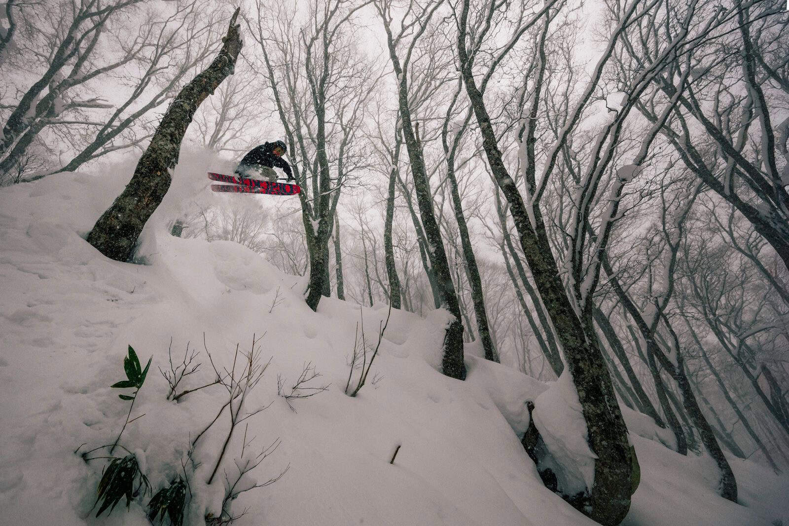
Almost halfway through January and we are nearing the peak of the 25-26 Japanese snow season. A solid system over the past week has seen big snow totals fall in areas across the country with high winds and at times dangerous conditions which will still have lingering effects in the days to come.
But for now, it’s time again to have a look at the most likely scenario for the rest of the season and revisit our seasonal forecast picture to see what is in store for the months ahead.
Short Term Update
After heavy blizzard conditions over the last few days things will quieten down slightly across most areas in the coming days. A deep low pressure system sitting over the north of Japan is directing strong northwesterlies across the Sea of Japan and will gradually move off to the north. Over the next 48 hours another smaller low will transit the Sea of Japan then move off into the North Pacific and deepen. West-northwesterly winds remain strong over Hokkaido over the next 24-48 hours but will weaken heading into the weekend.
In terms of snowfall Hokkaido, areas should see consistent falls over the next few days while Honshu will see some snowfall then have a brief break over the weekend with more benign conditions. For more detailed short-term information stay tuned for the weekly Japan forecast, issued every Thursday.

Climate Status Update
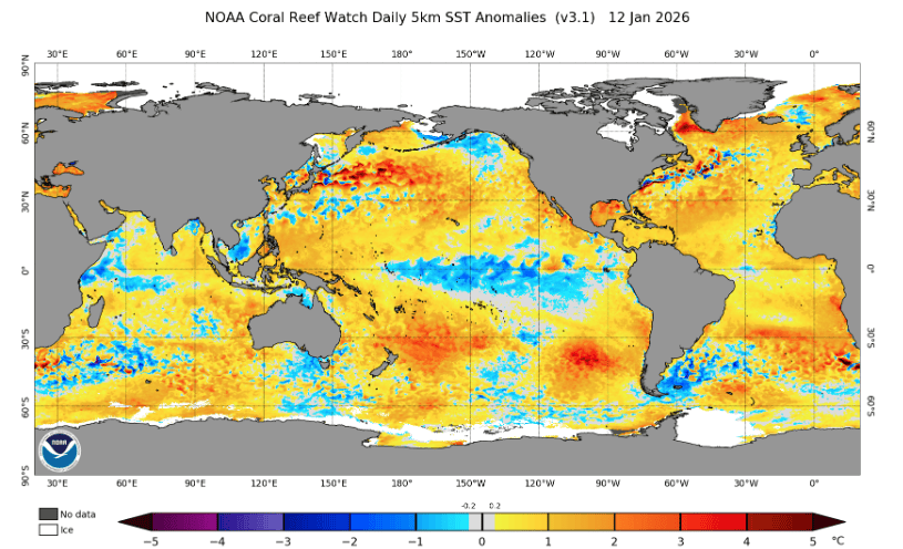
A quick recap our situation this season has been a La Nina event most likely weakening in the second half of winter to neutral conditions. We are still in La Nina conditions now, but the consensus is there is a 75% chance of returning to neutral conditions by the end of March. Below is the current SST anomaly map showing that La Nina signal evident from past updates, the collection of warmer waters in the western Pacific and the obvious cooler waters through the central-equatorial Pacific.
Elsewhere we have seen a particularly active EAWM (East Asian Winter Monsson), especially over the past week which has been a contributor to the large snow totals over the most recent storm cycles.
ENSO Outlook
Heading into the second half of winter the expectation was always for a weakening in ENSO back to neutral levels. You might be thinking we are almost there, so why hasn’t it showed any signs of weakening now? Solid question, the answer is that it is hard to predict exactly what ENSO will do and that most of the predictions show a quite abrupt return to neutral values, not a gradual return. We spoke about this in the last update where most models were predicting a quicker return to neutral over the second half of the season.
The updated version of the plot from last month is below showing ensemble forecasts for the Nino3.4 region (the region used as the main identifier of the ENSO index). The quick return to neutral values over the second half of winter, particularly from February is evident, remaining the same as in last month’s update.
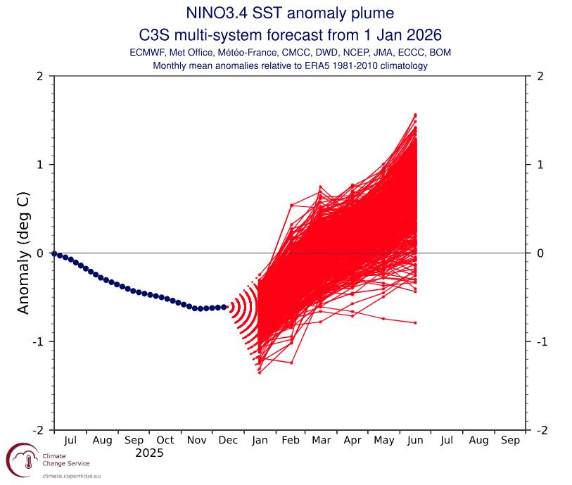
Forecasted evolution of the sea surface temperature anomaly in the Nino3.4 region over the next few months. Source: Copernicus Climate Change Service
Seasonal Products
Looking at the three-monthly products from major agencies, snowfall chances around Japan remain broadly neutral with perhaps a slightly elevated chance of above average conditions throughout central Honshu. Overall, it is still in line with our initial angle of average to above average conditions for the 25-26 winter season. With ENSO weakening into the back end of the season and the absence of another major driver to take charge conditions being average to above average (dependent on the weakening of the La Nina teleconnections) remains the most likely scenario. Importantly as we all know, average to above average snowfall in Japan means heavy snowfalls are very much on the cards with some of the deepest turns anywhere in the world.
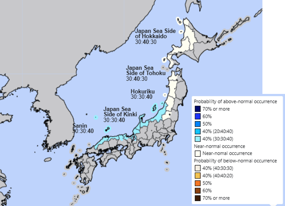
This story is shown in the JMA’s most up to date three-monthly snow forecast for January-March. Broadly neutral chances of average snowfall for northern Honshu/Hokkaido and slightly elevated probabilities for more central/southern Honshu regions. Based on how active the EAWM has been, sticking with an average to above average snowfalls for most of Japan remains a valid outlook.
Wrap Up
Halfway through January and fresh off one of the biggest storm cycles all season, things look to be much the same for the remainder of the winter with the biggest uncertainty being the weakening La Nina event. Overall, things look relatively steady with our most likely outlook of an average-to-above average winter remaining unchanged. I’ll keep an eye on how things are shaping up, in the meantime get amongst some of the recent snowfall as the conditions ease slightly and things become more stable.


