Australian Forecast, Monday June 1st – Looking Mint for Opening Weekend with a Load of Snow in the Nick of Time
Mountainwatch | The Grasshopper
Published early Monday, 1st June 2026
G’day, guys and gals, I, the Grasshopper, have been roused out of my summer hibernation by cooling temperatures and the whiff of snow in the air. Yes, it’s true: the Aussie ski season is scheduled to kick off this coming long holiday weekend, and the forecast looks mint for it.
But will there be any snow, I hear you ask? You bet there will be!
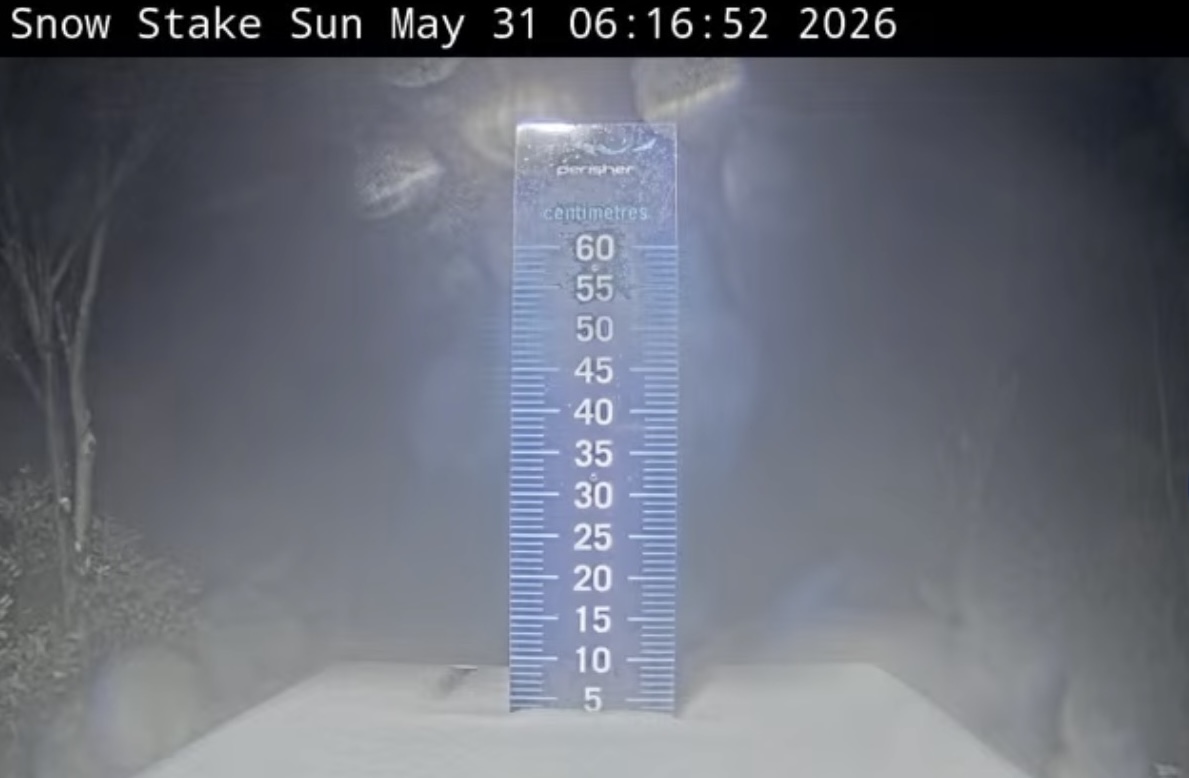
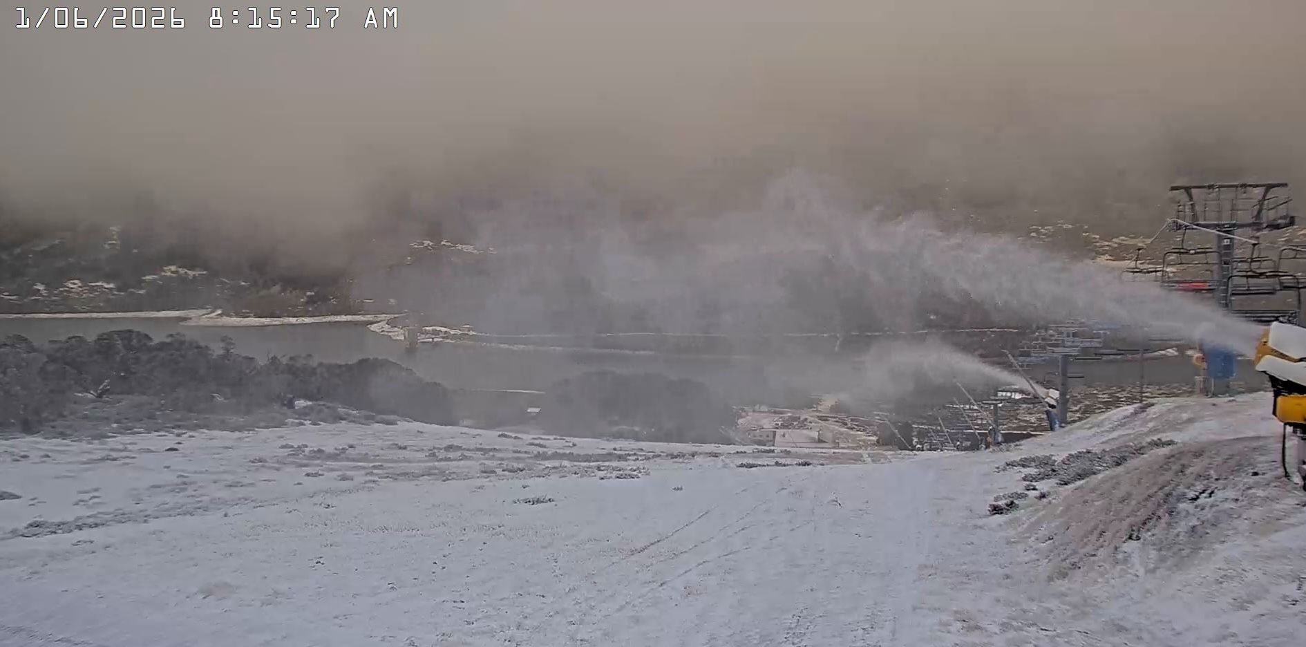
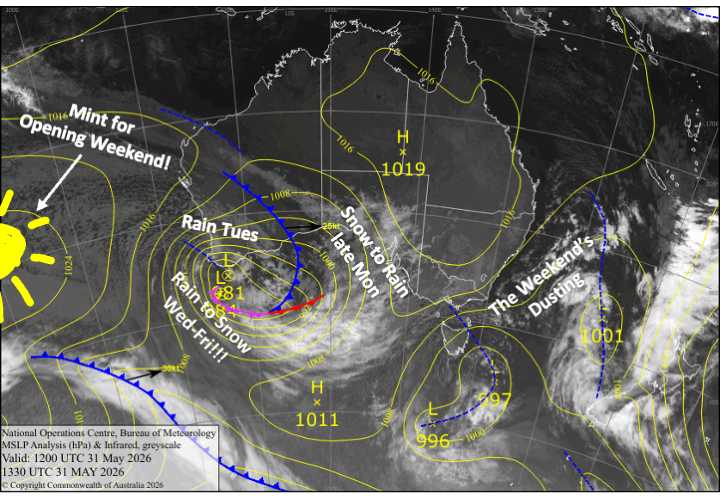
While a weaker storm from the weekend has left a few centimetres of snow on mid and upper slopes, there’s a stronger storm in the west heading our way. This cut-off low-pressure system is due to hit Monday afternoon and deliver a load of snow just in time for Opening Weekend.
Initial snowfall from this storm may not stick as temperatures will quickly rise and we’ll cop a load of rain on Tuesday. However, cooler temps from Wednesday should see up to 45-55cm accumulate on the upper slopes and 10-20cm on the lower slopes by the time the storm clears late Friday. With additional snowmaking, this should be enough to get us slippin’ and slidin’ under blues skies for Opening Weekend. How good!
Monday 1st June
With the weekend’s storm cleared out by dawn, the next storm will roll in from the west through the latter half of the day. Snow and low-level rain spread eastwards from late afternoon, with snow levels starting around 1500-1600m but steadily rising, so that by the end of the day, snow will be limited to the upper slopes.
Tuesday 2nd June
Snow levels lift above the mountain tops during the early hours before dawn, so we’ll see nothing but rain throughout the day. Any snow we’ve managed to accumulate up to this point, which is likely to be in the 5-15cm range, will take a serious hit.
Wednesday 3 June
We finally enter the colder phase of the storm as the low-pressure centre passes over Tasmania. Snow levels will gradually drop throughout the day, reaching the lower slopes in the evening, and by midnight, the upper slopes could see up to 15-25cm pile up.
Thursday 4th June
We’ll continue to see snow in the Aussie Alps throughout the day as the storm likely reaches its coldest point, with snow levels dipping to around 1300-1400m for a time in the morning. However, snowfall isn’t expected to be particularly heavy at this stage, with around 5-15cm likely to accumulate.
Friday 5th June
The tail end of the storm will see snowfall gradually peter out during the latter half of the day, shortly after northwesterly winds turn southerly. Another 5-15cm is on the cards, but some of that could fall as rain about the lower slopes as a surge of milder air gets caught up in the flow. Clearer skies and cold temperatures at night/overnight will also allow the snow guns to get one last blast in before Opening Weekend.
Extended Forecast
Opening Weekend is set to be a ripper, with the storm having cleared out in the nick of time, leaving a fresh blanket of snow. We’ll have nice dry weather from Saturday, 6th, through Monday, 8th, which is King’s Birthday public holiday, as a ridge of high-pressure drifts overhead. Temperatures will warm up on Sunday as southerly winds swing around to the north, but it should still cool off enough for snowmaking on Saturday and Sunday nights. The northwest winds will pick up on Monday.
That’s all from me today, folks. I’m sending out these forecasts every Monday, Wednesday and Friday throughout the season. Have a great couple of days, and I’ll see you back here on Wednesday.
Grasshopper


