2023-2024 North American Snow Season Outlook – Grasshopper’s Mid-January Update
Mountainwatch | The Grasshopper
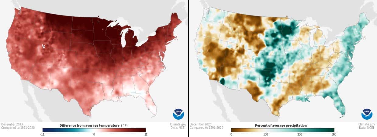
From woeful to reasonable, conditions have markedly improved across North America since the New Year rolled in. After a about a week and a half of relentless storms, and more in the forecast, it seems winter has finally arrived in the Western Cordillera and is intent on making up for lost time. But for how long can it keep up this intensity, and what effect will a strong El Nino, peaking out in the Pacific have? And is El Nino to blame for the poor start?
Up until about midway through the first week of January, the North American snow season was limping along with well-below average snowfall in almost all areas. There were, of course, some individual SNOTEL sites giving us average or above readings in the central and southern Rockies, but these were clear outliers.
Warm temperatures were a major factor contributing to the poor start, even in the Cascades and Canadian Coast Mountains where there was plenty of precipitation which fell mostly as rain. The Sierra’s and northern Rockies didn’t stand a chance with little precipitation falling there.
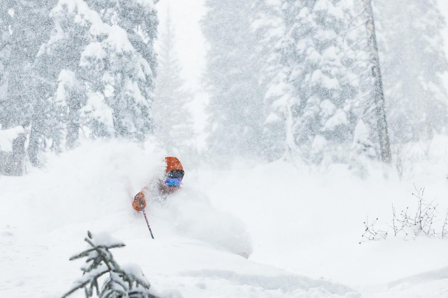
As if the collective sighs and scraping of smooth surfaces on rock was heard by some snow deity, things took a turn late in that first week of the new year. First a storm rolled over the Sierras and southern Rockies, closely followed by a constant stream of cold, moisture-laden storms coming in from the northwest. These storms worked their way into the south and east, draping a powder curtain down over North America and Reggae has the details in our latest World Snow Wrap.
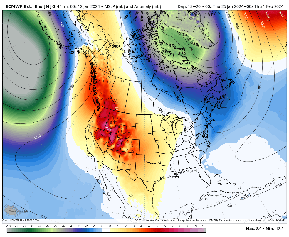
The image below shows just how much the situation has change in a short space of time. Most catchment basins have jumped at least 10-20 percentage points compared to the 1991-2020 median, while jumps of 30-60% can also be found.
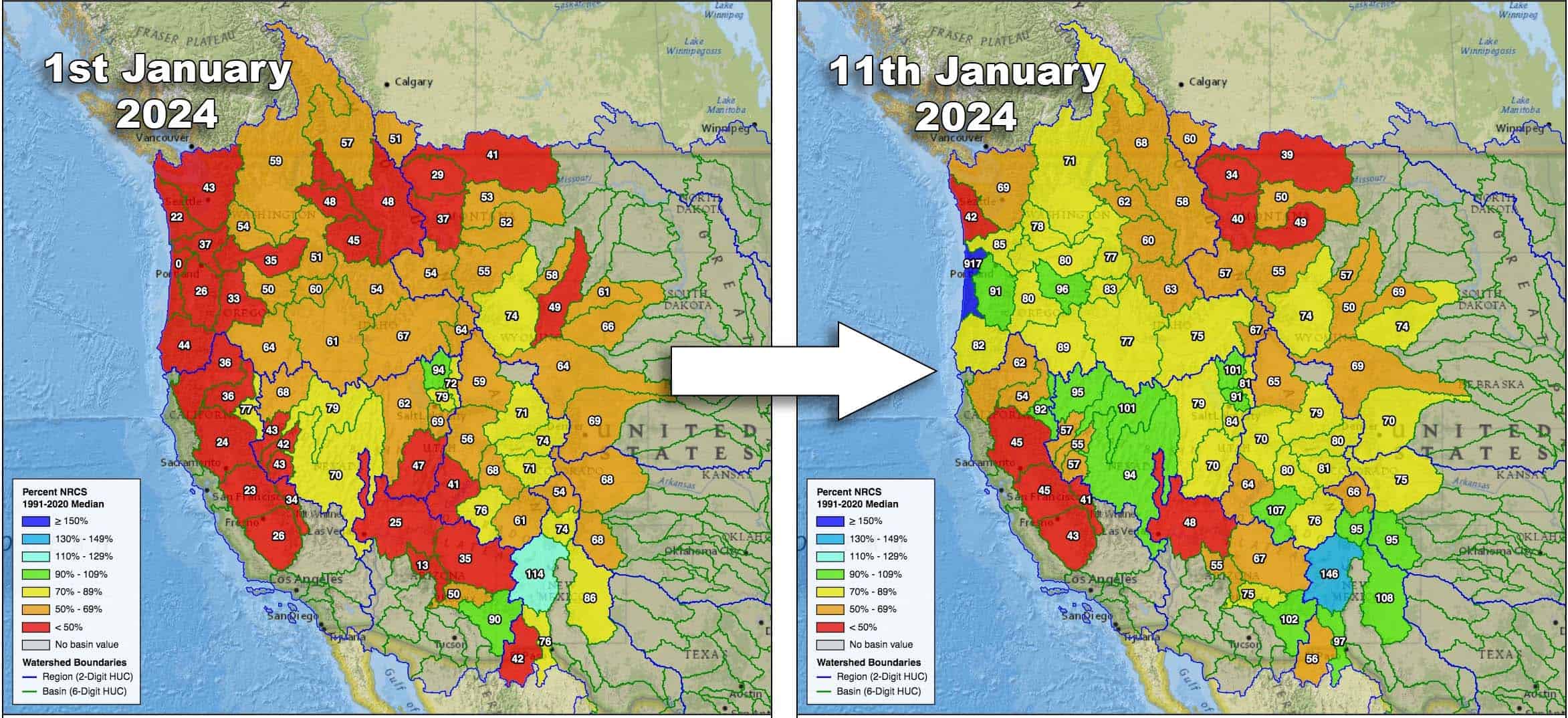
Still, current conditions fall well below the median in most basins. If we were to have another look at these charts in a few more days, after a current storm leaves a thick swathe of powder over central areas, we would see another jump in the right direction in Oregon and California through to southern Idaho, Wyoming, Utah and Colorado. An extra 50-100cm+ at some resorts will make for some epic powder days regardless of how deep the snowpack is, which goes to show it’s often more about timing.
From Tuesday 16th through Thursday 18th, it’ll be areas to the north that take some great leaps forward with a heap of powder falling up there. Winter then backs off and things look to get a bit warm and wet in the Northwest from Friday 19th, as an atmospheric river of wind flows in from the south.
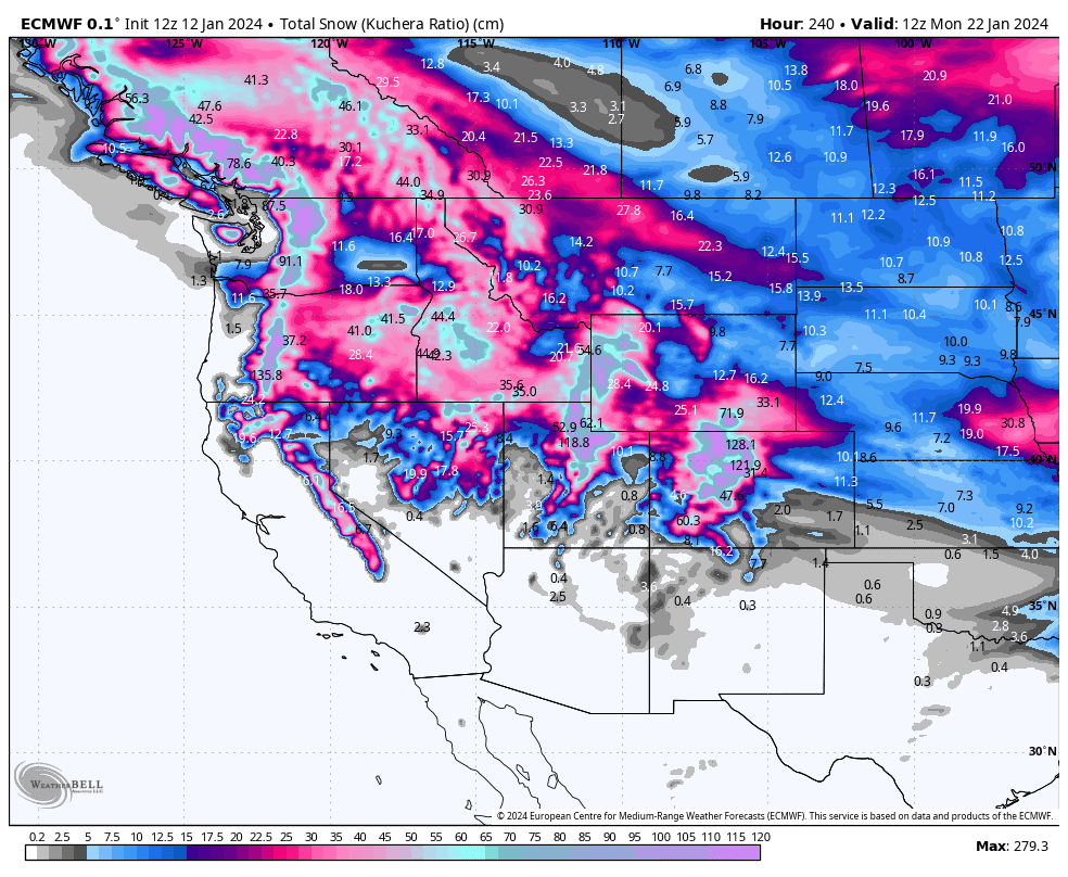
Cooler air and widespread snow is possible from Monday 22nd to Wednesday 24th, before high-pressure looks to slow things down even more for the final week of January.
That leaves us with the second half of the season to nut out. That’s right, the season here lasts for about 5-6 months! The majority of resorts are aiming to close sometime in April, so there’s still a whole lot more shredding to be done here.
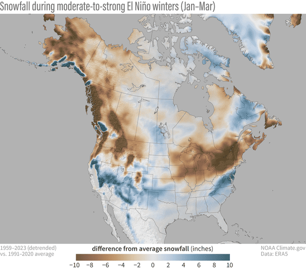
So, while many aspects of El Nino have played out so far – warm temps in the north, higher precip along the east coast and central areas of the U.S., and broader analogous pressure patterns – and we could reasonably blame it for many of our woes, there is still plenty of time for El Nino to bare its teeth. Additional El Nino effects we’d like to see include cooler and wetter/snowier conditions over the lower tier of North America, which would improve conditions in the Sierras, and southern Rockies.
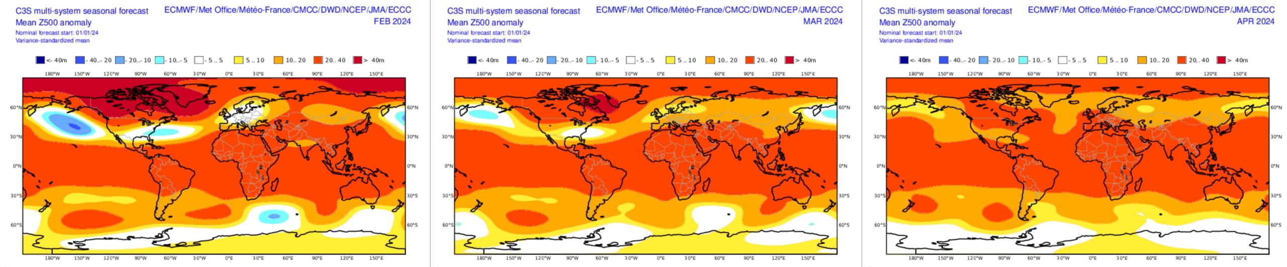
For that to happen, however, El Nino has an uphill battle ahead as it has likely already peaked. El Nino is currently within “strong” thresholds after getting close to “very strong” thresholds in the weekly data late in November, and is forecasted to weaken hereon in, reaching neutral conditions during April or May. Seasonal models, as well as NOAA’s outlooks, all follow suit with El Nino trends over North America fading during the next three months.
Aside from mother nature, other factors playing havoc with El Nino trends include warm waters elsewhere in the Pacific Ocean and across the globe, the Arctic Oscillation, which beats to its own drum and has been negative since late December and is expected to turn positive in about a week. This results in more southerly airflows and potential for warmer temps and while that doesn’t negate the chance of snow, it may result in rain at lower elevations. However, the AO does regularly flip from one mode to the other and is likely to swing back to negative by the end of the month.
Other tropical fluctuations, such as the MJO (Madden-Julian Oscillation) tend to hit El Nino head-on. Like it did in early December, another strong MJO pulse is forecasted to drift over the Maritime Continent over the course of a week or so starting mid-January. Here it may dampen El Nino’s influence on the global circulation, but then strengthen it once it drifts into the Pacific later in the month.
So, all in all, I still expect a weak El Nino trend to play out during the Feb-March period, with plenty of wibbles and wobbles along the way. Remember, an El Niño pattern is dealing with averages and may account for up to 10-20% of snowfall variation in a season. The real on-the-ground weather is only reasonably forecastable up to 7-10 days out. As I alluded to earlier, to score the goods it’s often more about timing, and to do that you can keep your finger on the pulse here with my weekly forecasts, issued every Thursday. Until then…
Grasshopper


