Grasshopper’s New Zealand Snow Season Outlook, June 20th – Latest Update
Mountainwatch | The Grasshopper
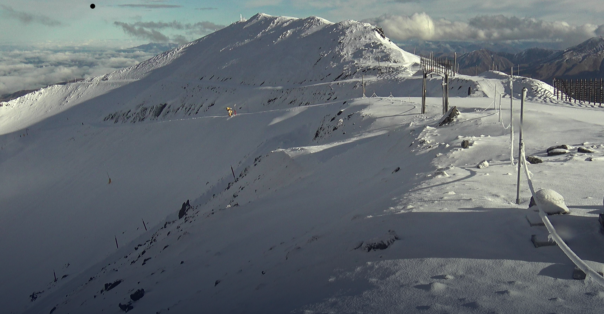
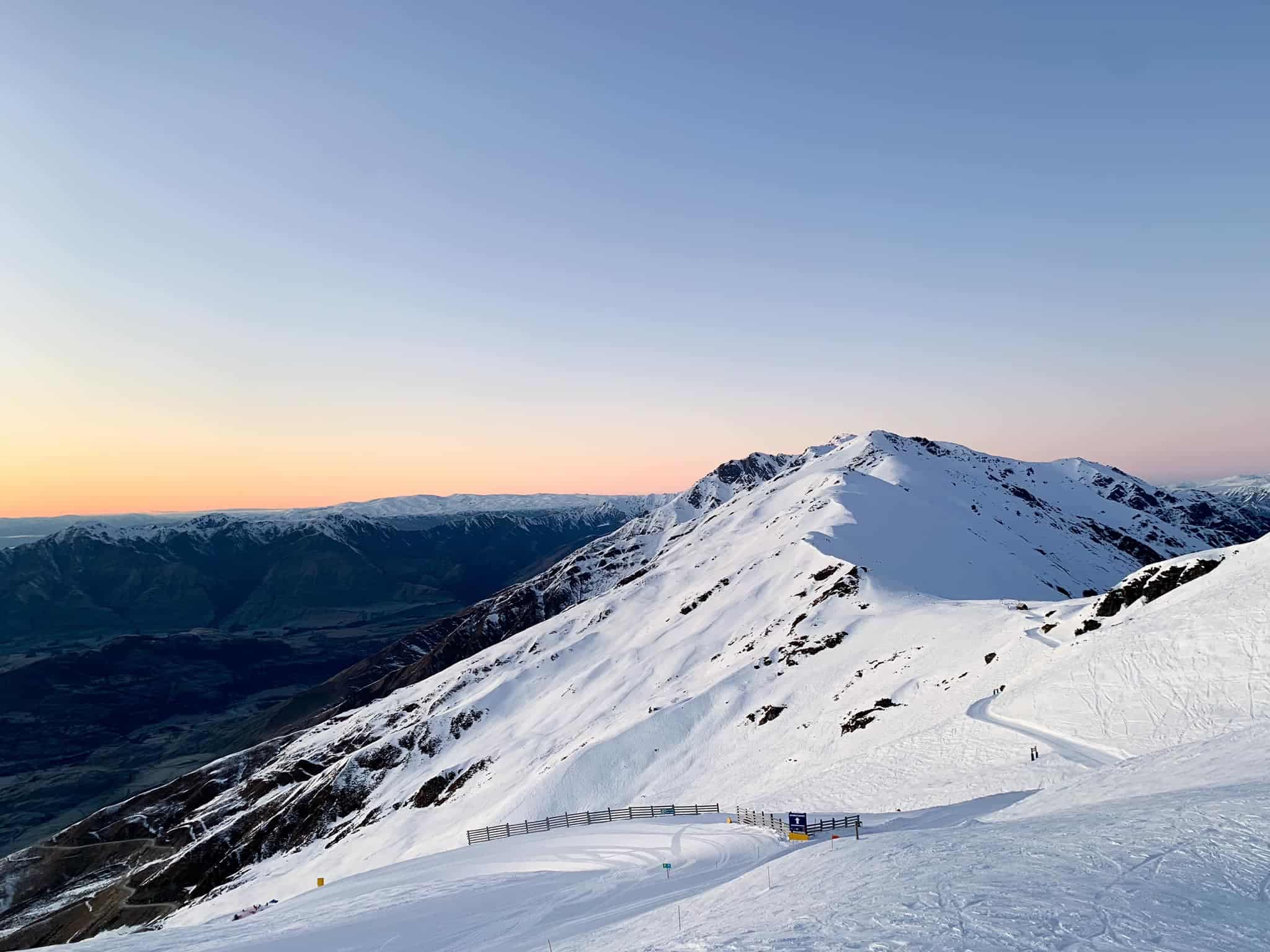
Patchy Bases as Resorts start to fire up the Carpets
Whilst a couple short, punchy early snow events offered up some early promise in mid-May and at the start of June across the South Island resorts, the hangover from our triple-dip La Niña in New Zealand, and warm sea surface temperatures around our coasts has tempered expectations for the official start of the Ski Season at many resorts.
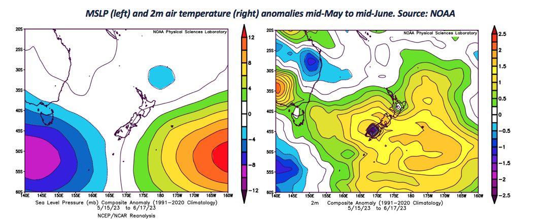
Over the past month or so, higher than normal pressures have been slow to clear to the east of the country with frequent northerly flows across New Zealand driving anomalously warm temperatures for both islands; New Zealand recorded its warmest May on record overall. This has not precluded the odd cold snap, as last week where snowmakers where in full swing down south, but generally conditions have not been conducive for the man-made snow!
On top of this, some of that early season snow has taken a hit when warm northerly rain has crept in down south and is likely to mean many of the resorts are slower to open up than normal this season. Not unintentionally, little mention of the North Island fields so far…at this stage, the less said the better!
School’s out, but will there be snow about?
As the NZ school holidays fast approach (1st-16thJuly) many a budding shredder will be keeping an eye on the webcams over coming weeks and hoping to see plenty of the white stuff about. But what can we expect from the forecast through the end of June?
Little change to the weather formula this week with another northern Tasman Low approaching the upper North Island from Wednesday. It is all outlined in my forecast published yesterday.
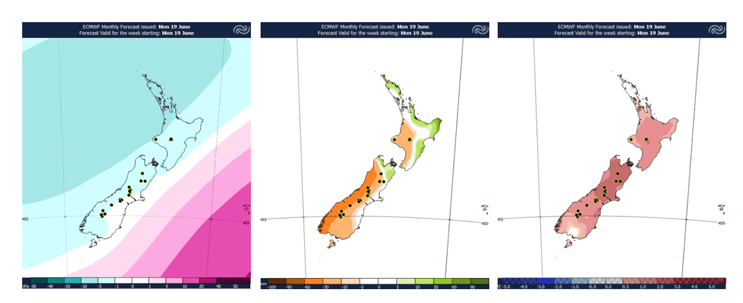
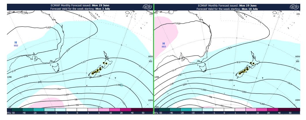
Next week: 26th June – 2ndJuly
Lower than normal pressures across Aotearoa next week heralds some more volatility in the weather. Expect more typical winter westerlies to return with at least a couple fast moving systems moving across the country offering a route to some useful snowfall top-ups next week, especially at higher elevations. With these systems whipping through, the weather on the hills will not be quite so inviting though; gusty winds and plenty of cloud cover in the forecast next week. Mt Hutt and Porters may struggle to pick up much useful snow in this set up though, with temperatures again on the milder side east of The Divide.
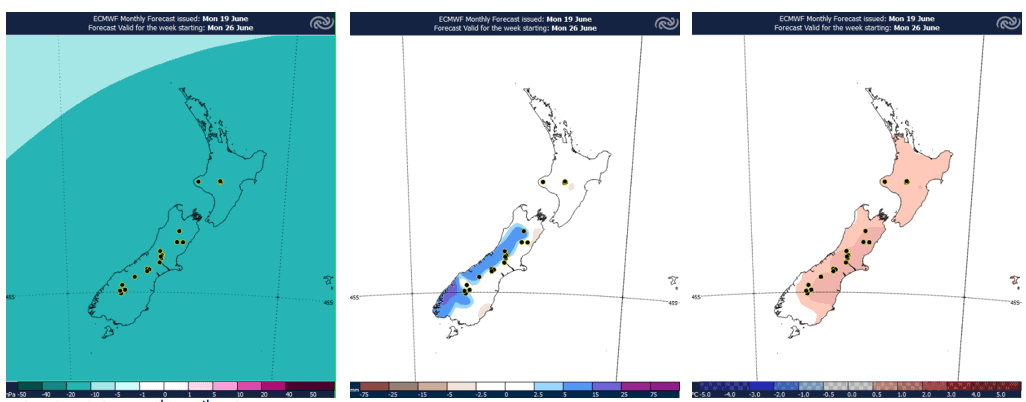
School Holidays: 3rd– 16thJuly
The volatility of the previous week may cease for a time early in July, especially the further south you are, with some more settled weather offering calm conditions on the mountains and some cold overnight temperatures to make some snow, but expect this to be relatively short lived and another spell of enhanced westerly weather to redevelop as we head deeper towards mid-month.
Again, showery winter top ups should be on offer in this set up, but at this stage no major winter storms on the cards. It will be a case of looking at the forecasts day-to-day to pick when to head up the hill and make the best of short intervals of fresh snow and calmer winds.
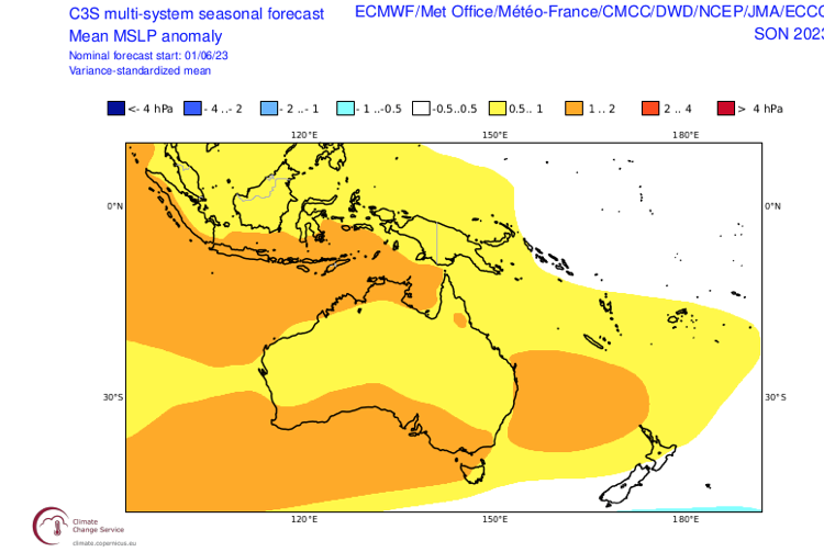
El Niño Après-Snow this Spring
Tropical Pacific Ocean temperatures are now comfortably into El Niño territory, but we continue to wait for the typical lagged affect in the atmospheric patterns. The event is underway and expect El Niño to peak through Summer.
Our last seasonal outlook served up the Niño recipe book (do your revision here), and expectations have not shifted dramatically with models still confidently pointing towards a moderate strength event. Interestingly, a positive Indian Ocean Dipole is also looking increasingly likely through coming months, which tends to superimpose on the typical El Niño pattern.
The key facet remains; expect cold S-SW winds to become increasingly dominant across the weather maps as we head deeper into winter and Spring and El Niño becomes well-established. Think semi-regular snow events to gradually tick up the bases across the resorts, as opposed to the big, irregular La Niña dumps of last year.
Diminishing returns the further north you go, but as the SW winds slowly cool sea temperatures around the country, we can expect any fronts to start to bite more for the North Island too. Colder Winter and Spring conditions than previous years should also offer more potential for the snowmakers.
All of this points towards good Spring-time conditions on the mountains too, with the snowpack likely looking healthy by the time the September and October roll around, and potentially slowing the melt down through these months.
Bottom line:
Stick to the groomers early in the season as the snowpack gradually builds, but expect these to be in a healthy state as we head into the business end of the season allowing people to get into the backcountry, especially for the Southern Lakes resorts.


