The Grasshopper’s Weekly Japan Forecast, Thursday Jan 18th – From Butter to Cream; Heavy, Dense Snowfall Turns Light’n Fluffy From Tuesday
Mountainwatch | The Grasshopper
Written Thursday morning 18th January (Japan Standard Time)
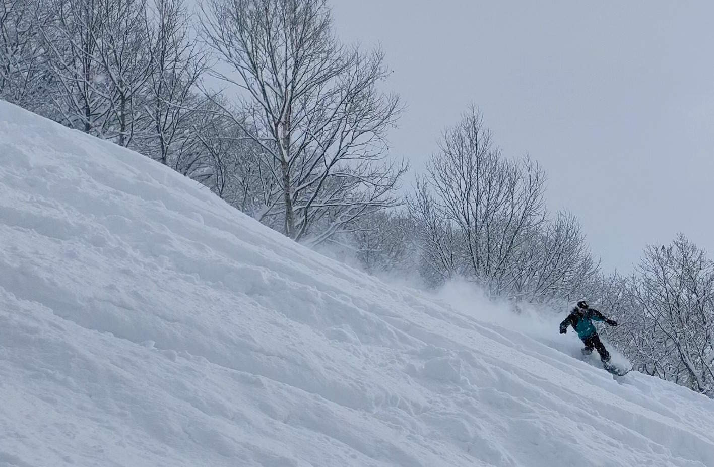
As expected, back-to-back storms plastered Japan with a tonne of high quality powder from Friday to Tuesday. Honshu has received the biggest totals, which range between about 80cm to 180cm at base levels (respective measurements taken at Hakuba and Myoko), which you could perhaps add 25-50% for mid and upper slopes. Hokkaido was also solid and consistent as usual, with about 60cm measured down low at Niseko and Furano since Friday.
In fact, the last couple of weeks have been massive for Japan, as Reggae wrapped up nicely here, and conditions have improved considerably after a slow start to the season.
Today, a front passing over Honshu will bring a load of heavy, dense snowfall to mid-upper slopes, not the usual light’n fluffy Japow of late, as well a rain lower down. A similar thing will happen from Saturday into Monday as a low shoots out of the warm west, but here the precipitation will be more widespread and even heavier than today’s event and will make it up to Hokkaido from late Sunday.
It’ll all come crashing down on Tuesday, however, (temperatures, snowlines and snow, that is) with the arrival of cold W-NW winds, kicking off about 48hrs of high-quality moderate to heavy snowfall, which will churn the slopes from butter to cream again.
Thursday Jan 18th & Jan Friday 19th
We start the forecast with a front draped over Northern Honshu as a weak low drifts over Hokkaido. To the south of the front: mild, humid W-SW winds; to the north of the front: cold, dry northerlies.
Unfortunately, most of the precipitation lies to the south of this front, which will balloon out over the entire island of Honshu this morning. There’ll be heavy falls of snow+rain for those mountains that cop it in a westerly flow, which includes most of northern Honshu. In central Honshu, the Hakuba resorts in particular will cop it, with heavy, dense snow falling above about 1000m, but rain & sleet below that.
The front will eventually pass over Honshu this evening/overnight with precipitation easing to light snow showers as the colder northerlies arrive. The snow showers won’t last long, however, and skies quickly dry up Friday morning with sunshine breaking out for the remainder of the day.
Up on Hokkaido, meanwhile, the cold northerlies will arrive this morning, bringing a scattering of light snow showers, which will confine themselves west of Sapporo early Friday as sunshine breaks out further inland.
Saturday Jan 20th to Monday Jan 22nd
Saturday morning, things will turn sour once again over central Honshu as a low out of the warm west begins its eastwards track along the Pacific coast. This time, winds from the south to east will bring heavy precipitation, with snowlines varying in time and space within a likely range of 700-1300m. Again, heavy, dense snow will fall above the snowline, with rain and sleet lower down.
The heavy precip will spread up northern Honshu late Saturday and early Sunday, then over Hokkaido late Sunday and early Monday while easing over central Honshu. Snowlines gradually decrease the further north you look, so that on Hokkaido, snow should fall to base levels except for a period Monday night where a little low-level rain can be expected.
Tuesday Jan 23rd & Wednesday Jan 24th
As they say, what goes up must come down, and Tuesday will be the day that it all starts to come down: temperatures, snowlines and snow!
Cold air from the W-NW will gradually pile on during Tuesday, with central Honshu in particular seeing heavy snowfall Wednesday into Thursday.
Snowfall isn’t likely to be quite as heavy further north, where more moderate falls are expected, and Hokkaido may be not get fully into the swing of it until later on Wednesday. Still, snow falling at a decent rate over close to a 48hr period should really add up.
Extended Outlook
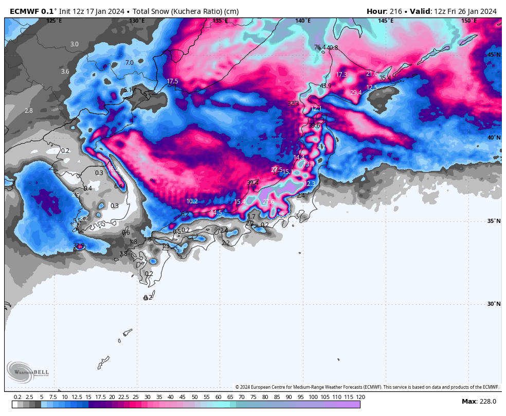
The snow storm that kicks off on Tues-Wed, will likely wind down next Friday 26th Jan. Models hint at another top-up over the weekend of 27th-28th Jan, as a weak cold front passes over.
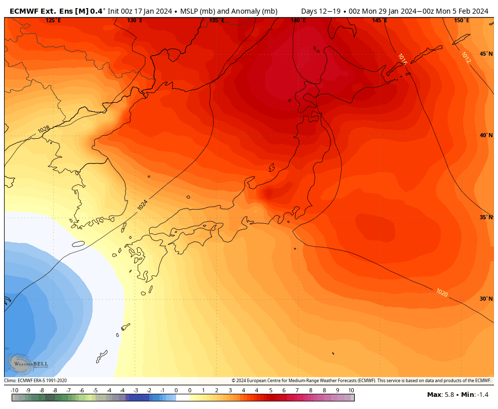
A settled spell is then expected through the first half of the following week, starting Monday 29th Jan, as high pressure drifts over the country. Things start to open back up through the back half of the week, but we may initially cop another one or two of these lows originating in the warmer west before colder weather arrives.
That’s all from me today. Have a great week, see you next Thursday.
Grasshopper


