Japan 2024-2025 Snow Season Outlook, Mid-Season Update – Warming Trend as La Niña Weakens
Mountainwatch | The Grasshopper
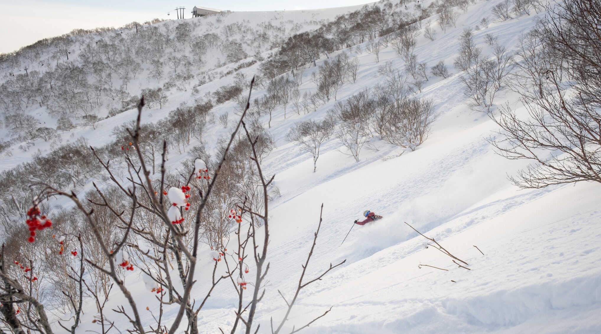
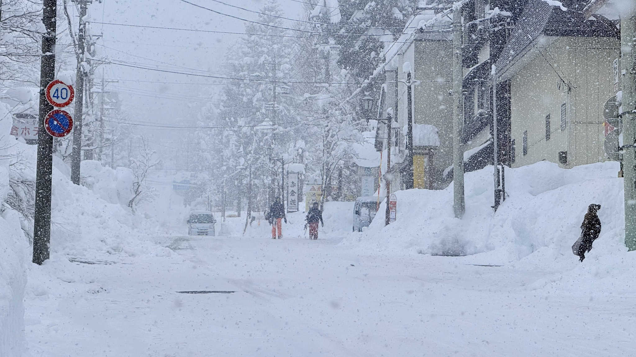
After a record-breaking December with some spots breaking 68-year-old records and some very deep days in Japan we now find ourselves at the end of January. The past 10 days have been relatively dry across with a couple of isolated smaller storms but a bigger storm is due this week which looks set to drop good snow totals, especially on Honshu.
Check my forecast from Thursday for the details, but now let’s look ahead for what to expect through the remainder of winter and into spring.
ENSO update
The running theme of this winter has been an expected weak La Niña or negative neutral ENSO phase with hints of development consistent with that of a La Niña event over the last two updates. Currently the story remains much the same with the question of whether we are currently in a La Niña event depending on who you ask. Conditions in the Pacific Ocean have reached NOAA’s thresholds but not quite those of some other agencies.
This aligns with our expectations of a subdued event. So why is this important? Heading into February the ENSO signal typically weakens and becomes hard to forecast through spring. As a result, we will most likely see a return to neutral values which do not have significant influence on Japan’s snowfall heading into spring.
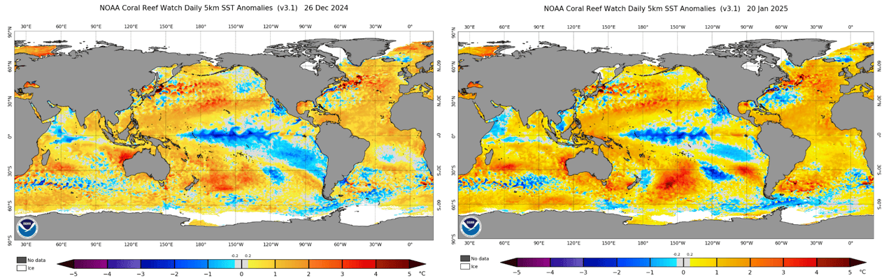
Below is an updated global SST anomaly map, comparing now with the end of December. Focusing on the Pacific we can see the central equatorial region looks quite like the end of last month while the collection of warmer waters in the west looks slightly better. Both the major features of a La Niña pattern possibly suggesting it is close to peaking with slightly warmer conditions in the eastern Pacific.
Spring Warming?
Moving through spring seasonal forecast, models are suggesting warmer than average temperatures over the next three months and possibly a lower frequency of storms than average.
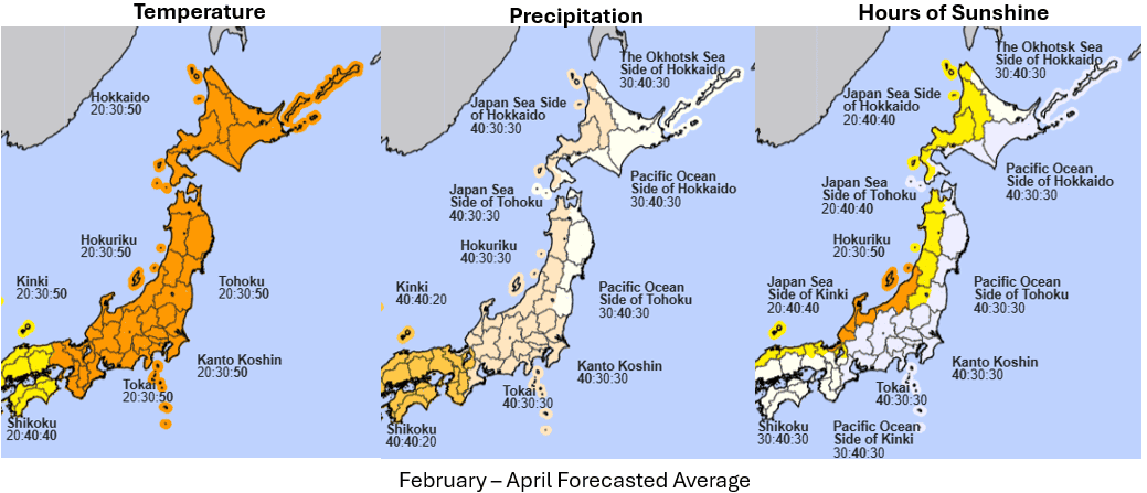
The three maps below show the forecasts through February, March and April for temperature (left), precipitation (middle) and hours of sunshine (right). It shows the highest probabilities leaning towards warmer conditions with slightly below-average precipitation and a slight increase in sunshine. This suggests a possible decrease in frequency of storms over the three-month period.
However, do not despair as while the most likely outcome for temperature is warmer than average there is still a 50% chance of average to below average temperatures for regions listed in the map as 20:30:50 (where the ski resorts are located!) Overall, the JMA seasonal products suggest a neutral to warming trend that may be more influenced by shorter timescale climate factors than those longer timescale influences like ENSO.
The next question is why? As mentioned in previous outlooks the East Asian Winter Monsoon (EAWM) is a key player in the Japanese snow season. Strong and cold northwesterly winds across the Sea of Japan are driven by an area of high pressure in Siberia known as the Siberian High. The strength of the Siberian high directly impacts these winds and their frequency. During a strong La Nina event the Siberian High is enhanced and as a result so is the EAWM which, all other things being equal, typically leads to higher snowfall years during these events. This year since we are experiencing a weak La Nina pattern we aren’t quite seeing that enhancement.
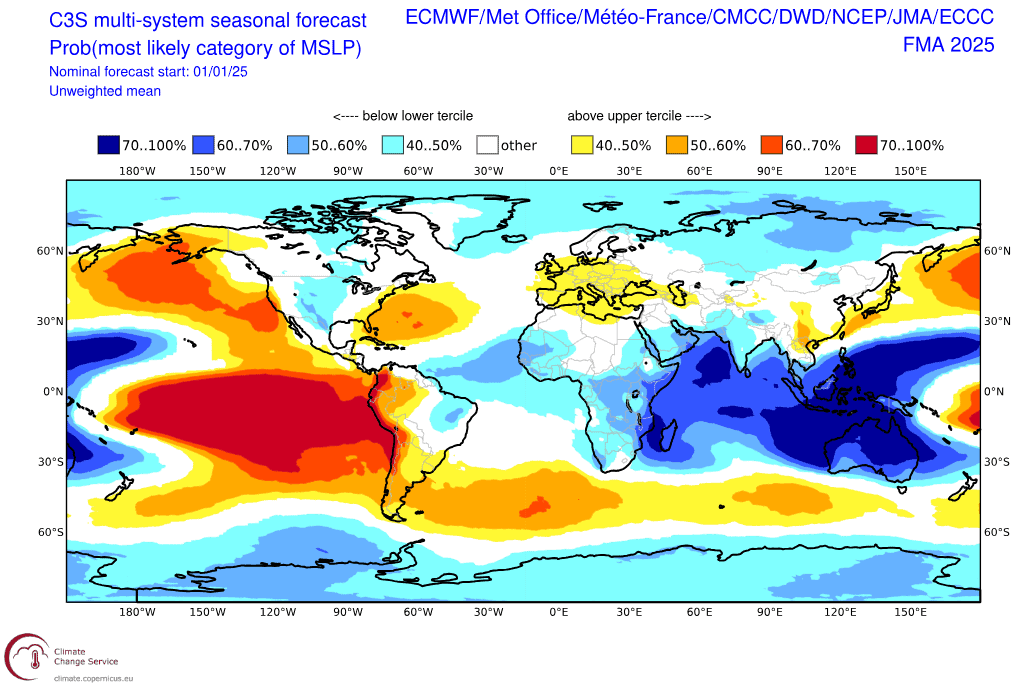
The visual below shows forecasted MSLP anomalies for the Feb-Apr period. Looking to Siberia we see neutral to slightly lower than normal pressures, which for the Siberian High means a normal to less intense region of high pressure. We can also notice the anomalous slightly higher pressure over Japan aligning with the expectation of more clearer days mentioned earlier.
Because of the more neutral expectations for the remainder of the season we may see more influence from smaller timescale climate drivers like the Arctic Oscillation (AO). Comparable to the Southern Annular Mode for our Southern Hemisphere drivers, this mode describes the deviation of cold air from the poles towards higher latitudes. When the AO is negative it allows for more frequent cold air outbreaks, helps strengthen the Siberian High and positively impacts snow-bearing systems for Japan. But because the AO acts on smaller timescales it’s hard to say how it will behave over the rest of the season.
So, the dream is over?
Not quite, although the outlook for the rest of the season isn’t pointing to the storms we have seen in the first half of the season, the deep days won’t go missing all together. The lack of a real strong climate driver to take the reins means there will most likely be larger gaps in between storms and the threat of warming heading into spring may see lower elevation resorts exposed to some marginal temperatures.
In the short term it will gradually trend to this pattern, becoming more evident in the back half of February. Enjoying the snow conditions Japan is famous for is going to be more about timing over the next three months.
In summary, the second half of the season will most likely see neutral to marginally below average conditions which may manifest themselves as warmer breaks between storm cycles. Obviously average snowfall totals in February are higher than March/April, so don’t despair. There will still be some deep days to come this season and you can stay up to date with the short term picture via my weekly Japan forecasts.


