Japan February Season Update – Storms Slow Down as We Head Into Spring
Mountainwatch | The Grasshopper
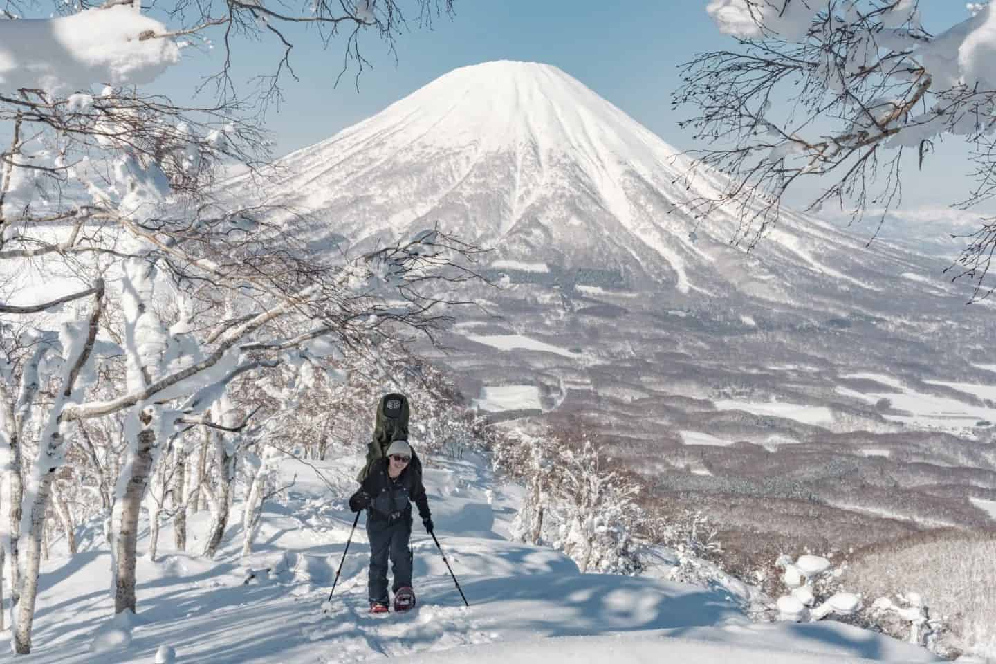
We are getting towards the pointy end of the season now with spring fast approaching and the Japanese snow season has been largely a success with some monster storms coming over the past month, solidifying solid bases around resorts.
The good times are set to continue over the next week as well with promising conditions setting up some stormy days, especially around Honshu.
Hokkaido has mostly been hiding in the shadow of Honshu this season with many storms dumping over Honshu but running out of steam as they head up north. In saying this, it has still had its fair share of typical Japow days. Looking towards the end of the season we’ll unpack what to expect through spring as things wind down.
Pressure and Precipitation
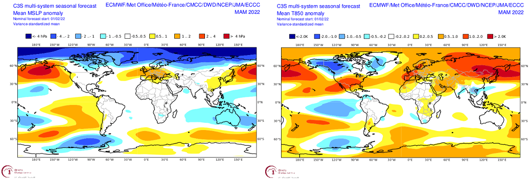
In a foreboding sign for the end of the snow season we have the multi-system three monthly forecast for MSLP and 850hPa temperature below, these charts are forecasting for March through to May. From the MSLP forecast on the left we can see a strong region of anomalous high pressure around the Aleutian Islands indicating a weaker Aleutian low and extending over pretty much all of Japan. This generally isn’t good news as it suggests less storms and convective activity.
The temperature forecast on the right isn’t much better with deep reds encompassing Japan. This chart suggests temperatures over the three-month period will be on average around two degrees warmer and, as we all know, warm temperatures generally aren’t helpful for snowfall.
JMA Update
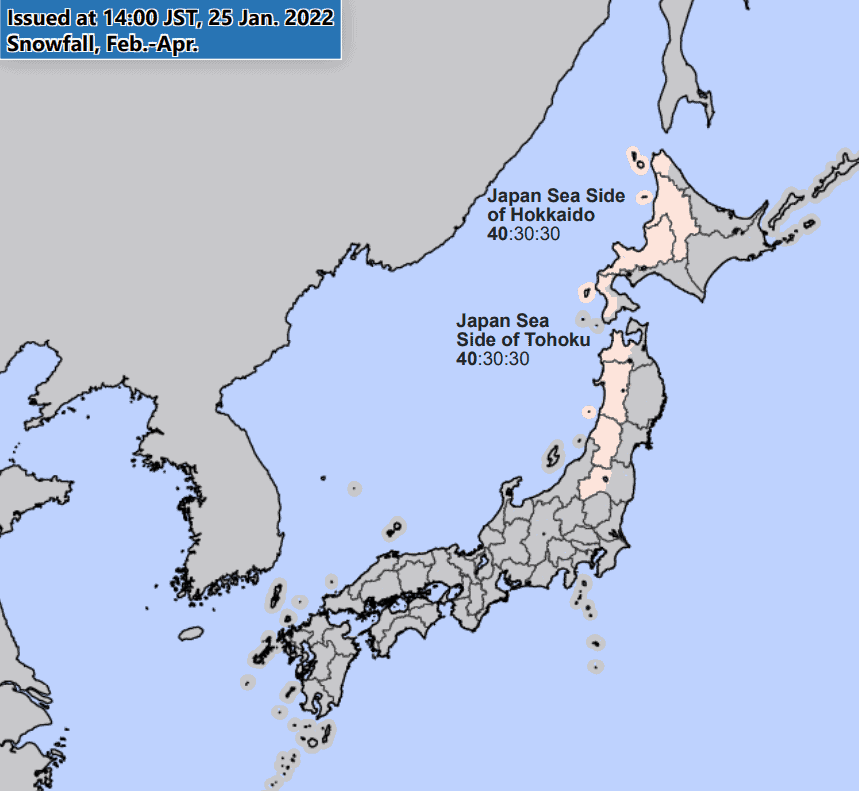
The three-month forecast from the JMA (Japanese Meteorological Agency) covering the end of the season shows a slightly below average snowfall expectation for areas around the north. Based on the way this season played out this may have been expected with northern areas never quite getting going consistently. This also aligns with the seasonal forecasts above where we are expecting average to below average conditions to close out the season.
Has much changed?
Well since we last spoke it does look a little bit different. Seeing as we are heading into the end of the season we are expecting things to wind down eventually and from the diagrams above we are looking at the snow season slowing down considerably over spring. Warm temperatures and high pressure never really bode well for consistent snowfall. In saying that, these forecasts are over a three-month average so a storm here or there is not impossible. Also, we are only in the middle of February and there are promising signs for the week ahead.
Conclusion
Don’t lose hope, if you are out enjoying the Japanese ski season and in Honshu it should be a great week this week. Looking further ahead it does look to slow down heading through spring, which is typical in Japan, but overall it has been quite a productive season with big totals recorded around central Honshu and plenty of deep days had thus far. There should hopefully be a few more left.
This is the final season outlook for the 2021/22 season and I’ll be back for the first 2022-23 season outlook in November. The good news is the Japanese government is slowly opening the borders and it’s looks like we’ll be able to head back to Japan next winter. Can’t wait,
Take care,
Grasshopper


