New Zealand 2022 Snow Season Outlook, July Update
Mountainwatch | The Grasshopper
After a slow start to the winter months in terms of snowfall, with anomalous warmth hanging around our shores, the ski fields received a welcome shot in the arm when the coldest airmass of the season so far arrived just in time for the School Holidays.
With resorts down south looking decidedly rocky, and ski lifts at a standstill, some timely snow arrived on June 27th, followed by a polar blast in early July with natural and man-made snow massively helping out bases across the country.
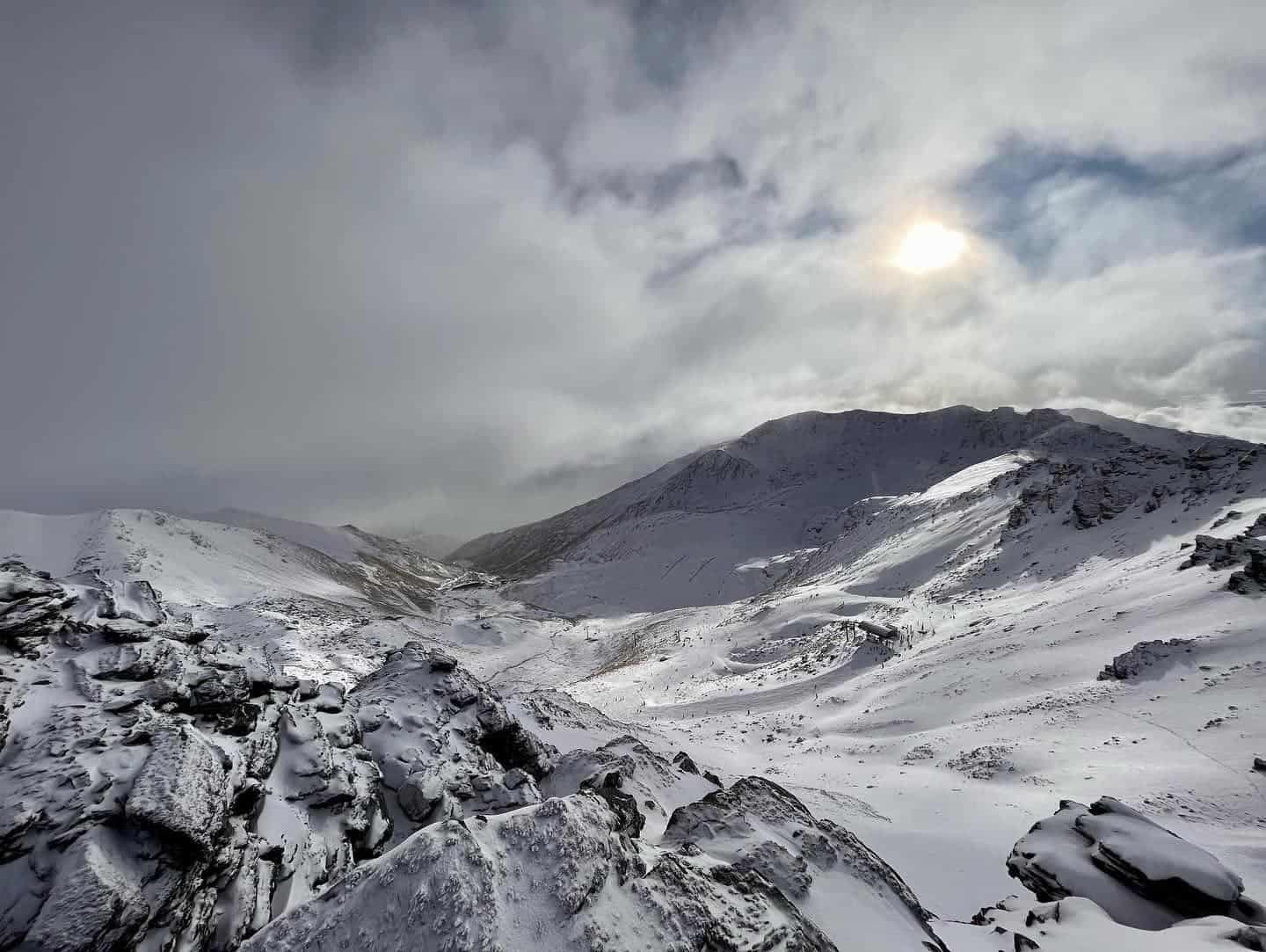
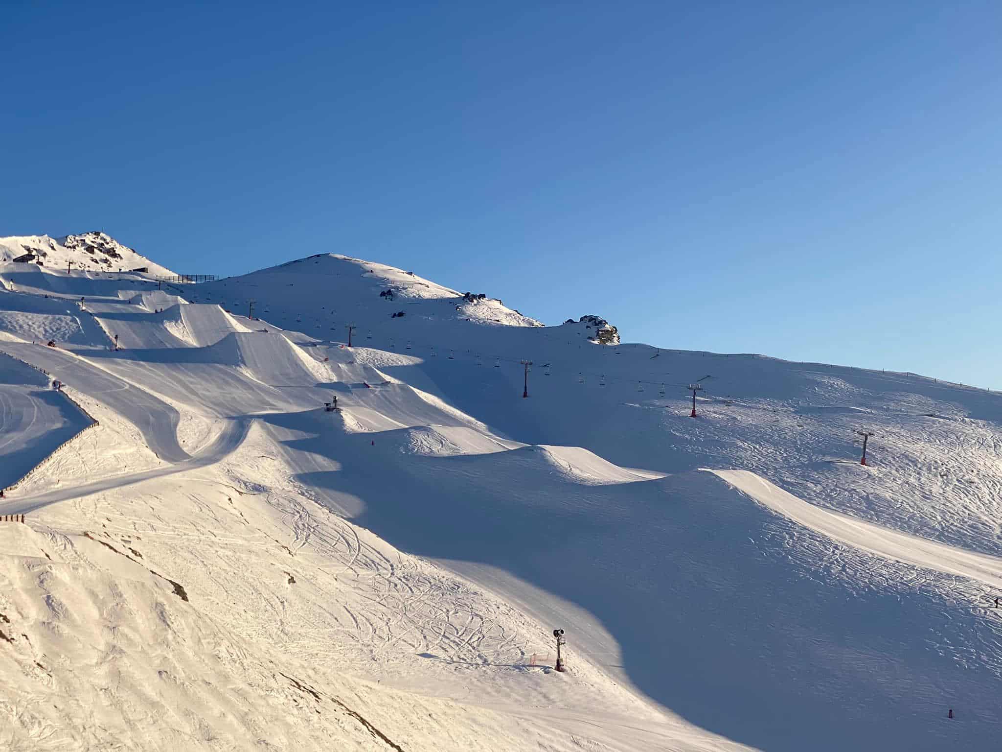
Whilst these natural dumps weren’t too spectacular (think a modest 5-15cm at the resort bases on most of the South Island hills each time), the cold temperatures have really helped the snow-making teams to get the lower mountain into shape across the resorts. Southern facing slopes of Mt Ruapehu did see some punchy accumulations though as cold southerly showers pummelled the mountain over a number of days, with the snow base over a metre on the upper mountain now! A timely reminder that one of New Zealand’s premier resorts is very much in business this season.
As a result of the cold snap, Coronet Peak, Mount Hutt, Treble Cone and Ruapehu (with a little extra help!) were able to open the gates just in time for the school holiday rush and have offered up some mint weather over recent days too with transient ridges drifting through.
180’s in the Park, 180’s on the Weather Maps
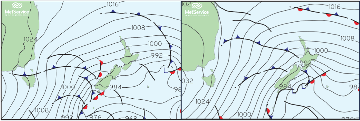
As discussed in our last seasonal outlook , most of June was not a conducive month for snow on the fields with anomalous high pressure to the SE of country blocking low pressures from progressing eastward with any speed; slow moving Tasman systems often became entrenched across NZ and drove prolonged wet, mild spells of weather with NE winds commonplace. June was, for the most-part, a classic La Niña hangover.
So, what conditions do we want for snow? Well cold S-SW winds is the BIG one, as seen at the end of the month and early July. Throw in a couple active frontal features and we have a healthy mix of natural snow alongside the gentle hum of the snow cannons!
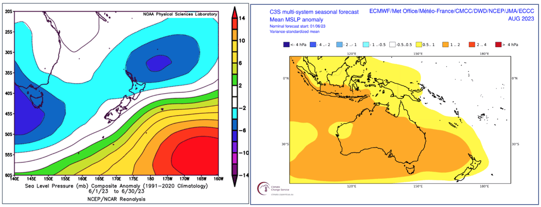
Switching from predominantly NE wind regimes to SW flows is no easy 180 though, and the atmosphere tends to move on monthly timeframes to achieve such feats. Whilst July is likely to see a mixed bag of weather, with a handful of warmer northerly quarter flows possible over coming weeks, models are confidently pointing towards a change of regimes as we head deeper into August and the end of Winter.
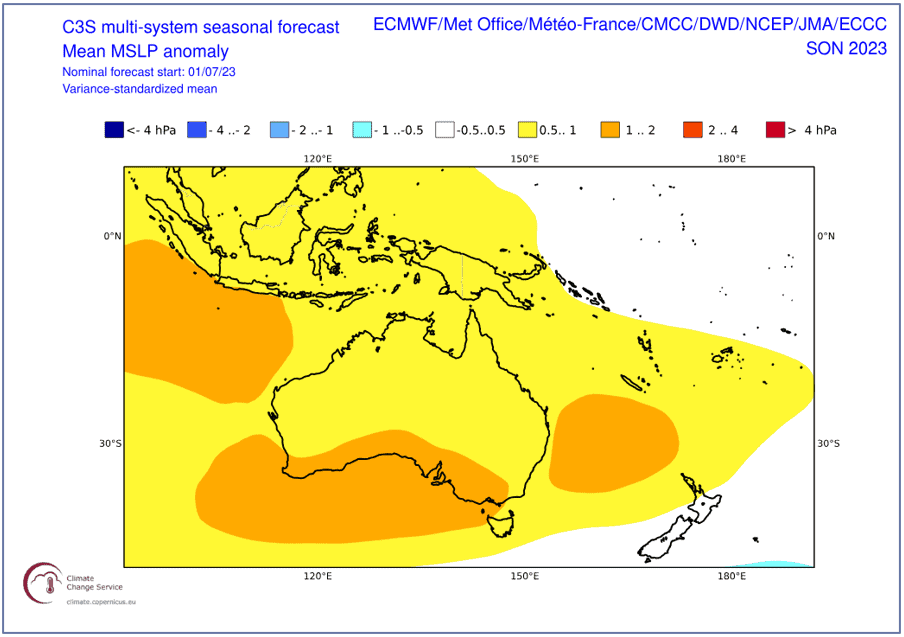
This is primarily being driven by a burgeoning El Niño event; so far it has not really taken off, but the atmosphere appears to be lining up head on for a super kicker now. The Pacific Ocean is certainly starting to tilt towards strengthening El Niño conditions as we head into spring, and the expectation is that we may quickly catch some air through August.
Spend Winter on the Groomers, but build up to the Backcountry this Spring
Winter
As the atmosphere transitions towards El Nino, expect the weather maps to fluctuate at times. We will definitely see some prolonged SW spells, but N-NE rain events are also likely to occur albeit with reduced frequency than compared with previous months. The backcountry will need some more time to develop so stick to the groomers, but watch out for a hard pack lower down the runs, especially if we haven’t seen any SW winds for a few days.
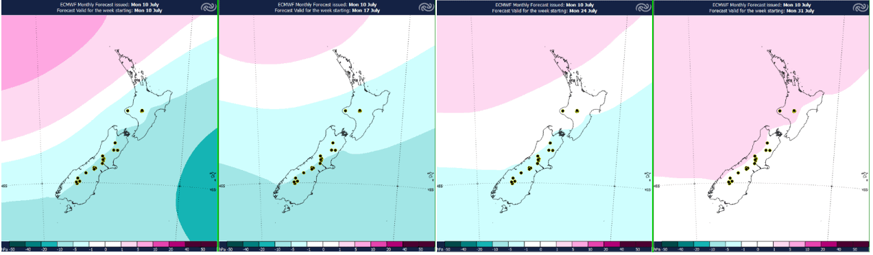
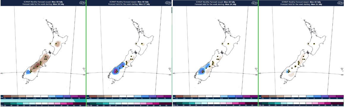
MSLP anomalies over the next four weeks are bullish about higher-than-normal pressure lingering in the Tasman Sea, especially the northern Tasman. This will generally promote a westerly patten across New Zealand through the period, but when the high waxes and wanes, this may enable low pressures to spin up in the interludes, these turning the flow N-NE across New Zealand every now and again.
We covered the forecast for this week yesterday, but looking ahead to mid-month, and the second half of next week, we could be in for some more active, warmer NW rain. This may have a detrimental affect on the slopes at lower levels, but should fall as snow higher up on the hills. Towards the end of the month high pressure is forecast to expand further south for a time, spreading across the whole country into the start of August and heralding a quieter spell of weather across the country. This might be a good bet for settled, less windy conditions on the hills.
No major changes in the MSLP pattern in August, especially through the start of the month with a northland ridge commonplace and westerly fronts washing up southern and central parts of country with regularity. We should continue to see the snowpack tick up little by little.
Spring
Overall, no big changes to the spring outlook with this update. The key message remains the same; expect cold S-SW winds to become increasingly dominant across the weather maps as we head into spring as El Niño becomes well-established. Expect regular top ups to a gradually building snowpack, with more limited big season-making dumps than last year. Alongside this, there should be ample opportunity for snowmaking as cooler snaps run through with regularity.
All of this points towards good Spring-time snow coverage on the mountains, with the snowpack likely looking very healthy by late season, and a propensity for late season cold airflows potentially slowing the melt down through these months.
One thing to consider will be the weather conditions on the mountains though. With stormy southwesterlies the order of the day this spring, strong winds and cloudy conditions could periodically make for poor conditions on the mountains. Watch out for spells of ridging on the back edge of cold fronts for the best, clearest conditions up the hill and the potential for some fresh snow too.
That’s it from me folks. If you’ve got a different theory on what’s going to happen this winter, or just want to provide feedback, then please hit me up on Facebook and hit the follow button while you’re at it.


