New Zealand Snow Season Outlook, Mid-August Update – El Niño Set to Deliver September Snow
Mountainwatch | The Grasshopper
After a poor start to the NZ ski season, during an unseasonably mild and dry June at the ski hills, the weather maps did a very welcome backflip through July into early August.
After what feels like an endless La Niña hangover through autumn and early winter (the atmosphere having one too many après drinks at The Powderkeg perhaps?), with humid and mild NE airmasses have plagued the weather maps, the snow gods have finally swung the pendulum south-westerly with much colder polar air flooding across the country with increased regularity since mid-July.
August is tracking to run cooler than average nationally for the first time since May 2017; this a stark indication of just how good the last month has been for snowfall and snow-making!
What this all means is that we are looking in great shape as we head towards Spring. Both Islands ski fields have seen frequent and sizeable snowfalls over the past 6-7 weeks, and the seasonal weather modelling remains positive for this more SW regime to dominate through the coming months.
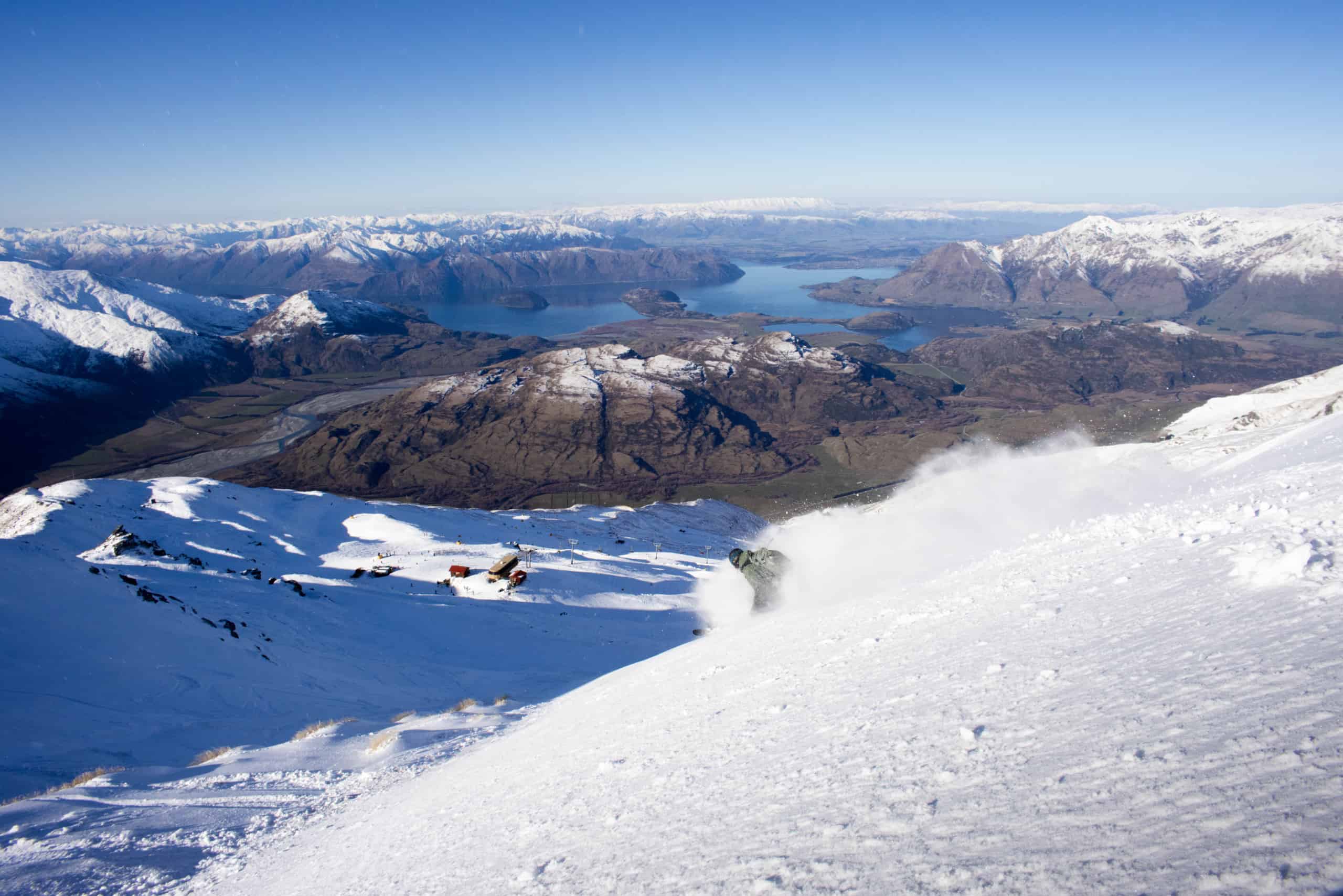
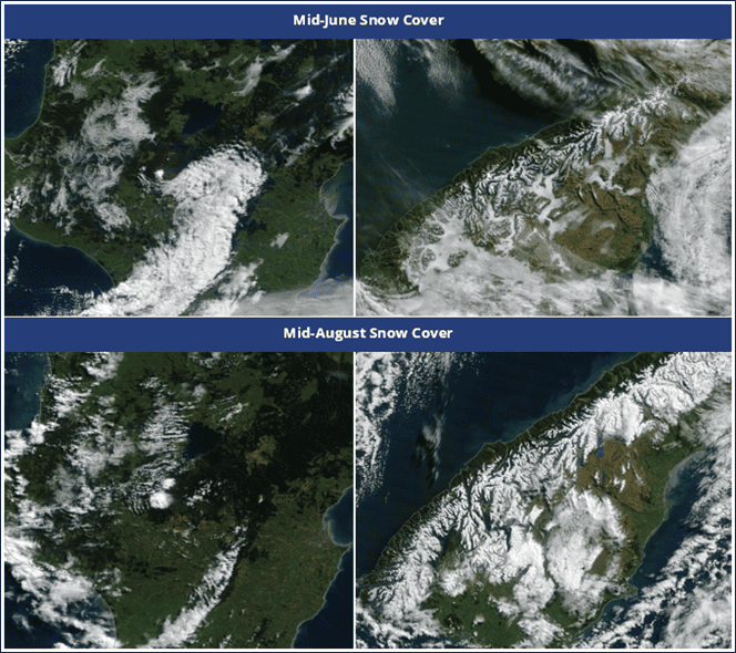
A quick whip around the snow fields and we can see the positive results of the last 6 weeks; the Southern Lakes fields coming in with bases between 50-120cm, The Canterbury fields generally between 50-150cm (but 193cm at the top of Mt Hutt) and the mighty Ruapehu clocking in 80-120cm at Whakapapa and a massive 130-260cm at the southerly exposed Turoa. With that much snow, the backcountry is also opening up nicely! Take a look at the satellite imagery below to see the glorious and significant expansion of the white stuff across our snowfields.
Wind, Snow, Sun, Repeat
The next four weeks will bring a bit of a mixed bag of weather across New Zealand, typical of winter and early spring. A rather familiar pattern of late early this week with plenty of cold/snow around, all clearing away NE and a nice ridgey window on Thursday and Friday to make the most of clearing skies and any fresh powder. Low pressure returns by the weekend though. For more details, check out the forecast from earlier in the week here.
This low clears away early next week (with some snow in the tail), before a more robust high pressure should transition slowly across the country – there could be some ripper conditions (sunny skies, light winds) on offer next week as higher than normal pressures look to win out overall.
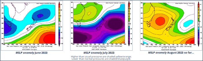
As we head into the final week of August and early September, the weather maps look decidedly SW again; high pressure anomalies lying across the Tasman Sea with lower-than-normal pressures to the SE of the country. This is the exact sort of set up conducive for semi-frequent Southern Ocean fronts washing up the country, topping up the snowfields with useful flurries.
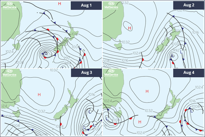
Expect the weather maps to evolve similar to the MSLP charts below – a day of gusty NW winds ahead of a low-pressure system or cold front, snow flurries with the front itself as the flow turns SW, then high pressure building in for a few days of more settled weather. These high-pressure days are the ones to target – fresh snow and bluebirds! Remember to wait for the pressure gradients to open up a bit wider and the winds to drop as the high pressure builds, with the upper mountains often susceptible to closure due to strong S-SW winds behind these frontal systems. The diligent mountain teams also need a chance to clear any avalanche risk areas, so day two of the high is often the pick of the bunch! Keep an eye on our regular short-term forecasts to help nail these prime weather windows!
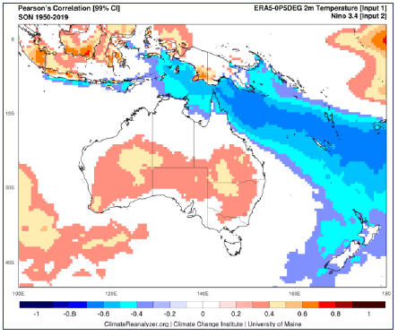
El Niño kicker could push last lifts to late spring
An El Niño event continues to strengthen in the tropical pacific and is expected to reach moderate to strong levels over the spring. The classic response to an El Niño event in spring for New Zealand are enhanced SW quarter winds across the country; this means more frontal incursions from the Southern Ocean than normal and, accordingly, an increased risk of cold outbreaks through the season.
Seasonal modelling continues to support this typical response for NZ and this is all good news for the ski hills, pointing towards a better-than-normal chance of an elongated ski season this year. Given the bases we have at Turoa, we have a chance of snow sticking around long enough to see the chairs running into early November here!
The snowpack should hold up rather well through September and early October, with further gains in early spring too, but the question will be just how many sporadic, warmer rain events sneak in over the second half of spring which will determine just how plausible those late season t-shirt runs will be.
That’s it from me folks. If you’ve got a different theory on what’s going to happen this winter, or just want to provide feedback, then please hit me up on Facebook and hit the follow button while you’re at it. Remember, the key to scoring in the Aussie Alps is often about timing, and the best way to time it right is to keep a handle on weather forecasts, which you can do right here on Mountainwatch with top-of-the-line model data and my very own super-duper forecasts.


