New Zealand Weekend Forecast Friday August 13 – POW Day in the Southern Lakes
Mountainwatch | The Grasshopper
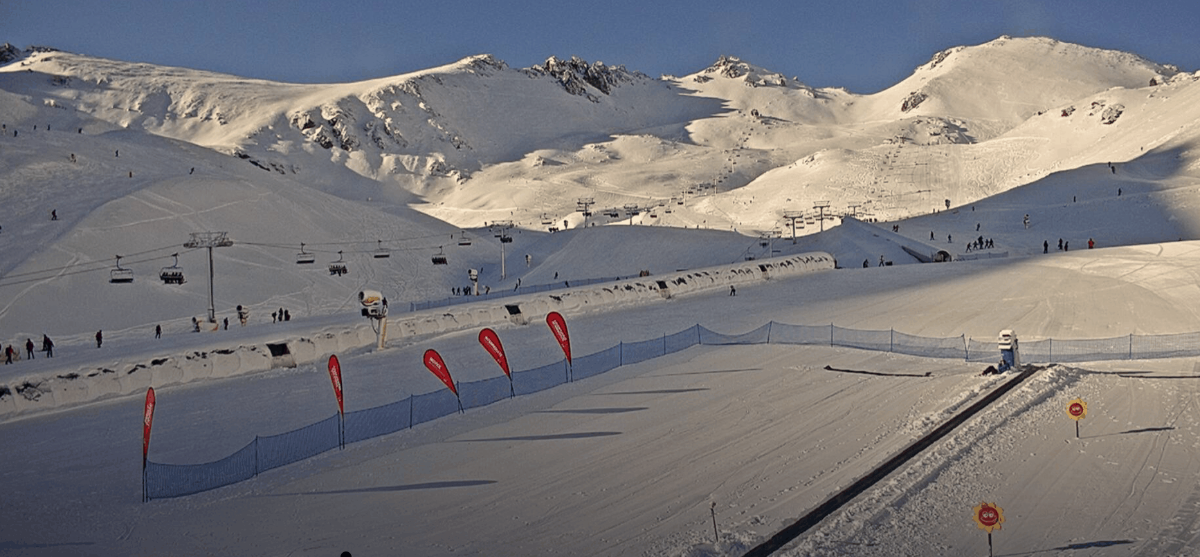
Fresh snow is being reported all around the Southern Lakes this morning with 10cm at Cardrona and Treble Cone and around 20cm for the Remarkables. The weather should clear today allowing us to enjoy the fresh cover. Some spots did receive a little rain at lower elevation so stay up high for the best turns. This system didn’t really do much for Canterbury and today it is working through Ruapehu where it should do a little better.
For today expect cloudy weather with some snow in North Island resorts and early cloud which should clear through the day for some great conditions. Get out there if you’re in the Southern Lakes and enjoy some fresh stuff.
Friday August 13
Ruapehu: The storm moves up out of the south to the North Island with a mixture of snow and rain expected with totals looking around 5-15cm, dependent on the freezing level. Heaviest precipitation early. Winds westerly around 30kmh.
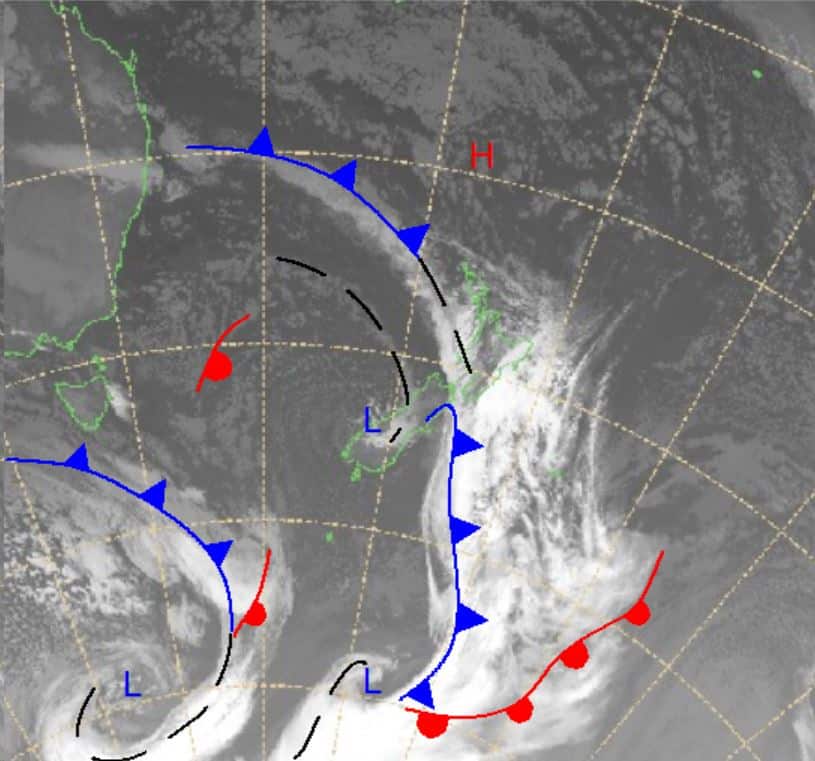
South Island: In Canterbury the weather is expected to clear in the morning with a little bit of leftover precipitation possible ahead of a mostly fine day. A similar story further south with some early snow and flurries before it clears for a partly cloudy day around the Southern Lakes. Snow showers in the Southern Lakes beginning very late heading into Saturday and totals could be 4-15cm.
Saturday August 14
Ruapehu: A cloudy day with rain from late in the morning expected to carry through to the evening. Strengthening westerly winds turning south-westerly later in the evening with possible accumulations of around 5cm.
South Island: Cloudy in Canterbury, strong westerly winds early with some small amounts of snow expected through the middle of the day. In the Southern Lakes precipitation clearing by the late afternoon. Snow around above 800m with accumulations of around 4-12cm most likely.
Sunday August 13
Ruapehu: Partly cloudy with south-westerly winds weakening a little and turning westerly later in the evening. Should see some periods of sun.
South Island: A partly cloudy day expected in the Southern Lakes with westerly winds strongest in the early morning turning north-westerly and slightly weakening, possible snow flurries. For Canterbury we are looking at a fine day, winds moderate north-westerly strengthening through the day.
Extended Outlook
Over the weekend we should see a little bit of everything – strong winds, snow and sunshine. Looking ahead there is precipitation expected over Monday/Tuesday in some locations, but a similar situation to earlier this week a high coming off south-eastern Australia should settle to the north of New Zealand. At the same time a deep low in the Southern Ocean should bring up some cold air and precipitation with the possibility for rain first before turning to snow in places and I’ll keep an eye out on how this is progressing over the weekend.


