Weather Definitions – The Grasshopper’s A to Z Glossary
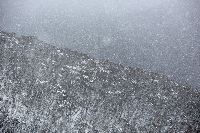
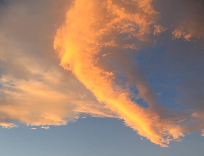
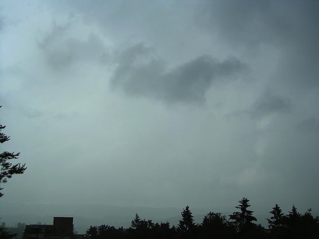
S is for snow, S is for storm, S is for skiing, S is for snowboarding. Photo: Jake McBride
Mountainwatch | Weather Glossary
Given the weather is the main topic of conversation for most people on most days throughout the world, it’s remarkable how little people actually know about it. So, in an effort to help you sound like you know what you’re talking about, the Grasshopper has put together an A to Z glossary of weather definitions. Remember as many as you can, and next time the weather comes up in conversation, your friends will think you’re a meteorological expert.
A B C D E F G H I J K L M N O P Q R S T U V W X Y Z
500 hPa level
The surface at which the atmospheric pressure is 500 hPa at every point. By plotting the height of this surface on a map we get a picture of the weather features at an altitude of about 5500 m and up in the atmosphere. These features are important because the drive the vertical motion that creates surface weather. They also help to steer the directions of highs, lows and fronts etc.
540 line
A depth of 5400 m between the 1000 hPa and the 500 hPa pressure levels in the atmosphere. The thickness of this 1000-500 hPa layer is largely dependent upon the average temperature in the layer and to a lesser extent on the moisture content. During a cold outbreak, the air is very dense and so this layer is thinner. When the thickness is less than 5400 m it indicates that the air is cold enough that frozen precipitation (e.g. snow) will be able to reach ground level in alpine areas without melting.
Ablation
The loss of snow by melting and evaporation. Ablation sucks.
Absolutely Stable Air
What we call it when a section of the atmosphere is so stable (warm light air over cold dense air) that a parcel of air rising through it will always wind up cooler and heavier than its surroundings and want to sink again, even if condensation is occurring and releasing heat.
Absolutely Unstable Air
What we call it when the temperature in a section of the atmosphere is decreasing so quickly that any air parcel that rises will find itself warmer, lighter and more buoyant than its surrounds. The further it rises the bigger the difference and so it will keep on going until it hits a layer of stable air above. During summer the lower half of the atmosphere is often absolutely unstable due to the action of the sun intensely heating the surface of the earth.
Accretion
What happens when a drop of super-cooled liquid water collides with an ice particle and freezes on impact.
Adiabatic
A fancy term to describe changes in the temperature of air due to expansion or compression. Air sinks, it is compressed and warmed adiabatically, without any exchange of heat with the outside environment (although there’s always some mixing around the edges). Air rises, it expands and cools.
Advection
A fancy word for the wind blowing stuff around – usually cold or warm air, but also some other more complicated atmospheric variables like vorticity.
Advection Fog
Fog caused by warm moist air flowing over a cold surface and cooling until condensation occurs.
Aerosol
Little bits of stuff floating around in the air. Dirt, insects, sea salt, pollution. These are really important because water vapour needs them to start the process of forming rain and snow. Not enough, and precious water vapour can slip by the mountains without turning into rain. That’s why Snowy Hydro seed clouds with extra aerosols.
Air
The gases that make up the earth’s atmosphere.
Air Mass
A large body of air that’s got basically the same temperature and humidity. When polar air masses slam into sub-tropical air masses we get fronts, which provide most of our winter rainfall.
Albedo
A measure of how reflective something is, expressed as a percentage or a number between 0 and 1, with 1 being perfectly reflective. Snow has a high albedo and rocks have a low albedo. The rocks absorb more heat and they also warm up quicker, so that’s why you get those characteristic melt patterns around rocky terrain.
Alto cumulus
A type of middle cloud, ranging from about 2500 to 6000m high in the atmosphere, that has a little bit of vertical extent. Will usually look a little puffy, blobby or patchy.

Altostratus
A type of middle cloud, ranging from about 2500 to 6000m high in the atmosphere, that looks more like grey sheet. Flat, bland, with a uniform colour. The Richie Benaud of clouds.
Anemometer
Measures wind speed
Anticyclone
The flow of winds around a high-pressure system. Anti-clockwise in the Southern Hemisphere, clockwise in the Northern Hemisphere.
Anvil
The wickedly cool looking head of a thunderstorm that spreads out for miles once it hits stable air above and can rise no further. Has the shape of an anvil, the thing Coyote was always trying to drop on Roadrunner
Antarctic Oscillation
A flip flop in pressures along a north-south axis in the southern oceans. During negative events lower pressures and stronger westerlies spread north from the Southern Oceans, allowing embedded fronts to visit south-east Australia more often. During positive events the lower pressures and westerlies stay well to the south of Australia, with the opposite effect.
Apparent Temperature
An adjusted temperature that takes into account both wind chill and humidity.
Atmosphere
The air stuck to the Earth by gravity.
Atmospheric Pressure
The weight per unit area of the column of air above a certain point. We use hectopascals to measure this. An average figure is 1013 hPa. This equals about 10 tonnes per square metre. Sounds like a lot right? But we’re built to handle it.
Aurora
Pretty lights that appear high in the skies near the poles when charged particles from the sun interact with the earth’s magentic field.
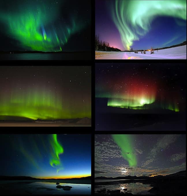
Aurora Australis
The southern hemisphere version of the Aurora.
Aurora Borealis
The southern hemisphere version of the Aurora.
AWS
Automatic Weather Station
Backing Winds
An anti-clockwise change in the wind with time or with height. A north-westerly tending south-westerly behind a front for example.
Banner Cloud
Clouds that extend downwind from a mountain sometimes on otherwise clear days.
Baroclinic leaf shield
A pattern of cloud on a satellite picture that looks like a leaf. These often signal the impending formation of a surface low.
Baroclinic Zone
A region where the temperature changes abruptly in the horizontal. Fronts are baroclinic zones for example. Baroclinic zones can also exhibit large changes in wind speed and direction with height, and the temperature gradient supplies a lot of the energy associated with low-pressure systems in the mid-latitudes.
Barometer
Measures air pressure
Barrier Jet
An area of faster winds caused when stable air approaches a mountain barrier and, being unable to flow over it, flows parallel to it.
Bergeron Process
This one is really cool. It turns out that water vapour, when given the choice, would rather turn into ice than water. So if you have an ice crystal, a water droplet and water vapour in the same patch of atmosphere, the ice crystal steals all the water vapour, dropping the humidity so that some of the water droplet evaporates into more vapour, which is also scooped up by the ice crystal. This goes on until the water droplet is gone, and only the ice crystal and a little bit of vapour remains. When this happens in a cloud it’s called glaciation.
Billow Cloud
Broad bands of cloud visible on satellite images that are oriented perpendicular to the wind.
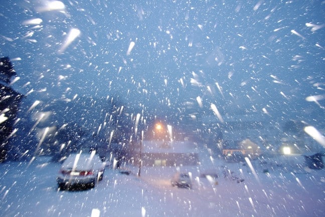
Blizzard
When it’s so freaking windy that it’s picking up snow from the ground and slamming it into your face, you’re in a blizzard.
Blocked Flow
A flow that is too weak or stable to go over the mountains, so it goes around instead.
Bomb
A low pressure system that is deepening really quickly. Depending on who you talk to the central pressure has to drop 12 hPA in 12 hours or 24 hPA in a day to qualify. It’s now becoming a bit of a cliché because the media love to use the term weather bomb and have over-used it something shocking.
Boundary Layer
The lowest kilometre or so of the atmosphere. This is where the friction of the earth becomes important and where a lot of the exchange of heat between the earth and atmosphere occurs. It’s also the place with the most diurnal variation; temperatures and winds go up during the day and down at night, fog comes and goes etc.
Buoyancy
An attribute of parcels of fluid (e.g. air) that is less dense than their surroundings and feel an upward force. When a parcel of air at the earth’s surface is warmed it can become more buoyant than the surrounding air and start to rise. It will cool adiabatically as it rises, but if the surrounding environment is cooling even faster it will continue to rise and cool until some of the water vapour it carries condenses into liquid and cloud forms. At this point, the condensation process releases latent heat, which can make the parcel even more buoyant. Thunderstorms get their energy from this chain reaction.
Cap Cloud
A cloud that sits on a mountain peak, like a cap.
CAPE
A measure of how much energy is available for convection, which depends on how warm the surface layer of the atmosphere is and how quickly it decreases with height. When thunderstorms occurred values range from a few hundred to a few thousand joules per kilogram of air. The more energy available the more buoyancy a parcel of air will experience as it rises and the faster it will shoot up through the atmosphere.
Capping Inversion
A layer of warm air aloft. This layer will tend to suppress cloud development as rising air parcels will lose buoyancy once they hit the inversion and find themselves colder and denser than the environment. Inversions are often present in regions of high surface pressure, where sinking air warms as descends. If the capping inversion is below the level of ski slopes you can get the awesome situation of a bluebird day with a blanket of cloud blocking out the world below.
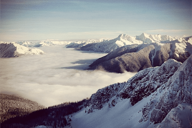
A capping inversion in British Columbia
Cirriform
Thin wispy high clouds, six to thirteen kilometres above the earth.
Cirrocumulus
High clouds, six to thirteen kilometres above the earth, that look patchy or ripply.
Cirrostratus
Flat high cloud, six to thirteen kilometres above the earth, looking like transparent whitish veil.
Cirrus
That classic wispy high cloud, six to thirteen kilometres above the earth, that gets its name for the latin word for a curl of hair.
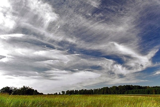
a classic example of Cirrus cloud
Climate
The average, over a long period, of observed weather.
Closed Low
A low pressure area with a clear centre of circulation. On a weather chart they are enclosed by one or more isobars or height lines. At the surface, a closed low can often form along a cold front. Once it does, it alters the flow around that front, often slowing things down and altering the distribution of rainfall. This can be good or bad for snowfall depending on the position of the low at the time. In the upper atmosphere closed lows often progress more slowly than the troughs from which they form. These upper features drive what’s going on at the surface and so if they slow down so will the surface features.
Cloud Condensation Nuclei
Small particles of grit, sea salt or pollution on which water vapour condenses to form cloud droplets, the start of the rain process. The relative size and abundance of these “CCNs” is varies with geography and this affects the characteristics of clouds and the size of raindrops they produce. If there aren’t enough CCNs available then humidities can reach higher than 100 per cent, which we call super-saturation.
Cloud seeding
The activity of adding ice nuclei to an airmass to encourage extra precipitation. Some airmasses that flow over mountain ranges have surplus water vapour that doesn’t get turned into rain. Put another way, the rain making process isn’t 100% efficient. By adding extra ice nuclei, usually silver iodide, you give nature a little helping hand. Snowy Hydro reckon they get an extra few per cent of rain every winter from this and that can be worth a lot of $$ in terms of hydro generation. Some environmentalists don’t like that silver iodide then comes down with every shower, but they seem to be losing the cost/benefit argument.
Cloud Streets
Rows of cumulus aligned in the same direction as the low level winds. They require a little bit of instability, but not too much, and winds flowing in roughly the same direction in the bottom couple of kilometres of the atmosphere. Fantastic examples of these can be seen approaching Japan in winter as part of the lake effect.
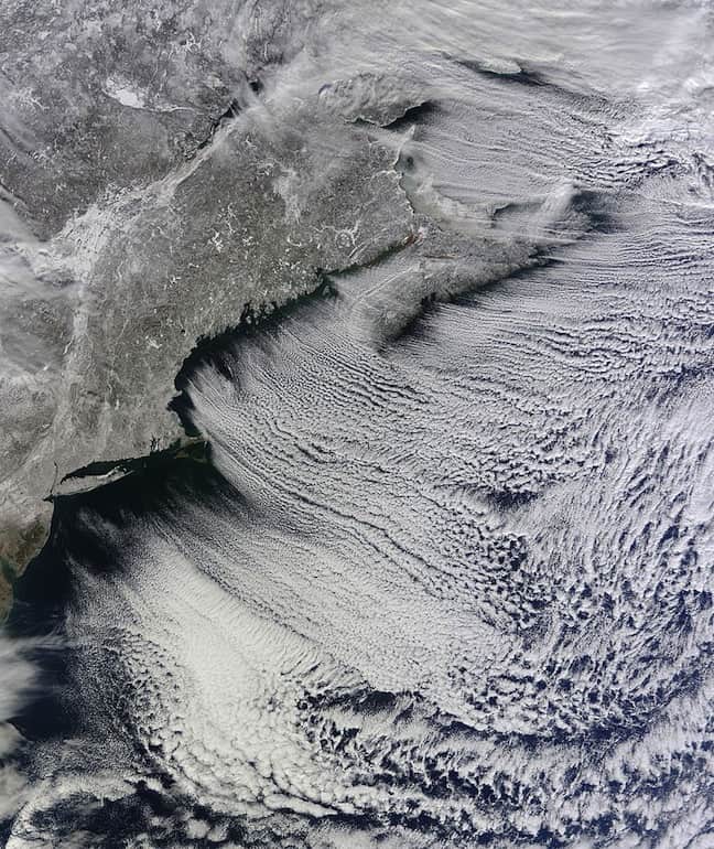
Lines of clouds stretch from north-west to south-east over the North Atlantic, while the relatively cloudless skies over land afford a peek at the snow that blanketed the North-east just a few days earlier.
Cold Advection
What happens when the wind pushes colder air towards a point.
Cold Front
The boundary between two air masses of different temperatures, when the cold air is advancing on the warm air. The cold dense air slips under the warm light air, causing it to rise and usually generating rain that comes out of flat stratiform cloud. Behind the cold front, the cold air is rapidly warmed by the surface and convective showers bubble up like popcorn.
Cold Pool
A pool of cold air. Kind of like a low centre for temperature. The coldest air aloft is often the region of greatest instability, so cold pools are where you get hail and lightning out of winter thunderstorms. The cold air also makes snow more likely.
Comma Cloud
A cloud pattern shaped like a comma that is seen on satellite pictures in association with some low-pressure systems.
Condensation
The change of state of a substance from vapour to liquid.
Convection
Transporting heat and moisture by moving the fluid that contains them. Meteorologists use convection to describe the motion that results when air is warmed at the surface and bubbles up through the atmosphere, often forming puffy convective clouds, and in extreme cases thunderstorms.
Convective Clouds
Puffy clouds with plenty of height, ranging from cumulus to thunderstorms (cumulonimbus)
Convergence
When more air is entering a given area on a horizontal surface than is leaving. In the immortal words of Yaz and the Plastic Population, “the only way is up”, with some air forced to eave the area by rising. Convergence is prominent in areas relatively low pressure, whether that’s a low centre, a cold front, or more local features such as a thunderstorm.
Coordinated Universal Time (UTC)
The new term for Greenwich Mean Time. Computer models and aviation forecasts are two examples in meteorology where its better to use a standard time than convert back to local time. In winter, South-east Australia is 10 hours ahead of UTC time, and New Zealand is 12 hours ahead. This increases by one hour during the daylight savings period over summer.
Coriolis Force
A term to describe the fact that to a fixed observer on earth bodies and fluids in motion will tend to curve to the left in the Southern Hemisphere and the right in the Northern Hemisphere, with the effect strongest at the poles and zero at the equator. People will tell you this is due to the rotation of the earth, and give hand wavy explanations of how this works but on closer examination the real explanation is very complicated and also relates to the fact the earth is not a perfect sphere, and so the centre of mass of the earth is not directly under your feet. There’s lots of maths and on the best of days the Grasshopper needs several strong cups of coffee to get his head around it. But you can just remember that in the southern hemisphere stuff turns to the left, and that’s how we get clockwise motion around a low and anti-clockwise motion around a high.
Crepuscular Rays
Those awesome rays of sunshine that break through clouds to light up just a little patch of earth, like a flashlight through swiss cheese.
Cumuliform
Puffy clouds
Cumulus
Average sized puffy clouds with mounds, domes, and turrets at the top. Look at them for long enough and you’ll see how much bubbling goes on.
Cumulus Congestus
A really big cumulus, top like a cauliflower, but not quite a thunderstorm yet.
Cutoff Low
An upper level closed low that has become cut off from the main westerly flow. Away from that flow they slow down and linger a while, as do the surface lows attached to them. This can be good or bad for snowfall depending on the position of the low at the time. If a cut-off low slows down west of the Australian Alps it can drag a bunch of warm air south, but if it slows down east of the resorts it will bring cold air north. Cut-off lows have also been responsible for some of south-east Australia’s wettest rainfall events, especially in summer, when they can suck in tropical moisture for days on end
Cyclogenesis
When a low is deepening. The genesis of the cyclone.
Cyclone
Describes the flow around a low pressure system. Cyclone means the axis of rotation of the wind has a component oriented in the same direction as the spin of the earth. When you look at the earth from above the South Pole it spins in a clockwise direction.
Depression
A region of low pressure that might not have a closed low in it yet, but probably has clouds and some rain.
Dew Point
A measure of how much moisture is in the air. It’s the temperature to which you have to cool a parcel of air before you get condensation (dew). The more moist the air, the higher the dew point. When relative humidity equals 100% then dew point equals the current air temperature
Dew Point Depression
Air temperature minus dew point. The smaller the depression the higher the relative humidity. This can also be used to calculate the approximate base of clouds above the measurement level. Every degree of dew point depression is equal to about 125m. So if temperature is 15 degrees and dew point is 10, then cloud base will be about 600m above you.
Diamond Dust
A ground level cloud of ice crystals that are so light they seem to hang in the air.
Doppler Radar
Radar that can also measure how quickly something is moving towards or away from the radar. It does this by using the frequency shift in the reflected beam. Stuff moving towards the radar reflects the beam back at a higher frequency than it was emitted. Stuff moving away reflects it back at a slower frequency. The common analogy used for doppler applies to sound waves: a motorbike sounds higher pitched moving towards you than it does moving away, so you get that nnnnneeeeaaaaahhhrowwwwwww sound as it passes.
Downburst
A strong downdraft from a thunderstorm. All that air gets thrown up, cools, picks up a bunch of water and then woosh, slams back down to the surface with often damaging winds. Downdrafts are often mistaken for small tornados.
Downslope Flow
Wind flowing down a mountain slope. Often occurs at night when surface air-cools and becomes denser and is pulled down hill by gravity.
Drizzle
Precipitation made of really little drops of water, less than half a millimetre in diameter. Often comes out of thick low cloud, and can really cut down visibility for aviation etc.
Dry Adiabatic Lapse Rate
This is the rate at which dry air-cools as it is lifted. It’s about 9.8 degrees per kilometre that’s basically a function of how much atmosphere and gravity there is. This means that on an unstable showery day if its 10 degrees at sea level then it could be zero at 1000m with snow settling below there.
Easterlies
Winds from the east.
Echo
The energy that rain drops reflect back towards a radar.
ECMWF
The European Center for Medium-Range Weather Forecasts. These guys have a global weather model which runs out to 10 days that is the envy of many.
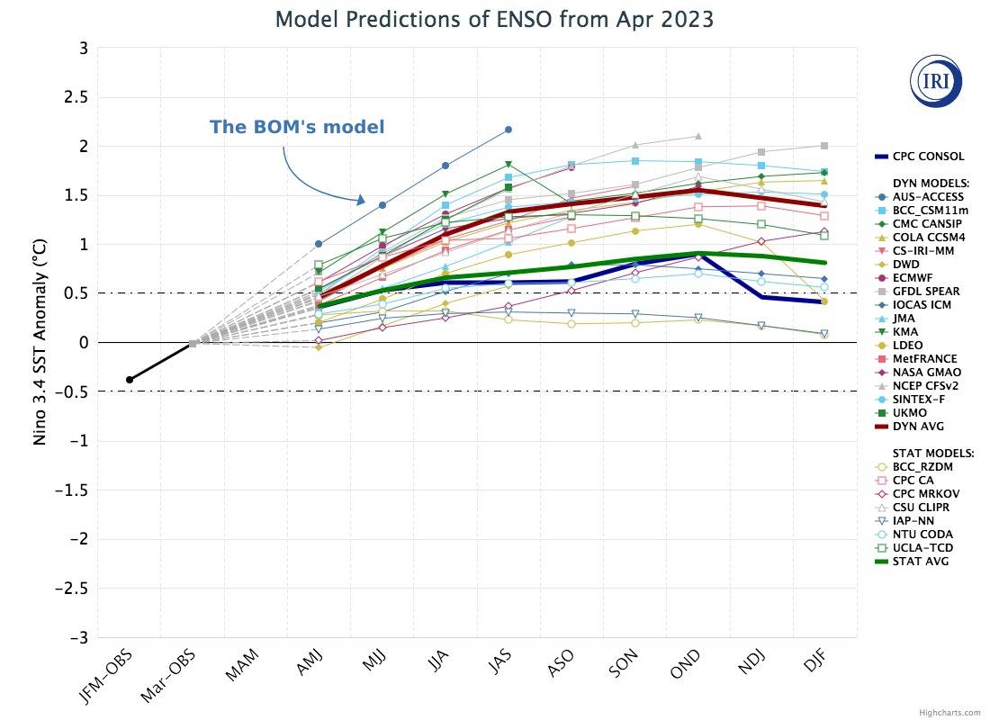
El Niño
El Niño is a climate pattern that describes the unusual warming of surface waters in the eastern equatorial Pacific Ocean. Trade winds and atmosphere are also impacted by El Niño.
Ensemble Forecast
A technique of running the same weather model many times simultaneously, with tiny differences in the starting conditions of each individual model run, called and ensemble member. Gives an idea of how the atmosphere will evolve as a spread of probabilities. Ensembles are generally better than any single model from about 72h hours ahead.
ENSO
The El Niño-Southern Oscillation (ENSO) is a recurring climate pattern involving changes in the temperature of waters in the central and eastern tropical Pacific Ocean. On periods ranging from about three to seven years, the surface waters across a large swath of the tropical Pacific Ocean warm or cool by anywhere from 1°C to 3°C, compared to normal.
Equinox
When the midday sun is directly overhead at the earth’s equator. Night and day are about equal length all over the world. Occurs around March 21 and September 22. Only happens twice a year when the tilt of the earth’s axis isn’t pointing towards or away from the sun.
Foehn
A warm dry wind that comes about when air descends as it crosses a mountain range and warms as it is compressed at lower elevations. Often the air has already been warmed on the windward side of the mountain by the process of condensation and precipitation, which releases latent heat into the air. In Christchurch the Foehn wind is called the nor-wester and it can see temperatures soar into the 30s when they are languishing below 20 on the other side of the Southern Alps.
Fading northwest arch over Canterbury New Zealand during a sunset. It is due to a foehn wind.
Freezing Fog
A fog that is super-cooled. This means the temperature of the droplets is below zero but they haven’t frozen yet because they lack the freezing nuclei to do so. They will freeze upon contact with any trees, fences or other objects, forming a rime or glaze.
Freezing Level
The height above sea level where the temperature drops below zero. Snow will settle above this level, and often a couple of hundred metres below depending on the surface conditions.
Freezing Rain
Rain that is super-cooled. This means the temperature of the droplets is below zero but they haven’t frozen yet because they lack the freezing nuclei to do so. They will freeze upon contact with anything they touch, and that can be disastrous for aeroplanes.
Front
A boundary between two different air masses. Often the location of significant weathe
Frost
It’s like dew, but occurs when temperatures at ground level fall below zero.
Gale
A wind with speed of 63 km/h or more.
Geostationary Satellite
A satellite that stays over the same pleace on the equator by orbiting with the same rotational speed as the earth. The satellite pictures we see of the whole Oceania region come from the Japanese Geo-stationary satellite MT-SAT.
Glaciation
When cloud droplets turn from liquid to ice, helped by the Bergeron Process. High clouds will usually be glaciated.
Graupel
Small hail or snow pellets.
Gust
A rapid, temporary increase in wind speed
Hail
Precipitation formed when frozen rain drops, supported by strong updrafts, stay in a thunderstorm for so long that they become really big and fall to the ground before they melt.
Hectopascal
The unit of pressure we use. One Hectopascal equals 100 pascals, the downwards force exerted by 10 kilograms spread evenly over a square metre. Atmospheric pressure is usually around 1012 hPA, or the weight of 10,000 kilograms spread evenly over a square metre. That’s how much the atmosphere weighs.
High Clouds
Clouds from six to thirteen kilometres high. Will have a thin wispy appearance because they are made predominantly of ice crystals.
High Pressure System
An area of relatively high pressure. Winds will be light near the centre, with a divergent anti-cyclonic circulation around it. Weather tends to be fairly settled due to the sinking motion of air within the high that creates a capping inversion and prevents strong convection.
Hoar Frost
Really cool frost crystals that form on thin items like wires, tree limbs etc. It needs to be quite cold for this to happen, and the process comes down to the physical properties of how water likes to form ice crystals at different temperatures and humidities.
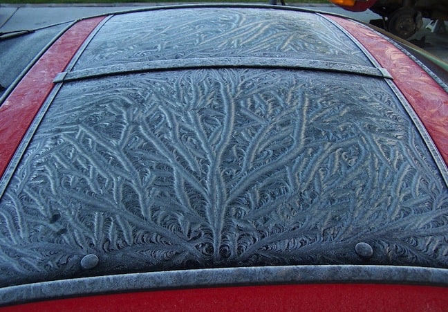
Window frost observed on a car
Humidity
A measure of how much water vapour is present in the air.
Hydrometeor
Any particle of liquid or frozen water in the atmosphere.
Ice Crystals
Snow that hasn’t formed into flakes – made up of needle and plate shapes. These little suckers need quite cold air to become dominant – if it’s too warm or there’s too much moisture around the ice becomes sticky and clumps together.
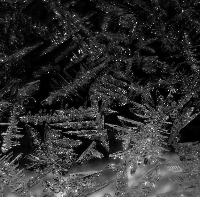
Ice crystal formation
Ice Nucleus
A particle in the atmosphere around which ice will preferentially form. Ice nuclei have surfaces with a similar molecular pattern to ice, so they provide a ready made grid for water to start depositing.
Ice Pellets
Not quite hail, not quite snow, more like raindrops that forgot to melt before hitting the ground.
Insolation
Heat received from the sun.
Instability
When cold air lies over warm air, and air at the surface has a tendency to gain buoyancy and keep rising once it gets an initial kick upwards.
IR
Abbreviation used for infra-red satellite imagery, which displays the temperature at the top of clouds based on the peak wavelengths of light they emit.
Isobar
A line connecting points of equal pressure on a weather chart.
Isopleth
A line connecting points of equal value on a weather chart.
Isotach
A line connecting points of equal wind speed on a weather chart.
Isotherm
A line connecting points of equal temperature on a weather chart.
Jet stream
Strong winds in the upper atmosphere created by large horizontal temperature gradients.
Katabatic Wind
Wind created by air flowing downhill. Katabatic winds at the edge of Antarctica can reach over 300km/h as cold air from the interior rushes down steep slopes of ice along the coast.
Knot
The unit of speed used in navigation (shipping and aviation) equal to one nautical mile per hour, or about 1.85 km/h.
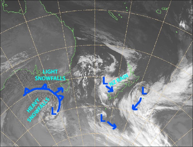
Lake Effect Snow
Snow showers that form when cold, dry air crosses a large body of warm water and picks up moisture and heat. Can lead to very localised heavy snow. Good examples occur along the west coast of Japan and south-eastern shorelines of the American Great Lakes in winter.
Latent Heat
The energy that is absorbed or released when a substance changes state between solid, liquid and gas. When you boil water, first you have to get it to 100 degrees, then it needs an extra kick to evaporate. This extra kick is the latent heat that’s present in the gas form. If you then condense that water vapour back to liquid the same amount of energy is released. The same thing happens between freezing and melting. This doesn’t sound super exciting but latent heat is one of the key methods of heat exchange in the atmosphere. Showers and thunderstorms get most of their energy from water vapour condensing back to liquid and releasing heat that makes the air in the storm more buoyant than the surrounding environment.
Leeward
The side of a mountain or barrier that’s away from the wind.
Lenticular Cloud
A lens shaped cloud often found above or on the leeward side of mountain ranges during periods of moderate to strong winds and stable atmosphere. The air rises and cools in response to the barrier and then descends and warms on the other side. Cloud forms somewhere in between, where the air is cool enough for condensation to form. The cloud appears stationary, but is actually the visible part of a river of air flowing over the barrier.
Level of Free Convection
The level where saturated air becomes warmer and more buoyant than the environment and starts to rise independently of other forcings. This level depends not only on the temperature and humidity of the parcel but also the temperature and humidity of the surrounding environment.
Lifting Condensation Level
The level where cloud starts to form when a parcel of moist air is lifted adiabatically. Generally, the higher the humidity the lower the lifting condensation level.
Longwave Trough
A trough in the westerly flow around the mid-latitudes that can easily stretch across a third of the globe. The shortwave troughs that generate our weather will be superimposed on these long waves.
Low Pressure System
An area of low pressure with converging winds and cyclonic circulation (clockwise in the Southern Hemisphere and anti-clockwise in the northern hemisphere. The circulation drives the advection of warm and cold air masses, creating fronts and generating precipitation. On a surface pressure chart a low will appear as tightly bunched isobars around a low pressure minimum marked with a capital “L”.
Mackeral Sky
Thin rippled cumulus clouds that have the appearance of fish scales.
Moist Adiabatic Lapse Rate
The rate a parcel of saturated air (100 per cent humidity) cools as it is lifted. It cools more slowly than a parcel of unsaturated air because moisture will continue to condense out of the cloud, releasing latent heat the whole time.
Mammatus Clouds
Sack like projections that hang from a cumulus cloud. Mammatus has the same root word as mammal. You fill in the rest.
Meridional Flow
Flow in the north-south direction, along a meridian (longitude line). Compare zonal flow which is in the east-west direction, along lines of latitude.
Mid-Latitude Areas
The areas roughly between 30 and 60 degrees of latitude. This is the transtion zone between cold polar air and warm sub-tropical air, where westerlies and weather systems such as highs and lows dominate
Middle Clouds
Clouds from about two to six kilometres high.
Mountain Wave
The wave that can be created when air is forced to rise over a mountain barrier. Depending on wind speed, stability and the shape of the barrier a standing wave can be created that “breaks” on the lee side of the mountain, creating violent updrafts and downdrafts. The waves can also propagate downstream, so that alternating lines of clear sky and cloud are visible on satellite pictures as the air flows up (cloud forms) and down (cloud evaporates).
Nimbostratus
Thick, formless rain cloud. More commonly associated with warm fronts where warm moist air is slowly rising, with its water content being squeezed out like a sponge. So rain from these clouds will generally be moderate and continuous, as opposed to the short sharp bursts out of a convective thunderstorm.
Nimbostrati often have very few visual features.
Numerical Weather Prediction
Using computers to forecast the weather.
Orographic
Related to the physical geography of the land.
Orographic Lifting
When air is forced to rise because there’s some land in the way. This can help create or substantially enhance rain in otherwise benign situations. In the mid-latitudes this results in the western side of mountain ranges being much wetter than the eastern side. The so called rain-shadow effect
Polar Front
The transition zone between warm tropical air and polar air. Where the energy and gradients for our low pressure systems generally comes from.
Polar Jet Stream
The really strong upper atmosphere winds that occur along the polar front due to the sharp temperature gradient across the front. Pressure decreases much more rapidly with height on the cold side of the front, so at higher levels a north-south pressure gradient is created which, because of the spin of the earth results in very strong westerly’s at upper levels. The progression, ebb and flow of these westerly’s then helps to drive the surface development of low-pressure features.
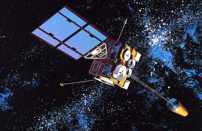
Polar Orbiting Satellite
A satellite which orbits the earth, passing over or close to the poles as they do so. These are usually several hundred kilometres above the earth and orbit several times per day, crossing a different point each time because the earth is spinning below them. They provide better images than geostationary satellites because they are much closer, but they generally only pass over each point on earth once a day, so they aren’t great for watching weather.
Pre-Frontal Trough
An area of low pressure preceding a cold front that can have its own wind change and weather.
Precipitable Water
The amount of water we could get out of a column of air if we squeezed out every last drop.
Precipitation
Water falling to the earth as rain, snow, hail etc.
Pressure
The force upon a surface by another surface in contact with it.
Pressure Gradient
The change in pressure over a given distance. Pressure gradients move the air around to make weather. At the most basic level they are created because the sun heats the equator more than the poles, making some air more dense than other air, so that it applies a force in the horizontal.
Radar
Stands for “Radio detection and ranging”. A way of “seeing” raindrops by bouncing light off them. The mathematics of decoding the signal that comes back is sickening, so be thankful we have smart people to create all those beautiful satellite images.
Radiation
Transporting energy through electro-magnetic waves. When radiation is absorbed by the earth or atmosphere it is generally transferred to heat energy.
Radiation Fog
A fog that forms when the ground radiates away a lot of energy at night and cools the air above it so much that condensation occurs.
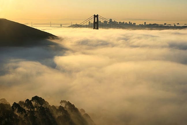
Heavy fog in San Francisco
Radiational Cooling
Cooling of the earth at night as it radiates infra-red electro-magnetic waves out into space, without any sunlight to compensate.
Radiational Inversion
The cold layer of air that forms at the surface at night due to radiational cooling. This thin cold layer of air is heavier than the air above it and does not like to mix, so the inversion layer becomes colder and colder until the sun rises and starts to warm the surface again.
Relative Humidity
The ratio of the amount of water vapour present in an air parcel compared to the maximum amount of water vapour that air could hold before becoming saturated.
Ridge
An elongated area of high pressure extending out from an anti-cyclone. Pressures along the ridge are higher than pressures either side. There will tend to be some sinking motion in the ridge, making it difficult for cloud to form. Cloud that is present, such as stratocumulus, will likely be flat in appearance
Sea Level Pressure
The atmospheric pressure at sea level for a given location. At elevated locations the station pressure is corrected to a sea level equivalent using equations that calculate the change in pressure with height for air at a given temperature. Using sea level pressure helps us usefully compare pressures recorded at different altitudes to work out what the differences will mean for horizontal pressure gradients.
Shear
The change in wind speed or direction with height or distance.
Shortwave Radiation
The radiation emitted by the sun. In the absence of clouds most of it passes straight through the atmosphere and is partially absorbed and partially reflected by the eart
Shortwave Trough
A wave in the upper atmosphere that induces upwards motion and lower surface pressure ahead of it. Cold fronts at the surface will be related to the upper trough, with their intensities closely linked.
Snow
As the Chili Peppers said: “if you have to ask…”
Snow Density
The weight of snow divided by its volume. In fresh snow it’s about 0.1 – that is – 1 litre of snow will melt down to about 100ml of water. This density obviously goes up as the snow is compacted down over several months of a season.
Snow Flurries
A short burst of light snow with not much accumulation on the ground.
Snow Pellets
Little hard white particles, basically the same as small hail.
Snow Shower
A short burst of moderate snow where some accumulation is measurable
Snowflake
Snow crystals stuck together and falling in a bunch.
Solstice
The longest and shortest days of the year, when the overhead midday sun is furthest from the equator. Occurs around December 22 and June 21.
Squall Line
A small line of thunderstorms, moving along in an organised fashion. Smaller than a front but potentially quite damaging.
Stable
When warm air sits over cold air and mixing is inhibited.
Stationary Front
A front between two air masses that isn’t moving very much.
Stratocumulus
Low level puffy clouds that have a defined top due to the presence of warmer, more stable air above. The air rising through the clouds reaches this warmer, lighter layer and cant go any further, so it spreads out instead like an oil slick, creating the flat appearance.
Stratus
Flat and boring low cloud with little or no convection occurring. Will often be associated with drizzle. Stratus on the ground is fog.
Sublimation
When ice changes directly to water vapour.
Subsidence
The sinking motion of air, usually in an area of high pressure, which causes the sinking layer to warm adiabatically (under compression).
Subsidence Inversion
The inversion that forms when air sinks and warms adiabatically in an area of high pressure, making it considerably warmer and lighter than air at the surface.
Subtropical Jet
The jet stream the forms between 20 and 30 degrees south as a result of air rising at the equator, flowing towards the poles, and turning to the west due to the earth’s rotation.
Summer Solstice
The longest day, when the overhead midday sun is furthest from the equator in your hemisphere.
Supercooled Liquid Water
Liquid water that exists below zero degrees celsius due the absence of any ice nucleii on which to form. Thunderstorms have heaps of this stuff thanks to their really strong updrafts which carry moisture high into the cloud where it can be swept up by hungry hailstones.
Synoptic Scale
Talking about the weather in terms of highs and lows on a scale of one to three thousand kilometres.
Temperature Inversion
When the temperature of the atmosphere increases with height.
Towering Cumulus
Big cumulus that looks like a cauliflower and will have some decent rain attached. The last step before cumulonimbus, towering cumulus are like the security guard who really wants to be a bad-ass cop.
Tropics
Areas of the earth within 23 degrees latitude of the equator.
Tropopause
The top of the troposphere, where temperature change with height stalls and eventually reverses into the very stable and boring stratosphere.
Troposphere
Where all the action happens. The bottom 9 to 15 km of the atmosphere with plenty of instability, vertical motion and water vapour to make things interesting.
Trough
An area of relatively low pressure but no closed circulation. There will usally be a wind change a surface convergence associated with the trough and this can make them a favoured area for thunderstorm development. Troughs can sit over the Australian interior for days, sucking in moist air and creating copious amounts of rain. Can be identified on a weather map as an axis of clock-wise (in the direction of flow) kinks in the isobars and is sometimes marked as a dashed line. Cold fronts usually have an associated trough.
Turbulence
Lumps and bumps in the atmospheric flow.
Upper Level
No fixed rule, but generally things more than 1500m high in the atmosphere, away from the boundary layer
Veering
When winds shift in a clockwise direction – eg from south-west to north-west as one cold front leaves and another approaches.
Vertical Wind Shear
Change in wind speed and direction with height. Important for thunderstorms as stronger winds aloft can carry the thunderstorms downdraft away from its updraft, helping it go for longer. Too much and it will blow the whole thing apart though.
Visible Satellite Imagery
Uses the visible wavelengths of sunlight reflected back from the earth to create an image. Sharper resolution than Infra red imagery but doesn’t work so well at night.
A sattelite in space
Warm Advection
When the wind pushes warm air around.
Warm Front
A boundary between warm air and cooler air, when the warm air is advancing and rising over the cooler air. This is usually a more gradual process than a cold front and the rain by comparison is lighter but more continuous over a larger area. Warm fronts are quite rare over south-east Australia because of all the land to the north, but very common for New Zealand, where they generally precede a cold front by a day or so.
Wet-Bulb Temperature
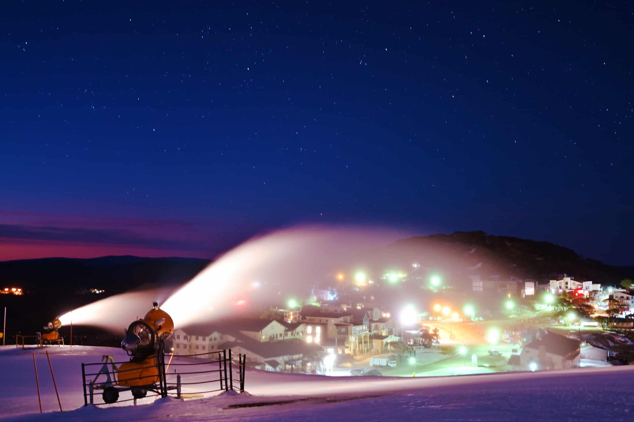
The lowest temperature you can reach by evaporating water into the air. The water sucks up energy to evaporate, cooling the air, and this process can go on until the air is saturated and relative humidity equals 100%. So wet bulb temperature is always between the air temperature and the dew point temperature. The awesome thing is that sometimes in dry conditions the wet-bulb temperature is below zero, even when the air temperature is above zero. Snow makers take advantage of this to operate at above zero temperatures; some of the water they spray into the air evaporates, cooling the immediate air to below zero so that snow can form.
Wind
The flow of air on a large scale.
Wind Chill
When the wind blows on your skin it strips away heat, making it feel colder than a similar day with no wind.
Wind Direction
The direction from which the wind is blowing, expressed as a compass direction (eg NW) or degrees clockwise from north (e.g. 90 degrees, 3 o’clock, is from the east).
Wind Shear
The change in wind speed or direction with height or distance.
Wind Speed
The rate air moves past a fixed point. Hourly observations are usually averaged over 10 minutes, with gusts measured over a few seconds. E.g. the wind might average 10 km/h over 10 minutes, but briefly reach 15 km/h for part of that. The wind speed would be 10 km/h gusting 15 km/h.
Winter Solstice
The shortest day, when the overhead midday sun is furthest from the equator in the opposite hemisphere.
WX
A totally kick-ass abbreviation for the word weather. “When you write wx as often as a wx fcstr then havin an abbrv like wx cn rlly cum in hndy”
Zonal Flow
Flow in the east-west direction, along a line of latitude. Compare meridional flow which is in the north-south direction, along lines of longitude.


