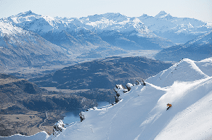
Australian Forecast – Clear & Calm with Overnight Snowmaking this Week, But No News of a Big Dump
Published early Monday, 19th June 2026
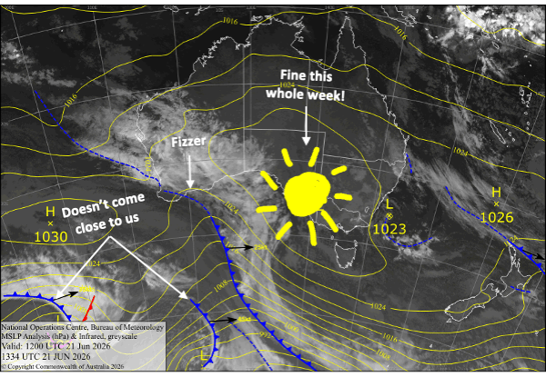
They say no news is good news, but in our situation that’s not the case. Unfortunately, I don’t bring news of an upcoming snowstorm that will drastically improve conditions.
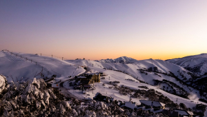
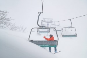
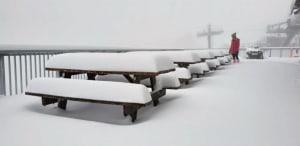
We did, however, receive a dusting of up to several centimetres up high at the weekend, and the coming week will see the snow guns getting a run on most nights thanks to chilly overnight temps. It won’t be super cold, mind you, but cold enough.
Apart from that, it’ll be a fine, dry, settled week as high pressure dominates our corner of the country- not the sort of news we’re actually after.
Monday 22nd June
Morning clouds clear for a fine sunny day with a light southwest breeze. Overnight temps should get cold enough for the snow guns to get a run in.
Tuesday 23rd June
Another fine day with some morning cloud and light breezes mainly from the southwest. It’ll be a good night for making snow.
Wednesday 24th June
Mostly fine with a south-to-southwest breeze. Temps should get cold enough overnight for the snow guns, except maybe in Buller where it’ll be marginal
Thursday 25th June
A clear, sunny and calm day, with snow-making temps overnight.
Friday 26th June
A partly cloudy, partly sunny day with little wind, and the snow guns will get another run overnight.
Extended Forecast
It’ll stay dry and sunny this weekend, the 27th and 28th of June as the high drifts east of us.
Northerly winds from Monday 29th June to Wednesday 1st July could see some snow falling up high again, before a cold change arrives late Wednesday to early Thursday, which may give us a dusting to lower levels and a chance to fire up the snow guns.
The next chance for snow is around the 6th July, but that’s still way off, so let’s not count our chooks just yet.
That’s all from me today, folks. I’m sending out these forecasts every Monday, Wednesday and Friday throughout the season, and during July and August I’ll fire one out on Sundays too. Have a great couple of days, and I’ll see you back here on Wednesday.
Grasshopper