Australian Weekend Forecast, Friday,July 3rd – Snow at Last!

Mountainwatch | The Grasshopper
Published early Friday, 3rd July 2026
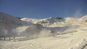
After a few days of battering from heavy rain and super-strong winds, we finally saw the first snow of this storm on Thursday morning, with around 5cm across the resorts above about 1700m. It was good to see some white about the place.
But today is the day we’ve all been waiting for: the first decent snowstorm in way too long. As I write in these small hours of Friday, temperatures have once again dropped, and the webcams show that snowfall is already well underway again. Check the snow reports from Reggae and our team of on-the-ground reporters to see how much has fallen so far.
By Friday night, once the snowfall has finally petered out, we should be looking at a daily total of 10-30+ cm, with additional snow blown in from the windward side. The bulk of this will fall on mid and upper slopes, above 1700 metres, with diminishing returns further down.
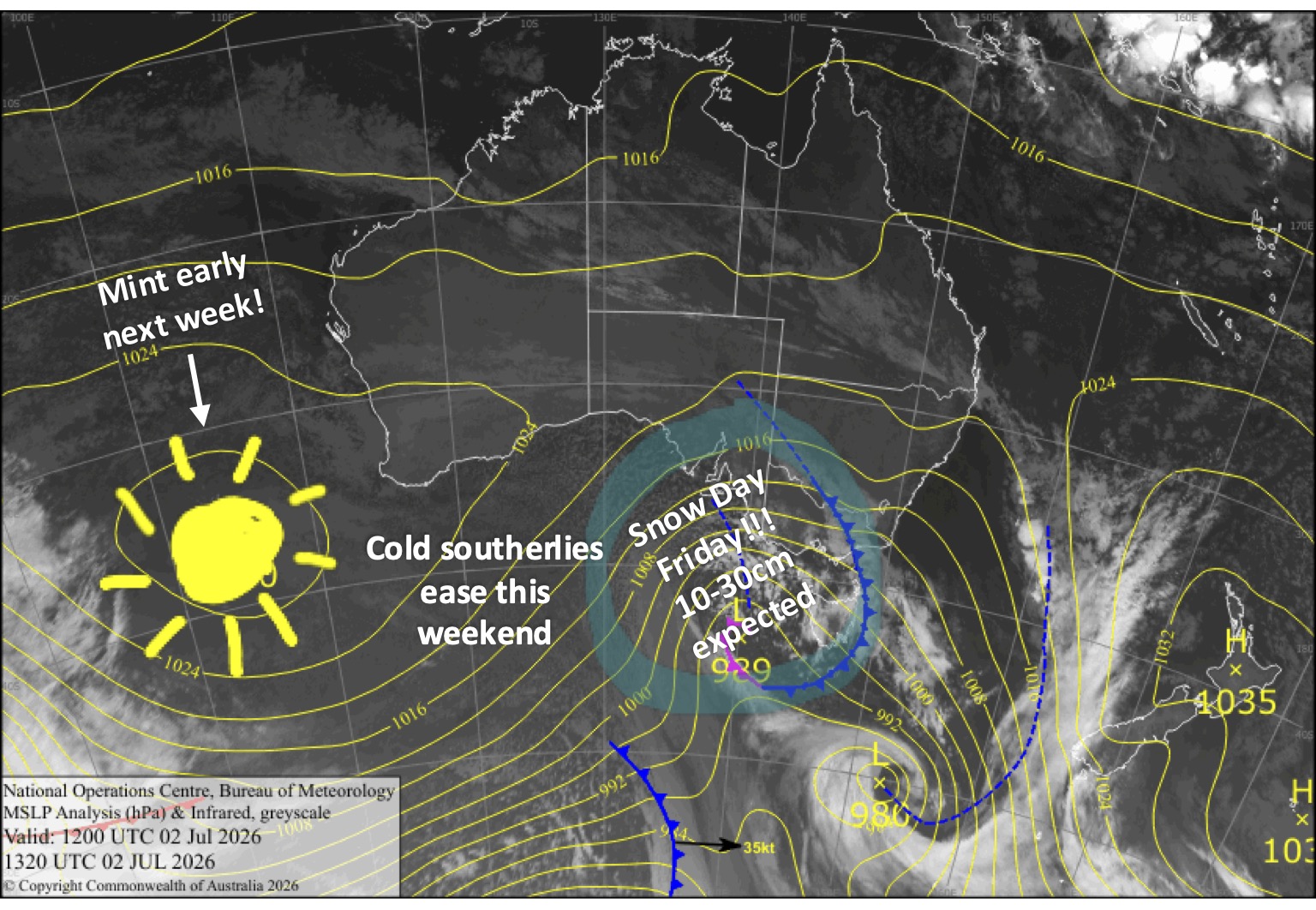
Friday 3rd July
A snow day at last! Snow gradually lowers to around 1300-1400m during the morning and early afternoon. It’ll then gradually back off through the second half of the day, eventually petering out at night. Strong gale northwest winds with blizzard conditions shift westward in the afternoon, then start to ease.
Saturday 4th July
Chilly southwesterlies bring light leftover snow flurries, mainly to western Victoria, where they could be a little more substantial. Clouds break up in the afternoon with increasing fine spells.
Sunday 5th July
A cloudy morning, but it’ll begin to clear later in the afternoon as cold southerlies turn eastwards.
Monday 6th July
A beaut, sunny day with a light north-to-northeast breeze. Cold & clear for snowmaking morning and night.
Tuesday 7th July
Clear and sunny with little to no wind. Cold & clear for snowmaking morning and night.
Extended Forecast
Later next week, models are coming into line for a nice wee storm system to deliver a shot of snow and cold temps around Sunday and Monday, the 12th and 13th of July. Combined with snowmaking, it’ll be a great addition to the pack. There’s also the chance of some extra snow over the following few days, but that’s where models differ.
That’s all from me today, folks. I’m sending out these forecasts every Monday, Wednesday and Friday throughout the season, and when the snow arrives and things start humming, I’ll fire one out on Sundays too. Have a great weekend, and I’ll see you back here on Monday.
Grasshopper