New Zealand Seasonal Outlook June Update – Holding out for snow
Mountainwatch | The Grasshopper
The Current Situation
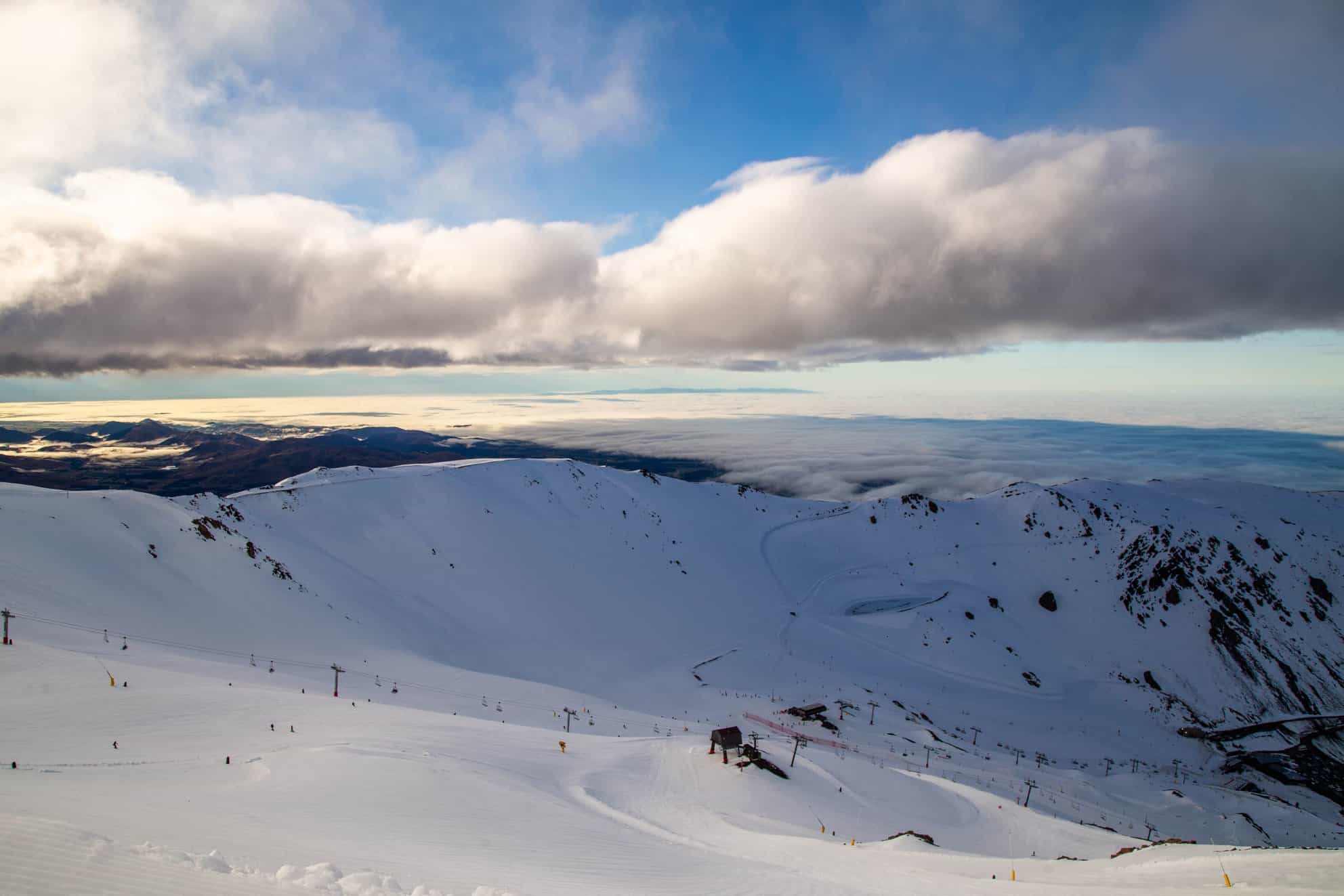
We are in the middle of June and it’s not long until the New Zealand ski season is in full swing with many resorts set to open just before the start of July. We have seen an intriguing start to the New Zealand winter with an early storm dumping big snow totals in Canterbury, but the Southern Lakes region has been left feeling like it has missed out.
The snow bearing systems we have seen so far have tended to be approaching from the southeast which favoursthe Canterbury region. Mt Hutt has already seen a few 20cm+ powder days on top of the early season dump that was reported to produce four-metre pockets in wind blown areas. It is because of this orientation that we haven’t seen significant totals in the Southern Lakes, but in the short term there is some snow on the way over the next week with snow expected all over the South Island Friday and late Sunday.
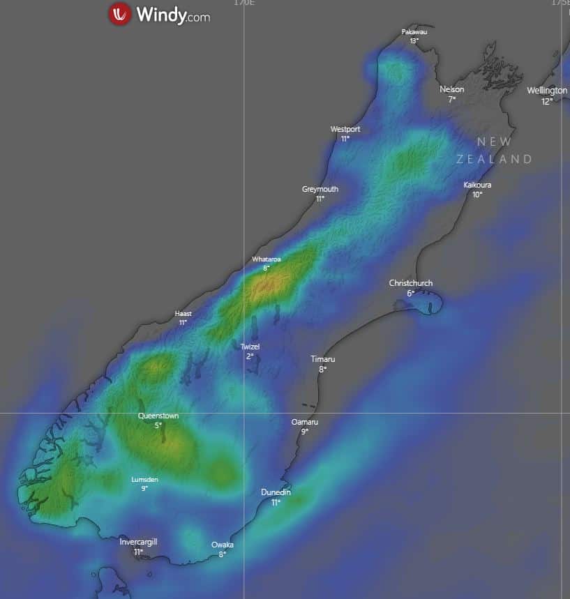
Precipitation on Friday approaches from the northwest hitting the west coast of the South Island while the falls predicted over the end of the week are set to come from the northwest initially, then the southwest. Predictions vary as Friday could produce some significant rain. The image below shows the 10-day snow accumulations in cm for the ECMWF model.
Neutrality
On the seasonal scale, a month on from my last outlook not much has changed with Mother Nature keeping her cards close to her chest. Forecasts are still calling for warmer than average temperatures and average precipitation over winter.
The state of the drivers remains similar with a neutral ENSO predicted for winter and a neutral IOD to accompany it. The negative swing in the IOD later in the season is looking increasingly likely which may promote more available moisture to fall as snow, provided the temperature is cold enough.
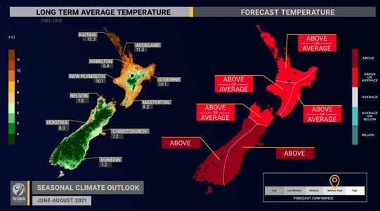
The latest NIWA temperature outlook for winter is slightly worse since we last spoke, especially for the South Island. Following on from this NIWA also predicts that precipitation will be normal or below for the entire South Island. Above average temperatures expected in all but the very north of the of the South Island does not bode well for snow resorts, but as we have already seen it does not rule out large snowstorms. However, it may mean that we may see warmer temperatures in between storm cycles. We just need to avoid these warm temperatures during storm cycles allowing temperatures to be cold enough to allow precipitation to fall as snow.
Under Pressure
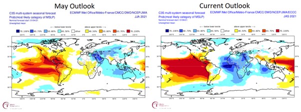
Seasonal forecasts for mean sea level pressure from multiple notable global models are suggesting high pressure encompassing the entire country for the winter. This is noticeably different from the last outlook seen on the left in the figure below. Of the models featured the consensus is high pressure over the country and to the north which promotes more fine, sunny weather and lines up with the forecast of warmer than average temperatures.
Although regions of high pressure covering the country may give us flashbacks to last year don’t lose hope. The winter is just beginning and with some snow on the way to welcome the opening of many resorts we can’t be that upset.
Wrapping up, it’s still relatively early days and although we might like a little more already on the ground it’s not time to panic just yet. My outlook is still for an average to below average winter there is still plenty left to play out. Get out there this weekend and if it is your first chance enjoy the opening weekend. For more specific short-term info about this weekend check out my New Zealand forecasts.
That’s all from me folks. If you’ve got a different theory on what’s going to happen this winter, or just want to provide feedback, then please hit me up on the discussion below. Or you can follow me on Facebook.


