New Zealand Forecast, Monday June 8th – NZ Ski Fields to Open this Weekend on a Man-Made Base
Mountainwatch | The Grasshopper
Published early Monday, 8th June 2026
The 2026 New Zealand snow season is just days away from getting started. Coronet Peak has already got the ball rolling thanks to its Snow Factory opening up some limited terrain accessed with its conveyor lifts on 29thMay. Mt Hutt is scheduled to open this Friday, the 12th, followed by a full opening at Coronet Peak on Saturday, the 13th, alongside The Remarkables and Cardrona.
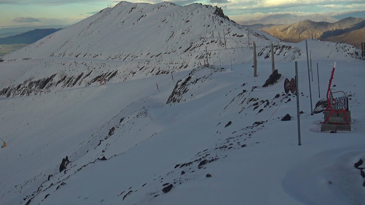
Pre-season conditions haven’t been ideal, leaving NZ mountains largely bare of snow, apart from what ski fields have been able to manufacture. Mt Hutt is the standout with about 10cm of natural snow on its upper slopes.
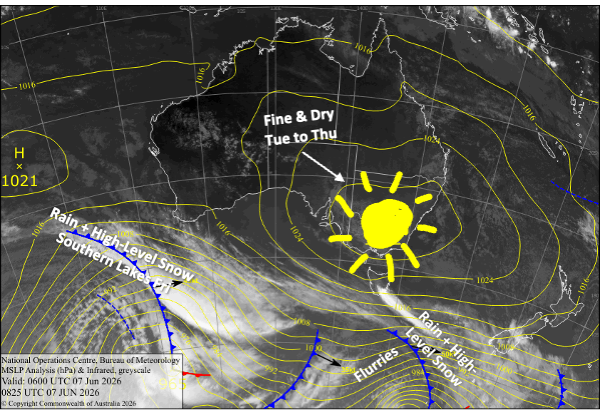
Resorts will see little, if any, snowfall in the lead-up to Opening Weekend, but a cold change on Monday, followed by clear, dry conditions, will give the snow guns a good chance to fire over the next few days. Hopefully it’ll be enough for ski fields to kick off their seasons.
Monday 8th June
A weak front from the south moves up the country. The Southern Lakes will pick up a dusting of snow above about 1900m as the front passes over during the morning, with rain lower down. Strong, cold southwest winds behind the front push in some light snow flurries during the afternoon, mostly benefiting The Remarkables where 1cm or less is expected. Despite little snowfall, the cold change will allow the snow guns to get a good, long run in from afternoon through the night.
Canterbury misses out on any snowfall when the front passes by in the afternoon, but will see the cold temperatures overnight for some snowmaking.
Tuesday 9th June
Skies will be clear and dry over the South Island, while the cold southwesterlies gradually ease as a ridge of high pressure builds. Cold overnight temps for the Southern Lakes will have the snow guns firing again.
Wednesday 10th June
Dry, sunny skies again for the South Island as the ridge continues to build while drifting northwards, allowing northwest winds to develop over the Southern Lakes, making overnight temps there more marginal for snowmaking.
Thursday 11th June
Another fine, dry day as northwesterlies pick up. Clouds build over the southern Lakes late in the day, limiting any snowmaking potential.
Friday 12th June
Another passing weak front brings some early showers to the Southern Lakes, which will fall as snow above about 1900m for a dusting up top.
At this stage, Canterbury stays dry as the front fizzles out before reaching the region, but keep an eye on it, as not all models agree with that. Scheduled Opening day at Mt Hutt is most likely to see a mix of sunshine and cloud with light winds.
Extended Forecast
Looking ahead to Opening Weekend, a ridge passing over the South Island on Saturday June 13th, will bring dry and mostly fine conditions for scheduled Opening Days at Coronet Peak, The Remarkables, and Cardrona.
Cloud and northwesterly winds are expected to pick up on Sunday ahead of yet another weak front arriving late in the day or overnight, with just a little rain and high-altitude snow possible.
Later next week, from about Wednesday June 17th, a bigger, stronger storm from the west is expected to cross the country. Things are likely to start wet and warm, before a cold change with snow later in the week. Fingers crossed we score from this one as resorts will be desperate for some good ol’ natural powder.
That’s all from me today, folks. I’m sending out NZ forecasts every Monday, Wednesday and Friday throughout the season. Have a great couple of days, and I’ll see you back here on Wednesday.
Grasshopper


