New Zealand Weekly Forecast, June 14, 2022 – Early Season Snowfalls Continue Into This week, as Wild Winds Abate
Mountainwatch | The Grasshopper
Valid Tuesday 14th June to Sunday 19th June
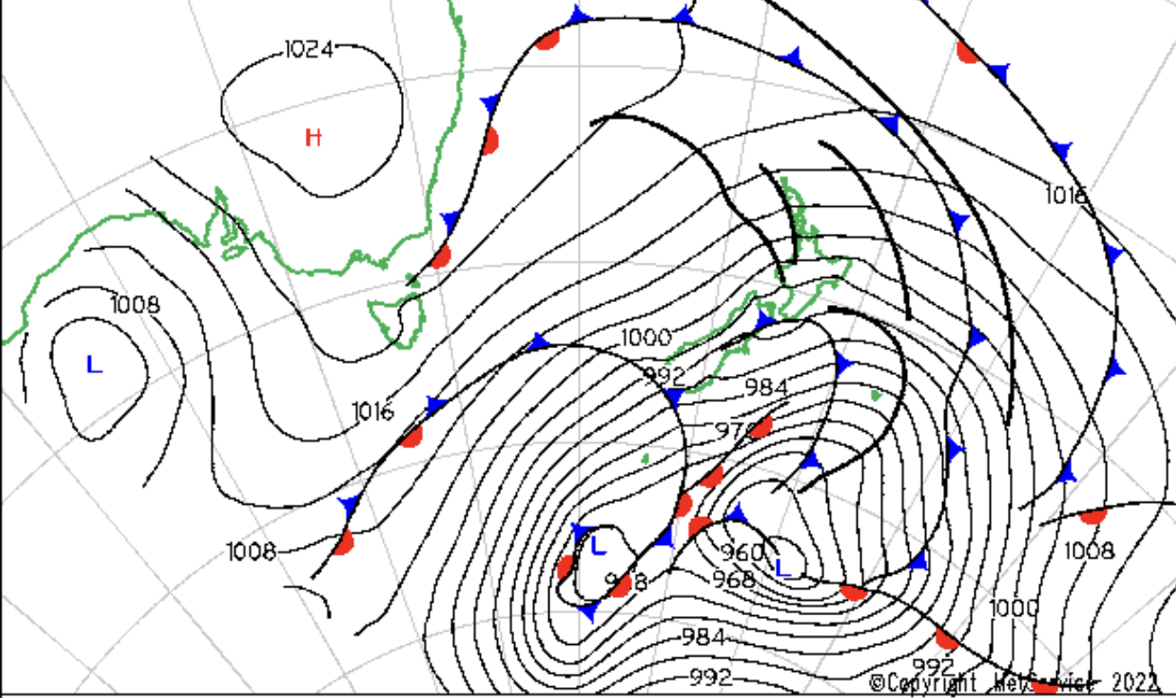
It is good to be back for the New Zealand weekly forecasts and we are starting with a good one. After a dry lead up, winter has really kicked in and New Zealand has been under the influence of a strong winter pattern over the past week, with a long wave trough directing a series of powerful storm systems across the country.
The Remarkables has collected 85cm of fresh snow over the past four days, setting up an excellent base ahead of the official opening on Saturday 18th June. Most other ski fields have also benefited from these recent falls, and there is more to come tonight and tomorrow.
Tuesday 14th June – Wednesday 15th June
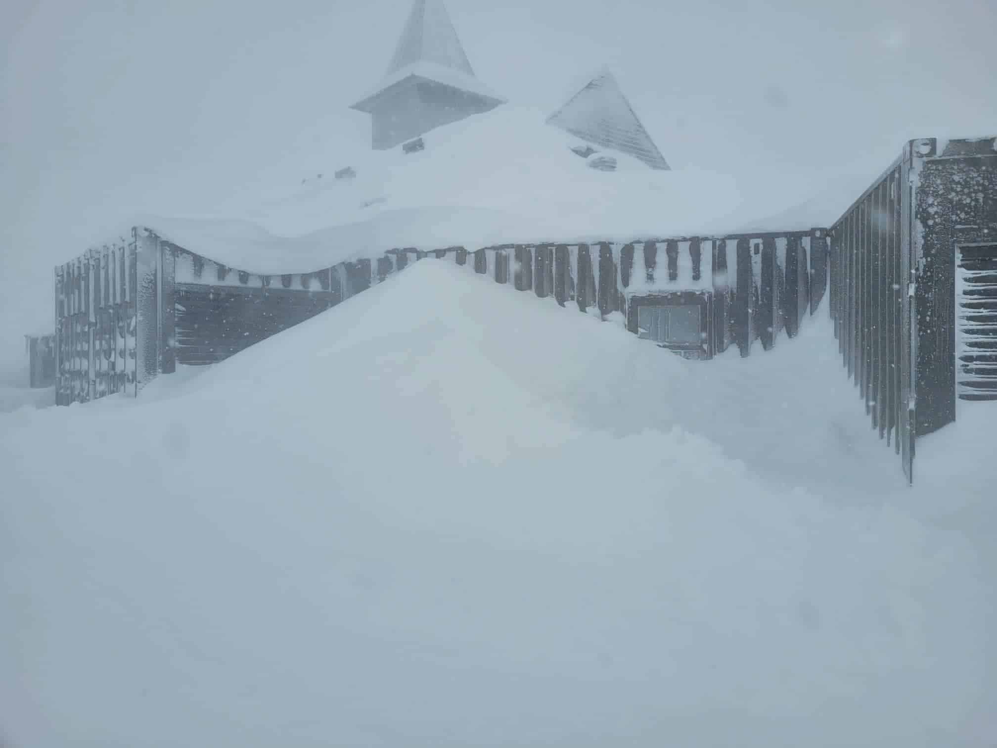
A significant low-pressure system was in the process of crossing the South Island on Monday, delivering another blast of cold, gale force winds and snow to all ski fields. Treble Cone had already picked up 44cm of fresh snow by Monday morning, and can expect another 10-20cm through Tuesday as a secondary front passes through. The airmass behind this secondary front is especially cold, so snow will fall to low levels around Wanaka and Queenstown.
Mt Hutt has already recorded 20cm with this system (on top of earlier falls), but has reported that strong winds have stripped snow from the upper slopes. However, in good news for opening day (Friday 17th June), higher snow accumulations are occurring on the lower slopes.
At Ruapehu, Turoa and Whakapapa are likely to see upwards of 100cm through the remainder of today and Tuesday, with gale force winds creating whiteout blizzard conditions. These wild winds will ease into Wednesday, as the low-pressure system moves eastwards away from New Zealand. It will remain cold at Ruapehu on Wednesday, while occasional snow flurries will continue.
Thursday 16th June – Friday 17th June
A small frontal system will brush southern parts of the South Island from Wednesday night into Thursday, delivering another round of low-level snow to the Queenstown and Wanaka areas. Around 10cm of fresh snow is likely for Treble Cone and for the Remarkables. Mt Hutt may also pick up 5-10cm on Thursday, coinciding with its opening.
A ridge of high pressure will bring more stable weather conditions to the North Island during this period, but Ruapehu may still collect a couple of centimetres of fresh snow on Thursday. This high will also cause snow showers to ease for the South Island’s ski fields.
Saturday 18th June – Sunday 19th June.
There is uncertainty in the outlook for this weekend, with the leading numerical weather prediction models differing in their projections beyond Friday night. The most likely scenario is for an increase in cloud over the South Island on Saturday, as a cold front passes to the south and an associated low-pressure trough deepens near the west coast. A ridge of high pressure may become re-established over New Zealand on Sunday, bringing more settled weather to most ski fields.
Extended Outlook
The South Island should remain under the influence of a large high-pressure system through the first half of next week, which will limit the potential for fresh snow, but create some nice blue-sky days in the mountains.
The North Island may come under the influence of a tropical low early next week, which has the potential to bring stronger winds and some rain to Ruapehu. This low will probably stay just to the northeast of New Zealand, but could still pack a punch in terms of wind as it passes by.


