The Grasshopper’s Weekly North America Forecast, Jan 18th – Deep Totals for High Terrain as Temperatures Bounce Back

Mountainwatch | The Grasshopper
Written Thursday morning 18th January (Pacific Time)
The recent cold and powder-filled run of late – which you can read about here and here – is about to take a warm and slushy turn as temperatures bounce back after the Arctic Oscillations recent foray into the negatives.
Over the next 7-10 days, the Mothership of low-pressure systems will remain parked up in the north Pacific, just south of the Alaskan Gulf, firing front after front over the North American West. This will create a rather messy situation (for me to describe at least).
These fronts will come imbedded in a constant flow of tepid and humid S-SW winds and will plaster those areas that manage to keep their heads above water with deep totals, especially in British Columbia, the Cascades and Sierras, although these will perhaps be the areas worst affected by high snow levels.
Thursday Jan 18th & Friday Jan 19th
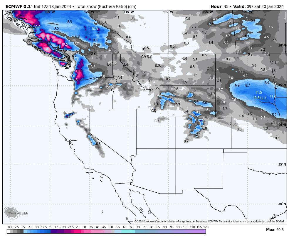
Today, a storm that rolled in from the northwest yesterday will exit eastwards of the central Rockies, leaving behind a trail of fresh snow over Idaho, Montana, Wyoming, Utah & Colorado. However, there’s a stark contrast of temperatures that divide this area into the north and south. The northern half (Montana, northern Idaho, northern-eastern Wyoming) will receive something in the order of 5-15cm of high-quality powder, while the south could see up to 15-25cm of heavier, denser snow and elevated snow levels due to mild temps.
While that’s taking place, an atmospheric river of wind pushes a warm front into the northwest from the south. There’ll be heavy falls in the Cascades and Canadian Coast Mountains today and/or tomorrow, and luckily enough, a lot of that will fall as snow to low elevations before snow levels really sky rocket on Friday, with rain expected on low-mid slopes at least.
The front will also push over the northern Rockies, with moderate falls mostly north of the Canadian border, and light falls reaching as far south as northern Idaho/Wyoming. Again, the warming trend here will see snow quality decrease as snow levels lift.
Saturday Jan 20th & Sunday Jan 21st
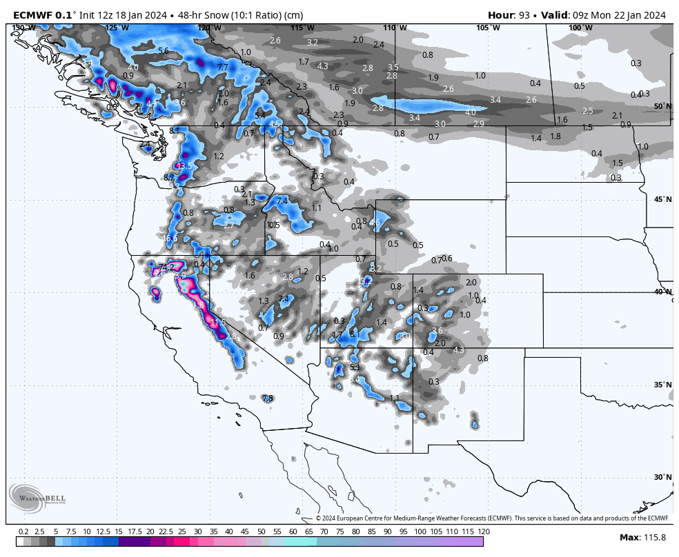
The weekend is a real mess of non-stop action, which actually kicks off late Friday evening, with another active front hitting the Sierras.
Moderate-heavy falls will spread down the Sierras early Saturday, but snow levels will be dangerously high, likely starting as rain at base levels for the I-80 and Tahoe resorts for example. Snow levels should gradually lower a little through the day to sufficient levels as a wee cool pool of air comes on.
The second half of Saturday and the first half of Sunday will see light-moderate snowfall spreading inland and northwards to encompass the entire North American Cordillera in some shape or form, although low-level rain is expected at many resorts. The heaviest falls are likely in the Cascades as the front drifts northwards.
The second half of Sunday will see scattered falls exiting the northern Rockies, while heavy falls continue in the Cascades, which also spread up into the Coast Mountains, while yet another from slams into the Sierras. Here, in the Sierras, the snow will bucket down again, but unfortunately temps and snow levels will also creep up again.
Monday Jan 22nd to Wednesday Jan 24th
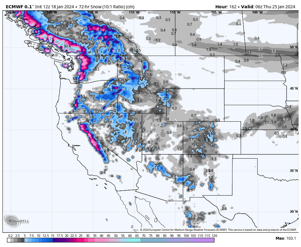
The messy situation continues through this period. Heavy falls along the Coastal Crest will eventually abate during Monday and early Tuesday only to return again to the Cascades and Coast Mountains for Wednesday as another storm rolls in off the Pacific.
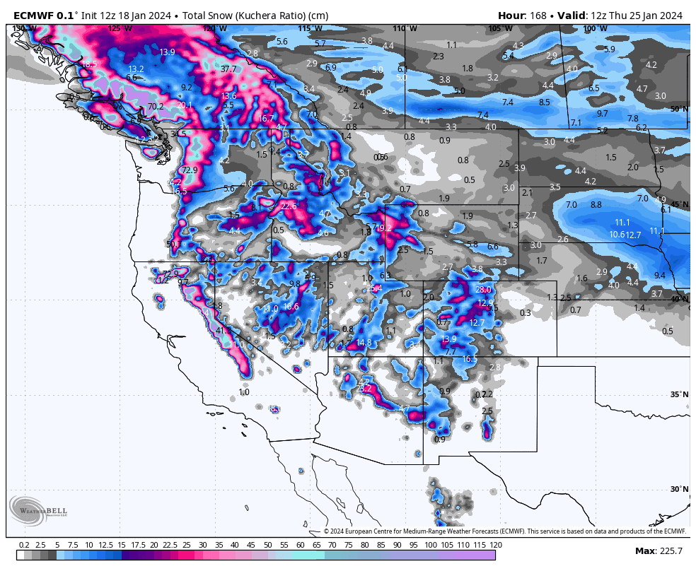
The Rockies will see two or three pulses of snowfall as each front mentioned earlier enters, then exits each area at different times and at differing intensities. Overall, everyone should get some, but there’ll be a slight north-south tapering in accumulations. Current forecasts suggest the northern Rockies will receive about 10-30cm, while the south around 5-15cm, but that’s subject to change being this far out. Temps remain mild, with freezing levels fluctuating between about 1500-2000m in the north, and 2000-2500m in the south, and most of the precip comes at the peaks so low-level rain or sludge can be expected at some resorts.
Extended Outlook
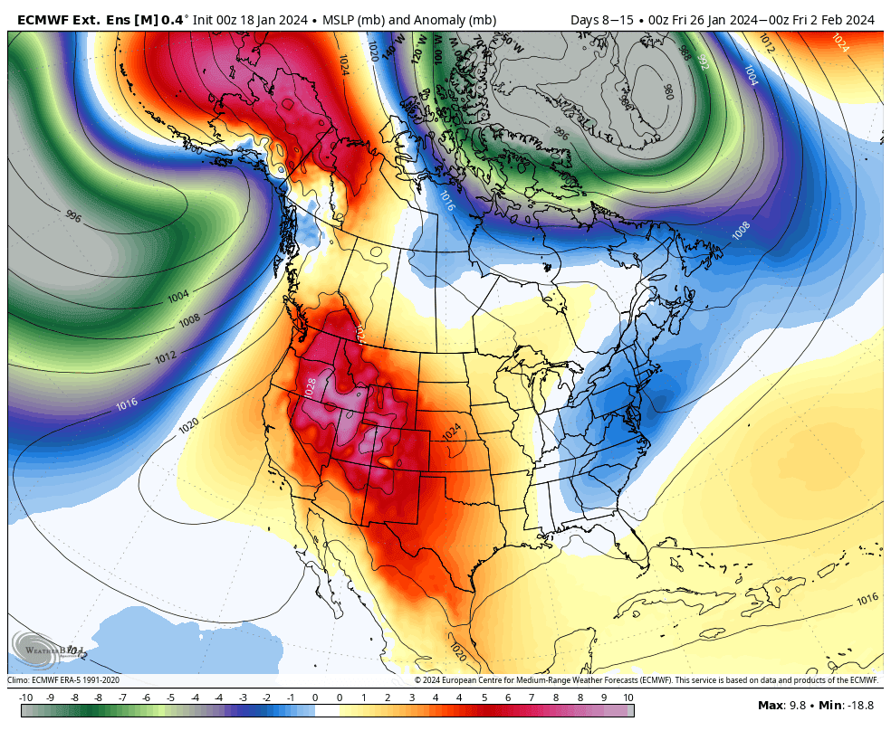
The barrage of tepid, humid southerlies is expected to continue over the north through to at least next weekend, the 27th-28th Jan.
High pressure then looks to take control through the first half of the following week, starting Monday 29th Jan. Storms are likely to return for the second half of that week, with a drop in temperatures also possible, although this may be restricted to the north.
That’s all from me today. Have a great week, see you next Thursday.
Grasshopper


