1 – 3 August, 2010 – VIDEO 1.2m of New Snow for Thredbo
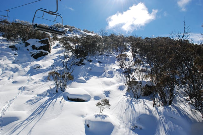
Pillow lines under Gunbarrel Chair. Image:: Mandy Lamont
Snow Journal | Reggae Elliss
Phenomenal snowfalls, which at their heaviest deposited 35cm in three hours, have blanketed Thredbo with over a metre of fresh snow in under 72 hours.
As forecast on Mountainwatch last week, the snow first started to fall on Saturday afternoon and really kicked into gear on Sunday afternoon as a vigorous cold front hooked in from the southwest and 35cm of snow fell across the NSW.
On Monday morning it looked to be clearing but more clouds moved in from the southwest, the wind picked up and the snow began to fall around 10am. The open areas were heavy and wind-packed, but those areas in the lee of the wind or in the trees were epic. By 12:30pm the wind had turned directly south, reducing visibility in the open to zero, but the snow began to fall thick and fast.
| You need to have the Adobe Flash Player to view this content. Please click here to continue. |
GoPro HD Hero cameras were used to make this video.
At 1pm the Thredbo Village Crew cleared the snow in the village square down to the pavers, by 2:30pm the square was covered again – 15cm had fallen in just 90 minutes.
The heaviest falls occurred between 3pm and 6pm on Monday – another 20cm in the village and 35cm on the mountain. For those who braved the weather it was fresh tracks every run – even when you skied the same line.
The amount of snow that fell in six hours caused plenty of chaos in the village and on the Alpine Way – the snowploughs couldn’t clear fast enough and the road kept a 10cm cover all afternoon.
All up 55cm fell on Monday and the total for the three day storm was 120cm. There have been greater 24 hour and 48 hour snowfalls – I can remember a couple of overnight falls of over 60cm, maybe in 2004 and in 1996, and in 1987 an infamous storm deposited enough snow to do backflips off the Bistro deck – but to see that much fall during the day in Australia is unusual.
Also unusually, the storm was coming directly out of the south and most of the snow fell on the southern side of the main range – putting Thredbo directly in the firing line.
The other NSW resorts are on the northern side of the main range and therefore didn’t receive as much snow – not that anyone is complaining with over 20cm falling at Perisher and Charlottes during the day. Selwyn also fared pretty well, with 25cm in 24 hours by Tuesday morning.
A temperature rise on Monday night softened the powder, but, don’t worry, this excellent base will freeze and more snow is due on Wednesday night and we may even see the sun by the weekend. With most resorts now having close to 100% of the terrain open it looks like August will a great month in the mountains.
Make sure you know when the snow is coming with the SNOW iPhone app & mobi site and SNOW widget for desktops and websites
Thredbo snow cams, daily snow reports and forecasts
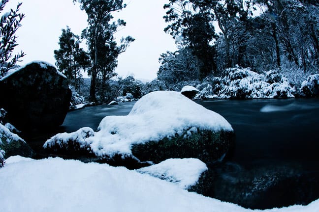
The Thredbo river in all its glory. Image:: Andrew Fawcett
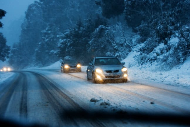
The Alpine Way. Image:: Andrew Fawcett
Thredbo forecasts,
snow reports and
live snow cams.


