Australian Forecast, Monday June 3rd – A Mild & Humid Week Ahead, but Potential Season Starter on the Horizon
Mountainwatch | The Grasshopper
Published early Monday June 3rd 2024
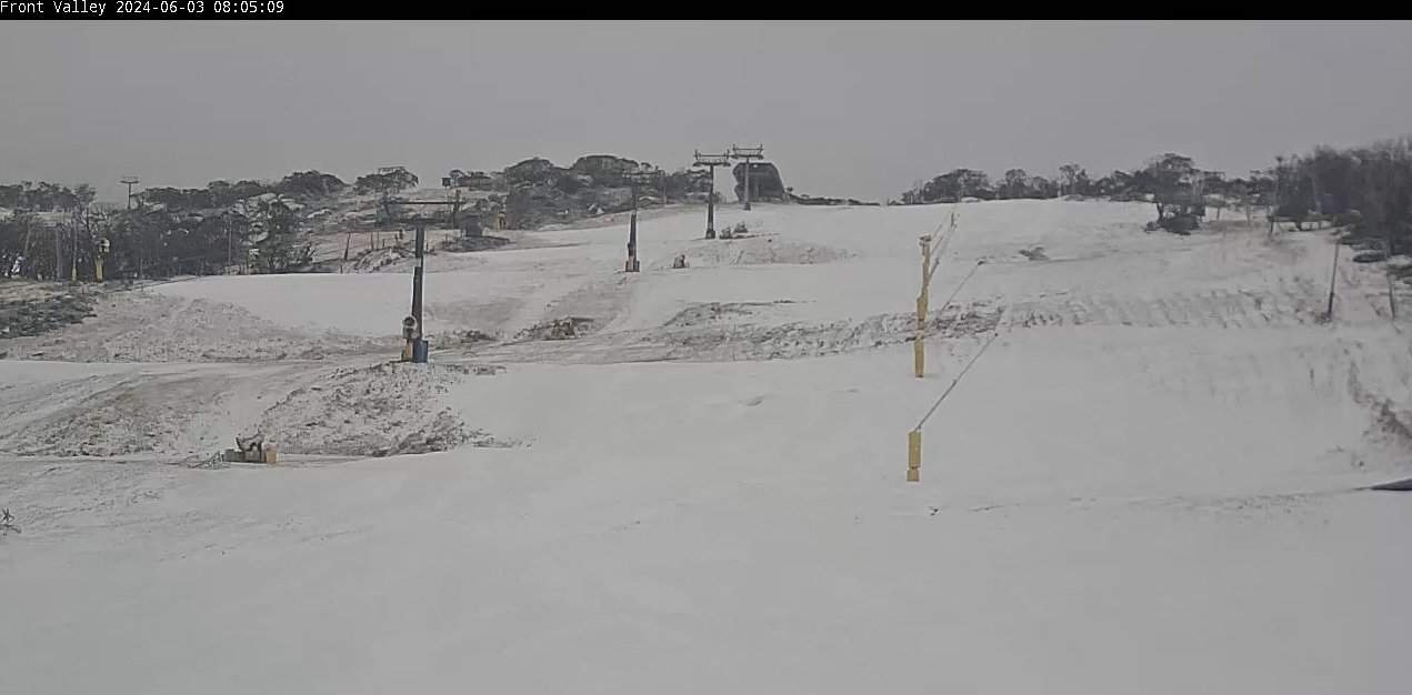
Over the weekend we received a wee dusting of snow mostly above 1700m, and a bit more to lower levels last night, with the snow guns also getting some run time. Before the lights went out last night, there was a thin veneer of white covering upper slopes.
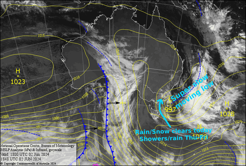
The forecast this week through Opening Weekend doesn’t look great for more of the white stuff, as a series of east coast lows bounce around in the Tasman Sea, bringing mostly mild and humid southeasterlies. We’ll be heavily reliant on the stockpiles of man-made snow that resort have been trying their best to build up for Opening Weekend.
It’s a far cry from earlier forecasts, which were much more favourable regarding snowfall. These east coast lows are tricky beasts to deal with, because they’re much less predictable than storms coming out of the Southern Ocean, and small deviations in their intensity and position can lead to big changes in our weather.
Talking about storms coming out of the Southern Ocean… next week, long range models hint at just that. A deep low passing south of Australia could send cold polar air and snow our way. It’s very early days, but this one has the potential to be the season starter if it comes to fruition.
Monday June 3rd to Wednesday June 5th
Remaining snow and rain will clear Monday morning or early afternoon, leaving partly cloudy skies for the rest of the day as well as through Tuesday and Wednesday, while winds gradually swing around from the W-SW to the SE.
Although the airmass will warm up during this period, overnight temps should dip into the negatives Monday night and Tuesday night if the cloud cover manages to clear for long enough, which will allow the snow guns to fire up.
Thursday June 6th & Friday June 7th
Wet, clagged-in conditions will build on Thursday as SE winds strengthen over the Aussie Alps. Rainfall could become quite decent and persistent on the NSW side, and at this stage, no snow is expected, although there is a slight chance some could fall about the tops.
SE winds will abate during Friday, allowing the rain and drizzle to gradually ease.
Extended Forecast
Opening weekend is likely to bring partially cloudy skies and a few light showers, as mild and humid SE breezes gradually die out. Monday 10th June should also see cloud and light showers, as NW winds develop due to the low out east finally moving away towards New Zealand.
Then, between Tuesday June 11th and Friday June 14th, a deep low-pressure system is expected to pass underneath Australia, dragging along a cold polar airmass with it. If current forecasts hold steady, then this could be the season starter storm we’ve all been wishing for with a solid dump of snow on the cards for the Aussie Alps. Definitely keep a close eye on this one!
That’s all from me today folks. I’m sending out forecasts every Monday, Wednesday and Friday from hereon in, so see you back here in a couple of days!
Grasshopper


