Australian Weekend Forecast, August 26 – Sunny Skies Before a Late Change Sunday
Mountainwatch | The Grasshopper
It was a great week of snowfall, which has seen about 20-50cm of quality powder added to the snowpack since last Thursday, and providing perhaps the best conditions of the season so far. The latest reading taken from Spencer’s Creek on Wednesday is up at 204.5cm – not bad!
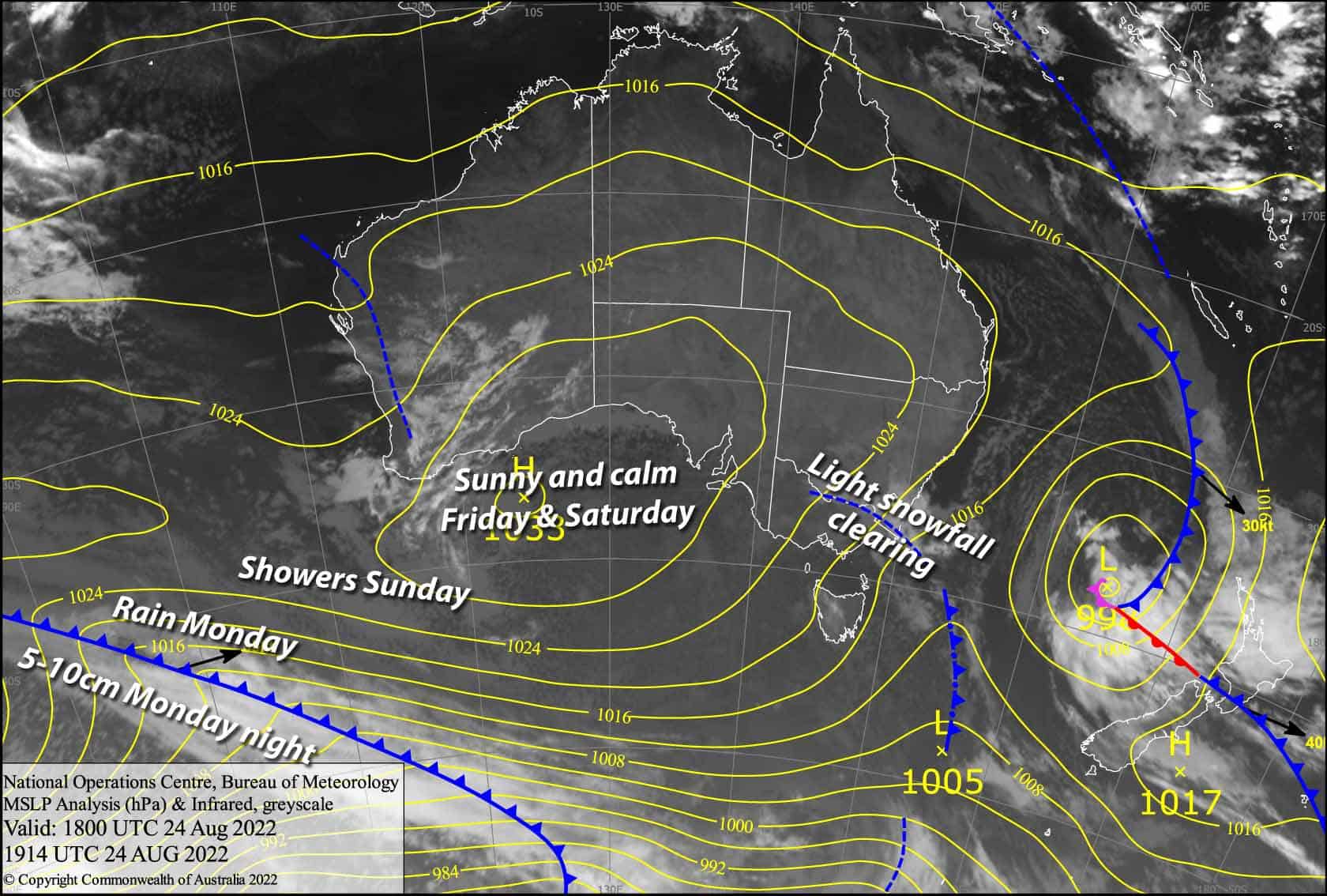
Today and tomorrow are must-ski days for fair weather skiers, as a high-pressure system skirting just south of us provides mostly sunny, calm conditions.
Friday 26th
A mostly fine, sunny day although some cumulus cloud should also pop up during the afternoon. Light and variable breezes.
Saturday 27th
Another mint day, with some cloud popping up again during the afternoon. N-NE breezes.
Extended Forecast
Northerlies strengthen during Sunday and Monday, with showers eventually turning to rain with heavy falls on the cards, before an active cold front hits us late Monday. Snowfall with the front will be short lived, clearing up by early Tuesday, leaving around 5-10cm of fresh powder.
High pressure should bring sunny settled weather Wednesday and next Thursday, before the weather starts packing up next Friday as another cold front approaches from the southwest. The front looks weak by the time it reaches us next Saturday, with just a little snow on the cards, but temps look nice and cold for the snow guns to make up the shortfall.
That’s all from me today folks. For this week, I’m sending out the forecasts Sunday, Thursday and Saturday. Next week, I’ll be back to the usual Monday, Wednesday and Friday forecasts. Have a great day and a good weekend.


