New Zealand South Island Forecast, June 30th – Freezing SW Winds, a Few Snow Showers and a Tonne of Snowmaking
Mountainwatch |The Grasshopper
Written early Friday 30th, valid to Sunday 2ndJuly
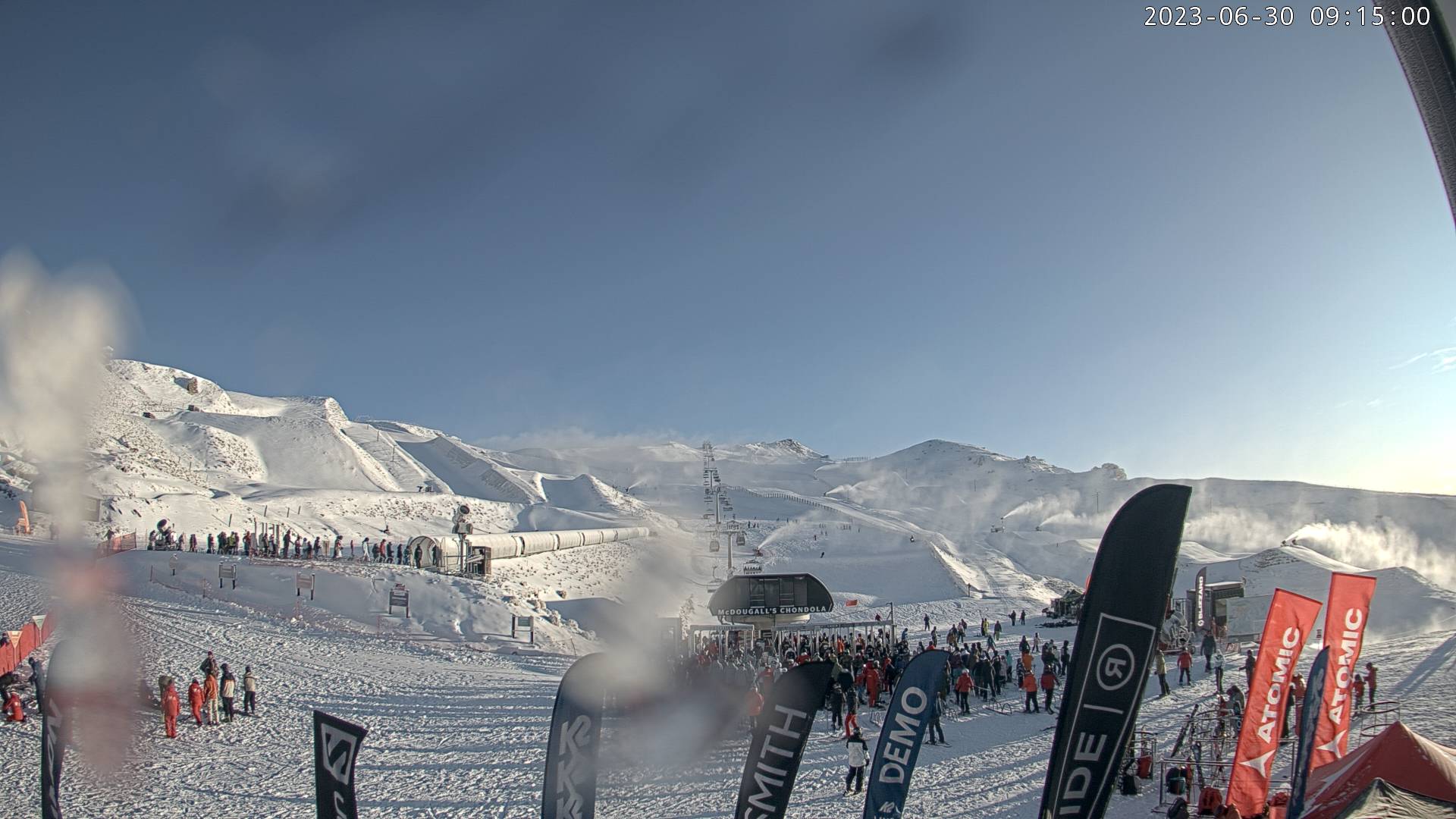
We’ve seen a mix of rain and snow falling over NZ resorts these last few days, which hasn’t helped after a month of un-winter-like weather has brought about a very sluggish start to the season here. Only the Remarkables and Cardrona remain open after Coronet Peak closed this week, while Mt Hutt and Treble Cone also remain closed.
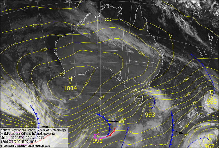
However, temps are now on their way down as a strong, cold W-SW flow blows over the country today and through the weekend, with a few snow showers and flurries thrown into the mix. Snow accumulations will only be a mere dusting of 1-5cm, although the Remarkables could score 10-15cm, but the freezing temps will have the snow guns firing, bolstering the main runs especially at base levels where it’s needed most. This should hopefully be enough to get all the resorts open either Sunday or early next week.
Friday June 30th
Partly cloudy with light snow showers. For the Southern Lakes, most of it will be south of the Crown Range with only a few making it further north. In Canterbury, Mt Hutt will see more than the club fields further inland. Freezing W-SW breezes.
Saturday July 1st
Fairly cloudy for the Southern Lakes, with snow showers clearing before dawn, but returning again late morning. Cold and gusty NW winds will be strong up high, gradually tending SW.
A mostly fine morning for Canterbury, but cloud will fly in around midday, with snow showers spilling onto the club fields, with only a slight chance of one reaching Mt Hutt. NW winds will go crazy during the afternoon, reaching severe gale force.
Sunday July 2nd
A partly cloudy/fine day for the Southern Lakes with snow showers likely clipping the Remarkables with one or two elsewhere. Strong and freezing cold SW winds.
Mostly fine for Canterbury. SW winds over Mt Hutt, but lighter westerly winds closer to the Main Divide for the club fields.
Extended Forecast
The Southern Lakes should receive more snow showers during Monday and early Tuesday ,before the cold SW winds die out Wednesday as a narrow ridge moves onto the country. Most of the snow showers will fall south of the Crown Range about the Queenstown resorts again, with just a dusting in store. But it’ll be all about the snow guns trying eek out every flake while they can, because unfortunately, a Tasman Low could bring warmer temps and rain later next week.
That’s all from me today, folks. See you again Monday.
Grasshopper


