Weekly Japan Forecast, December 26th – Big Boxing Day Special for Central Honshu, Persistent Snowfall Racks up in the North

Mountainwatch | The Grasshopper
Written Friday morning, 26th December (Japan Standard Time)
Temperatures across Japan have been running warm since late last week and the weekend, and there’s been little snow to speak of. Snow depths across the country are at low tide, particularly down low where the snowpack has suffered from significant melt and rain.
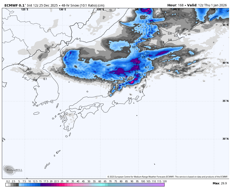
In keeping with the tradition of giving to the needy on Boxing Day, a storm that has just gotten underway in the early hours will see Central Honshu resorts receiving the much-needed gift of around 40 to 80cms, the largest dump of the season so far. Hokkaido and Northern Honshu will also receive 25-50+ cms before the storm clears up on Sunday.
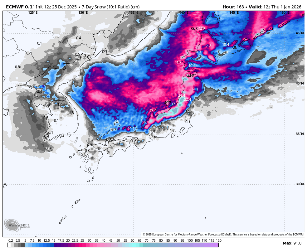
Hokkaido and Northern Honshu will continue to rack up the totals from Tuesday through Thursday, thanks to persistent cold winds off the continent. However, Central Honshu will sit on the cusp of this cold air and will pick up scraps with rain often affecting the lower slopes.
Friday 26th to Sunday 28th December
After a mild Christmas day brought rain and upper level snow to many resorts, Boxing Day won’t disappoint. Strong, cold north-to-northwest winds hit the country early on Friday for what will be the biggest powder day of the week and season so far for central Honshu. Snow will come down heavily throughout the day while improving in quality, and then start backing off overnight before clearing from the south during Saturday. A little more snow will fall early Sunday before high pressure clears things up proper, with calm, sunny conditions making for one heck of a powder day. Storm totals for the region are likely to come in around 40 to 80cms for most resorts.
Further north in northern Honshu and on Hokkaido, resorts will see more persistent moderate snowfall through to early Sunday, with increasing pressure then breaking up the cloud cover to sneak in some sunshine. Storm totals are expected to get up around 25-50+ cms.

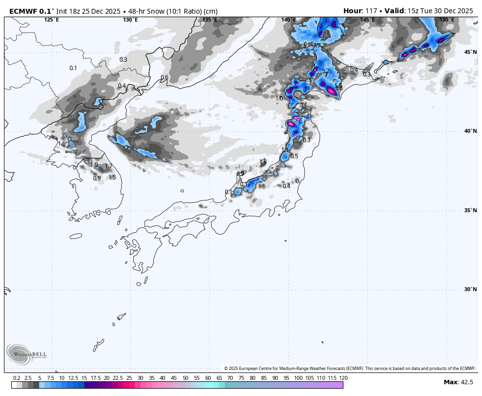
Monday 29th & Tuesday 30th December
On Monday the high drifts out east, allowing a warmer south-to-southwest flow to move in. Rain and upper-level snow spreads over Hokkaido early in the day before spreading down Honshu later, eventually reaching central parts at night where it would have otherwise been a sunny day.
Colder west-to-northwestelies sweep down over Hokkaido and northern Honshu on Tuesday, bringing light-to-moderate snowfall, while rain and upper level snow continue over central Honshu.
Wednesday 31st December & Thursday 1st January
Things become less certain during this period, but Hokkaido and northern Honshu are likely to see decent totals as cold winds off the continent continue pushing in consistent and high-quality snowfall.
Central Honshu will likely sit on the cusp of this colder air, causing snow levels to bounce around at slightly elevated altitudes. Totals are expected to be light and focused nearer to the Sea of Japan coast.
That’s all from me today, folks. Have a great week, and I’ll see you here next Thursday for another weekly rundown of Japan’s highlights and snowlights.
Grasshopper