North American 2021/22 Season Outlook, December Update – Good Conditions Set to Continue
Mountainwatch | The Grasshopper
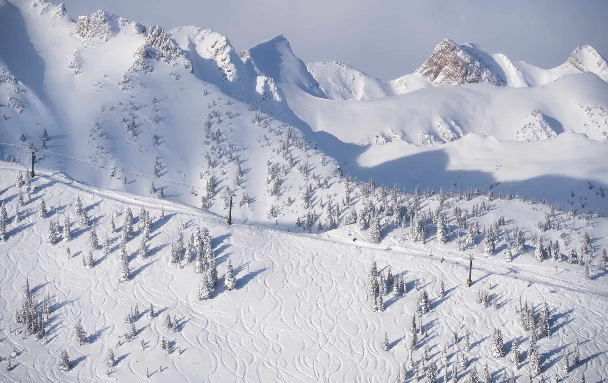
Merry Christmas and welcome to the December update for our North American seasonal outlook. Mother nature has also been feeling festive around western North America with big snowfalls in California and the Canadian Rockies just to name a few.
Some areas in Canada have seen record early season conditions, such as Kicking Horse opening with their deepest base ever earlier this month.
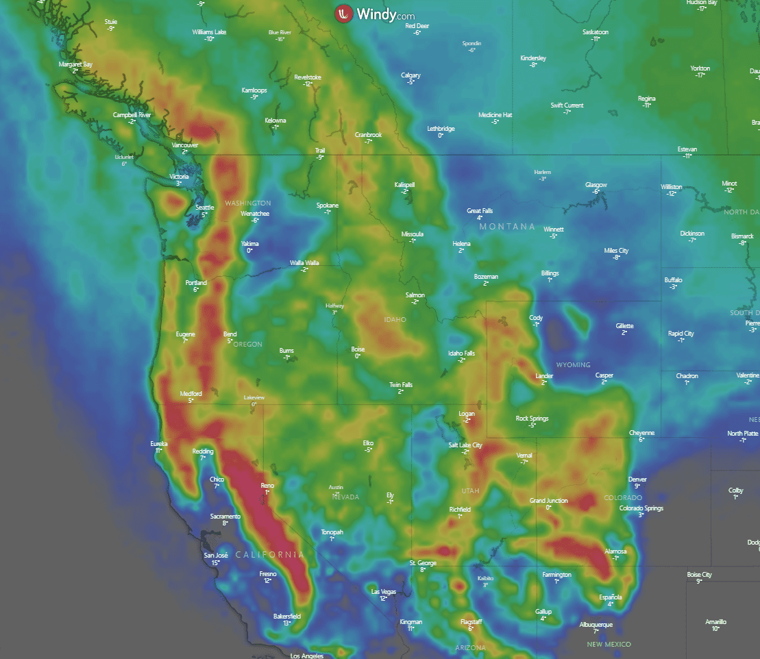
In the short-term things aren’t slowing down with BIG totals expected around North America over the coming days. Below is the forecast 10-day snowfall accumulations around the west of the continent. Large hotspots around Tahoe and through the Sierras, along with areas around Salt Lake City, the Pacific Northwest and a bunch of other places set to fare well. On this graphic the areas in bright red are around 150-250cm! Importantly, good snowfall should make its way south into areas like New Mexico, which have had a relatively slow start and not a particularly good outlook for this La Nina season.
So, it comes as no surprise the overall forecast for the rest of the season is looking increasingly promising for those northwestern areas of USA and western ski areas of Canada. Here’s how the outlook has developed over the last month.
State of Play
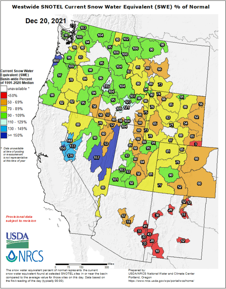
Picking up where we started last month, the figure below shows percentage of average snow depths around eastern USA. There is a much stronger theme of yellow and greens around the northwest than last month where we saw predominantly reds all over this region. Things are also slowly picking up through central areas, but areas down south are having a rough go of it as forecasted due to La Nina’s influence.
Updated Agency Outlooks
Last month I went through the seasonal forecasts from NOAA and Environment Canada. Due to La Nina conditions expected to peak through the northern hemisphere winter the overarching theme was good for the Pacific Northwest and Canadian Rockies, average through the American Rockies and Sierras and below average the further south you go into the United States. Not much has changed overall, with La Nina still expected to peak over the winter, but we have seen a stronger forecast for the areas which looked to be best placed along with a better chance of average conditions through the central western United States (places like Tahoe, Mammoth etc.).
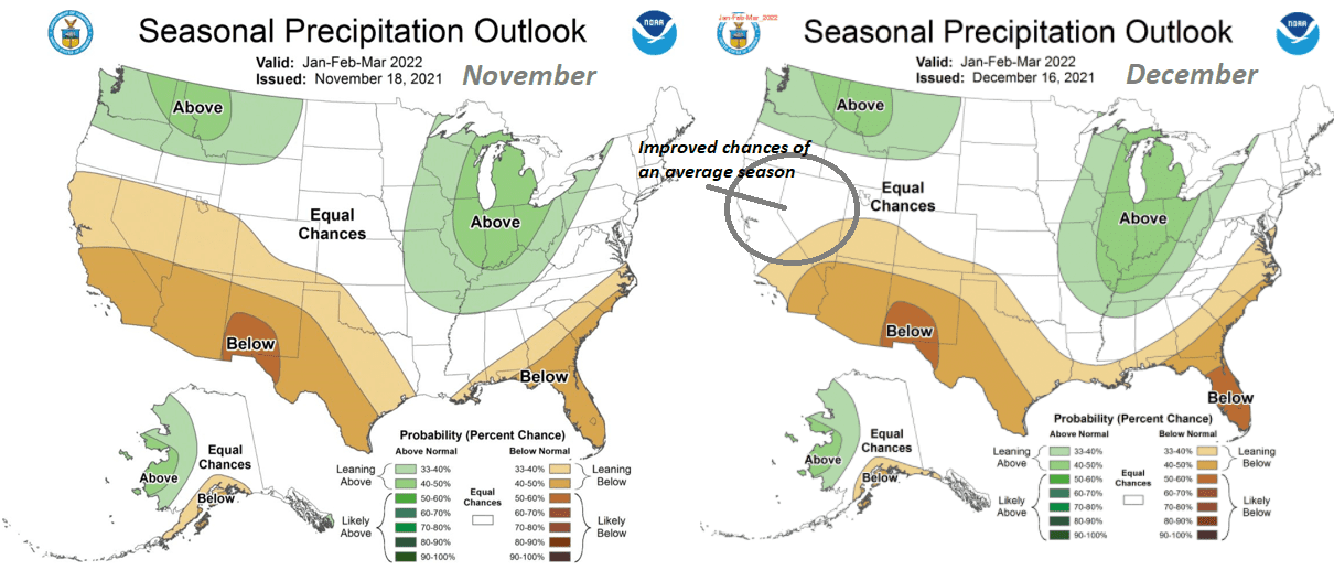
We can see this in the comparison below which shows the NOAA precipitation outlook for Dec-Feb generated in November (left) and December (right). The extremes of this plot (best chances of above or below average) haven’t really changed, but we can see an improved chance of an average season further south into the west which is good news and agrees with the recent storms through northern California/Oregon etc.
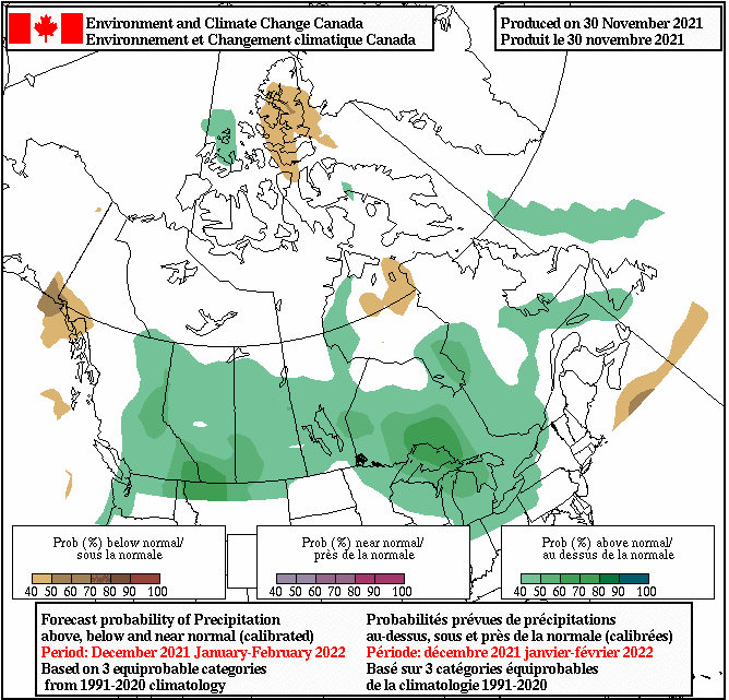
It is also a similar story with the Environment Canada outlooks. We can see a noticeable improvement in the temperature forecast below with almost the entire western half of the country dropping from average to below average temperatures expected. Combine this with the updated precipitation outlook in the next figure and its shaping up nicely for the Canadian rockies, with some areas already having the best early season snowfalls in recent memory.
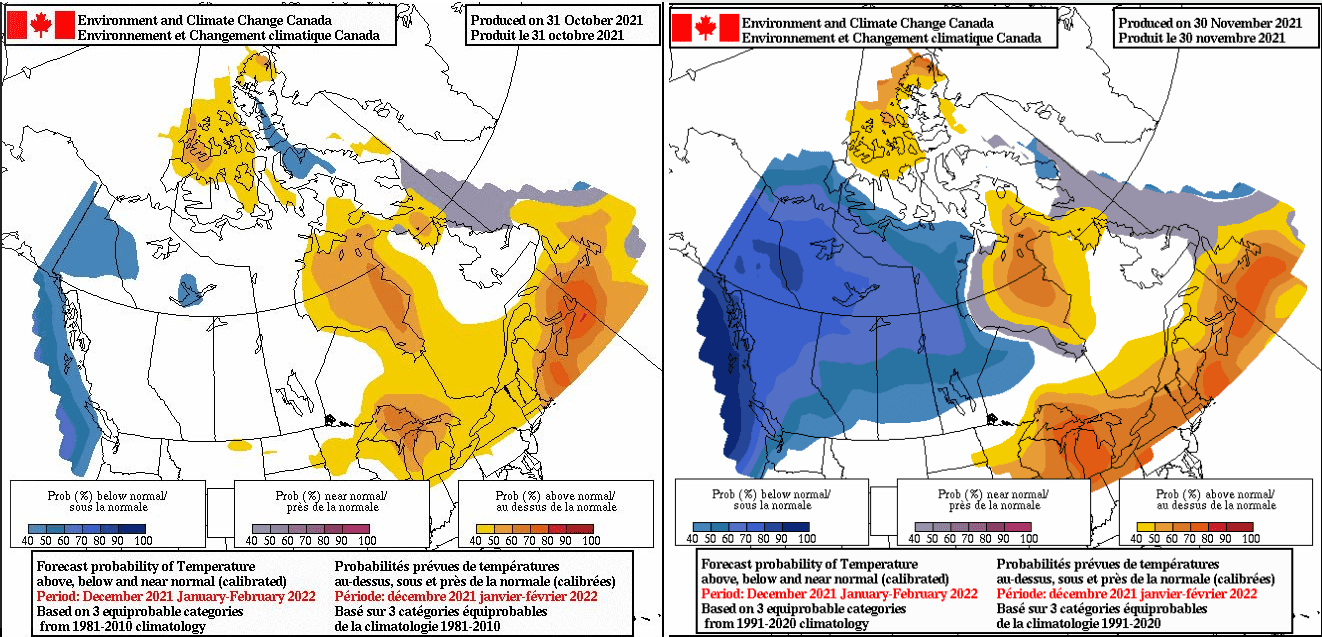
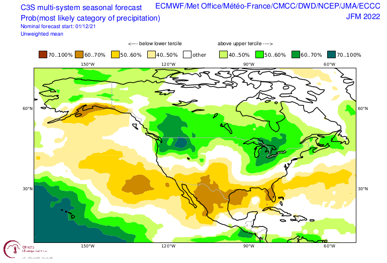
To summarise with the seasonal outlooks, I’ve included the C3S multi-system precipitation outlook for Jan-Mar which is comprised of multiple agencies model outputs from around the world (listed in the top right of the image). As I mentioned the overall vibe is like last month with an improvement in the forecast for those north-western US areas and throughout western Canada
Conclusion
So, after this update what should we expect from North American resorts over the snow season? Well for areas originally expecting an above-average chance at a good season (such as western Canada, PNW, etc.) and the areas expecting a not so good season (southern USA) the outlook is much the same. In fact, it looks like the signal for above average snowfalls has gotten stronger up north. The main development over the last month is a shift of the below average region of temperature and precipitation to slightly further south, improving the outlook for areas like northern California, Tahoe, Nevada, Oregon etc.
In short it appears that some of the conditions we are enjoying vicariously through social media look to be set to continue (especially over the next few weeks) with good widespread totals expected around different regions.
If only it were as simple as packing the ski bag and jumping on a plane, but hopefully keep the faith and the possibility of a late season trip isn’t too far-fetched.
Grasshopper


