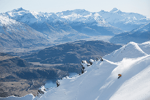
Australian Forecast – Fine Weather Holds as Resorts Continue to Rely on Snowmaking
Published early Wednesday, 24th June 2026
We’ve had a couple of nice days and chilly nights that have allowed the resorts to make some snow although cloud cover and high humidity hampered the snowmakers last night. We also had a few unexpected snow flurries pop up on Monday. They didn’t improve the conditions but made the place look a little more like winter with a sprinkling of white.
We’ll continue the run of fine weather through the end of the week, with snow-making temps overnight, hopefully with low humidity. However, with cold air above and some daytime heating at the surface, clouds will bubble up in the afternoons. As we saw on Monday, these could bubble up enough to produce some light flurries about the upper slopes on Wednesday, Thursday and Friday, if we’re lucky.
.
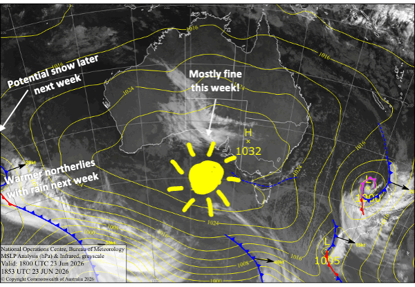
Wednesday 24th June
Mostly fine with a light south-to-southwest breeze. However, some cloud will bubble up in the afternoon, and there’s a chance they could produce a couple of light spits of rain, which may fall as light flurries up high if we’re lucky. Temps should get cold enough overnight for the snow guns, except maybe in resorts further west in Victoria where it’ll be marginal
Thursday 25th June
Another fine day where some clouds could bubble up enough in the afternoon to produce a light spit and snow flurry up high, especially in Victoria. Little to no wind and snow-making temps overnight.
Friday 26th June
Crystal clear in the morning, but cloud will pop up again in the afternoon, with the chance of a snow flurry up high and a spit of rain lower down. Little to no wind again, and the snow guns will get another run overnight.
Saturday 27th June
A mint, calm and sunny day. Less bubbling-cloud action, so it’s unlikely we’ll have any of that afternoon precipitation. However, there’ll be snow-making temps again overnight.
Sunday 28th June
A clear start to the day, then cloud will gradually build as a northerly breeze picks up. We could also have light showers late in the piece, falling as snow up high. Less chance for snow-making overnight.
Extended Forecast
The outlook doesn’t look great for the first part of next week, with a prolonged mild northerly flow dumping a bucket load of rain on the Aussie Alps from Monday 29th of June through Thursday the 2nd of July. However, a cold change or two around Friday the 3rd and Saturday the 4th of July is expected to bring a period of snowfall and another chance to fire up the snow guns. Forecast models aren’t yet aligned, with storm totals ranging from a little to a lot. Fingers crossed for the latter and I’ll have a clearer picture of that on Friday.
That’s all from me today, folks. I’m sending out these forecasts every Monday, Wednesday and Friday throughout the season, and during July and August I’ll fire one out on Sundays too. Have a great couple of days, and I’ll see you back here on Friday.
Grasshopper