Grasshopper’s Weekly Japan Forecast, Jan 6th – A Half Serving of Powder in a Relatively Sunny, Calm week
Mountainwatch | The Grasshopper
Written Friday 6thJanuary (Japan Standard Time)
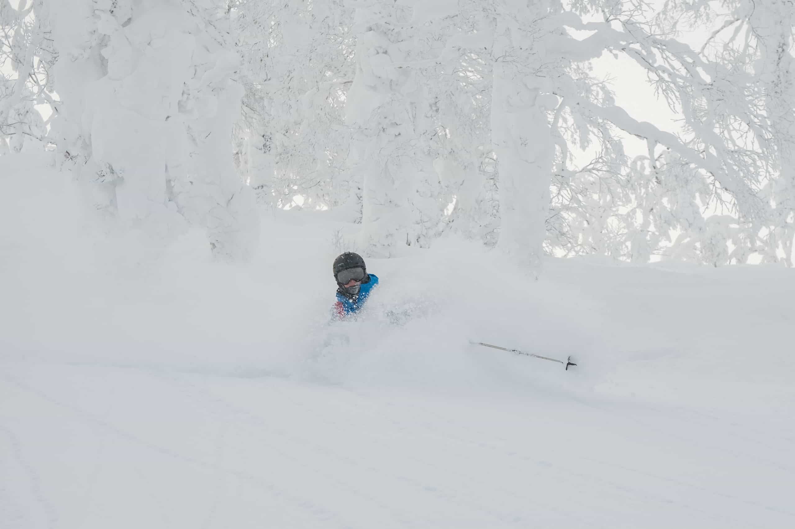
Well, it’s been another deep powder week here in Japan as Reggae can attest to after he flew in late last week – he’s timed it well!
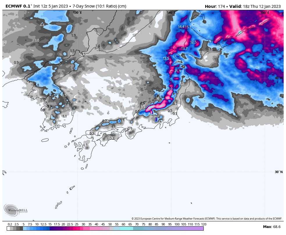
This week, we’ll pleasantly see more sunshine than we’re used to, with weekly snow accumulations looking a bit lower than the previous couple of big weeks, perhaps even a half serving of those weeks, which together pumped out somewhere between 1-2.5m of powder for many resorts.
The best falls will come late Saturday into early Sunday on central Honshu, before a cold front brings widespread heavy snowfall later on Monday into Tuesday. It’s not the week-long snow storms of the previous weeks, but is better than earlier forecasts, which foretold of a couple of rain events.
Friday 6thJan
A freezing NW breeze will continue to push in a sparse scattering of light snow showers over northern Honshu and Hokkaido throughout the day. Gaps in the cloud are showing up on the satellite image, which will no doubt let rays of sunshine though too.
A ripper of a day for central Honshu. More consistent and slightly heavier snowfall gradually eases this morning and eventually clears up this afternoon as a ridge of high pressure puts an end to the cold NW breeze.
Saturday 7th & Sunday 8thJan
Remaining light snow showers will clear up on Hokkaido during Saturday as winds turn predominantly from the north and back right off, providing a rare, mostly sunny weekend, especially for resorts inland.
Northern Honshu too will be rather settled, with a mixture of cloud and sun, as well as the odd light snow shower thrown in for good measure.
Central Honshu will see more yo-yoing of conditions this weekend. Starting out under a ridge of high pressure, much of Saturday will be clear and calm before a weak cold front brings light to moderate snowfall from Saturday evening, which will eventually clear Sunday afternoon.
Monday 9th to Wednesday 11thJan
A low will slowly pass to the north of Japan during Monday, with snowfall ramping up over northern Honshu and Hokkaido during the morning in a slightly warmer SW flow, before a fresh wave of cold NW winds wash over during the afternoon, bringing a period of moderate-heavy falls.
That same wave of cold air will hit central Honshu late Monday, after spending much of the day under partly cloudy skies, with heavy snowfall ensuing.
Snowfall and cold NW winds over Japan will start to abate during the second half of Tuesday, eventually becoming light and very sparse Tuesday night.
Cloud will clear central Honshu Wednesday morning for an amazing sunny powder day, with breaks in the cloud also appearing further north.
Thursday 12thJan
A weak cold front is likely to bring a period of light snowfall to northern Honshu and Hokkaido on Thursday, while central Honshu should remain mostly sunny under high pressure.
Next Friday & beyond
Warm, clear skies next Friday are likely to lead into warm, rainy skies next Saturday as southerly winds pick up. Models indicate a cold front will hit next Sunday, returning temperatures down to where they out to be and turning winds back to the NW. A day or two of snowfall should follow, before another low-pressure system could repeat these conditions later the following week.
Despite at least a couple of good periods of snowfall, ensemble models indicate snowfalls over the seven-day period starting next Friday, the 13thJanuary, will come up significantly shy of the snowfall we’ve seen these past two weeks, and is perhaps a continuation of the average-to-below falls of the coming week.
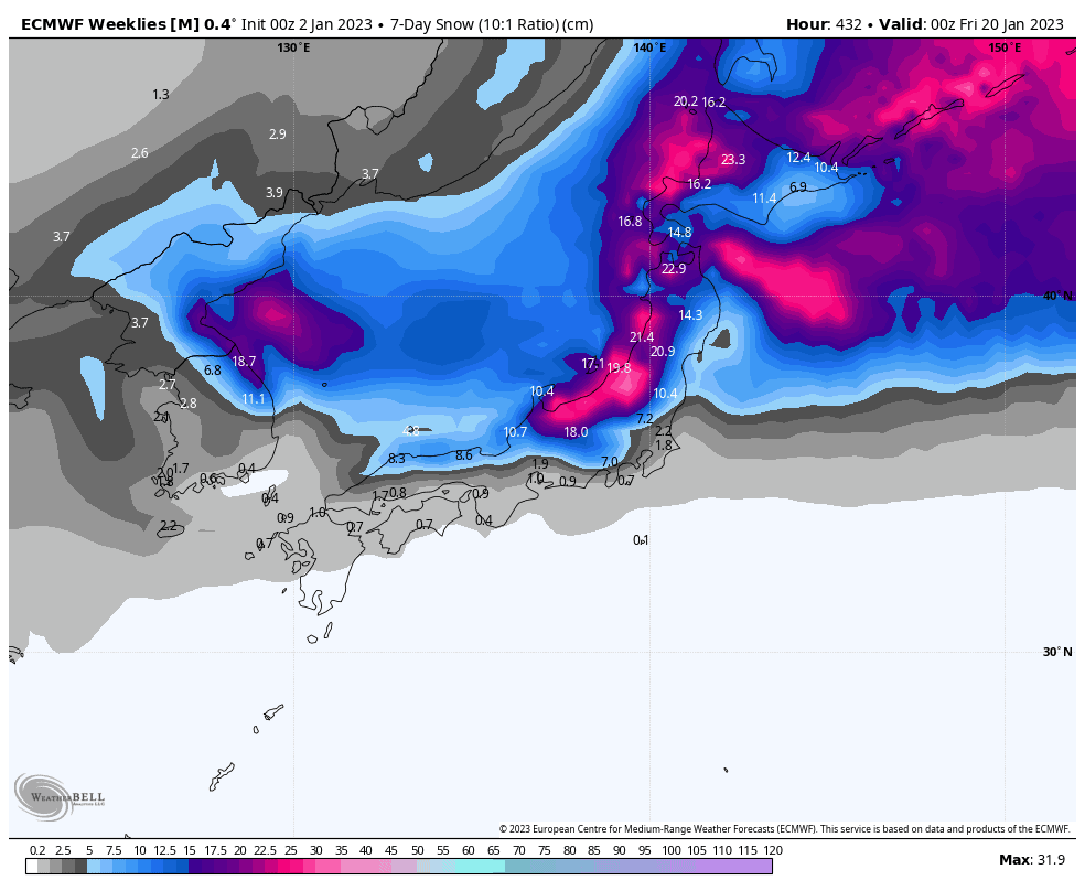
Despite at least a couple of good periods of snowfall, ensemble models indicate snowfalls over the seven-day period starting next Friday, the 13thJanuary, will come up significantly shy of the snowfall we’ve seen these past two weeks, and is perhaps a continuation of the average-to-below falls of the coming week.
Well, that’s all from me this week guys, see you next week!
Grasshopper


