Grasshopper’s Weekly North American Forecast, Jan 6th – Sierras Hog the Headlines Again, but Idaho Sneaking in a Look too
Mountainwatch | The Grasshopper
Written Thursday January 5th (Pacific Standard Time)
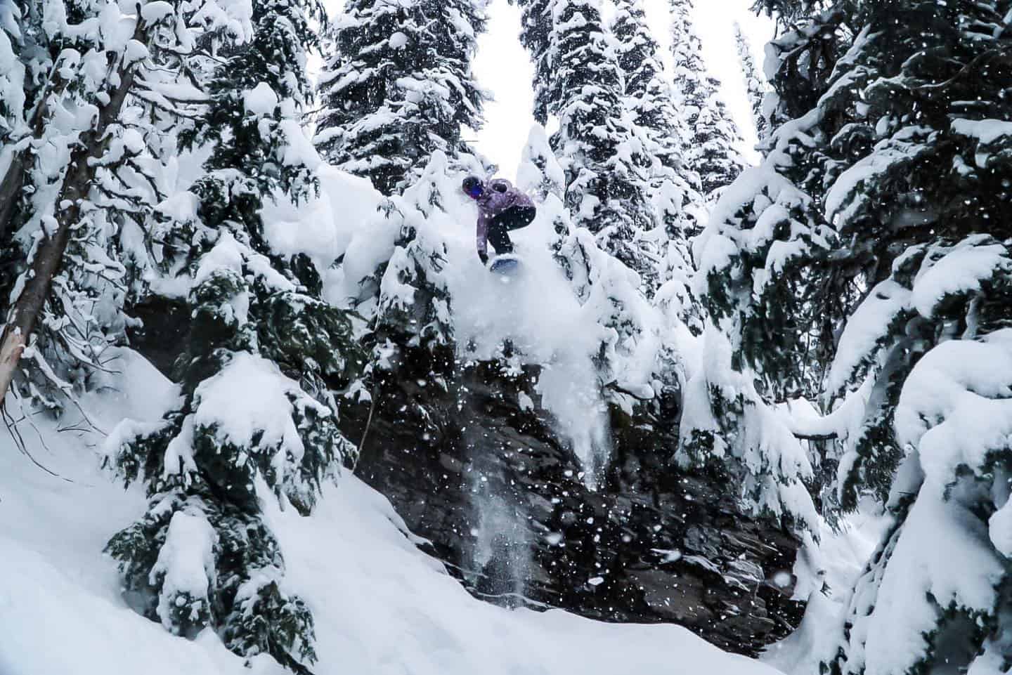
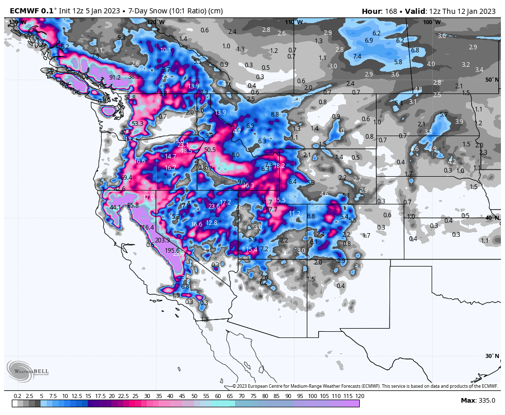
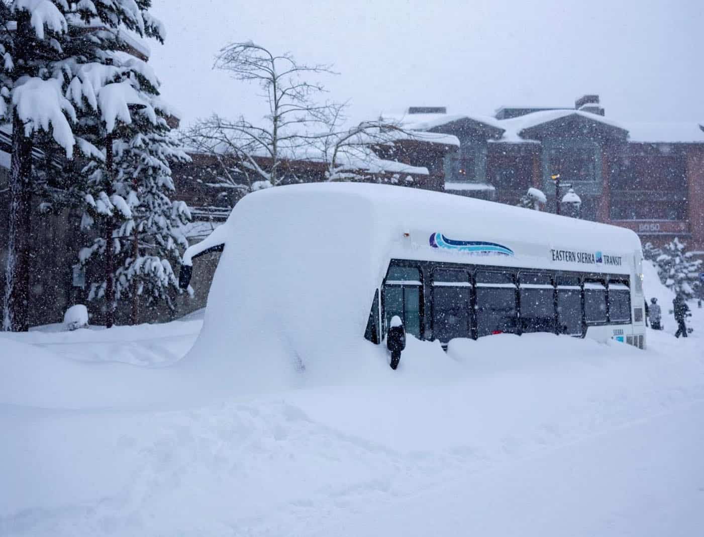
A constant stream of S-SW winds will continue hammer the Sierras as it has done over the last week or more, as Reggae aptly summed up in his World Snow Wrap. Over 1-2m of snow should fall, but freezing levels will soar up to 2,500m for a time with rain falling on lower slopes.
It’ll be a similar story for the Cascades and Canadian Coastal Ranges, where good precipitation totals are lined up, but it’ll be a heavy mix of rain and snow. A quiet period for the Rockies of Canada and the South will see resorts there pick up mere scraps, while mountains in Idaho will bear the brunt of the S-SW flow and pile on about 0.5-1m.
Thursday Jan 5thto Saturday Jan 7th
The Sierras will hit the ground running with heavy snowfall today (Thursday), as a tonne of Pacific moisture pushes hard up against the mountain range. That moisture will penetrate further inland with decent, yet lighter, snowfall instore for the central Rockies, which will clear up during Friday. Snow will again start falling in the Sierras during Saturday, becoming heavy at night.
Meanwhile, mild winds from the south will bring a lot of rain to the lower slopes of the Canadian Coastal Range over the next few days, and to a lesser extent the Cascades, which will thankfully fall as snow on mid-upper slopes. The Canadian Rockies will finally get a small slice of the action during Saturday with mostly light snowfalls getting underway, which will favour interior BC.
Sunday Jan 8thto Wednesday Jan 11th
The Sierras will again hog the headlines, with heavy snowfall expected Sunday through until late Tuesday. Temperatures will be an issue, however, as will the horrendously strong S-SW winds, especially on Monday as the freezing levels rise to near 2,500m, which will likely result in rain on the lower slopes of the Tahoe resorts.
The Cascades and Coastal Ranges will continue to see a lot of action too as a rapid-fire succession of frontal systems bring periods of moderate-heavy falls of that same rain and snow mix. A front stalling over the area during Wednesday will set up a prolonged rain and snow event, which may last into next weekend.
Further inland, high pressure over central and southern Rockies will see Colorado, Arizona and New Mexico missing out on much of the action as waves of Pacific moisture bring light-moderate snowfalls to the northern half of the Rockies during Sunday and Monday, from the Wasatch Range in Utah, northwards. Alberta will again only see scraps make it onto the eastern side, while resorts in Idaho will make the most of it, the aptly named Smokey Mountains bearing the full brunt of the strong SW flow.
Idaho will again do well as a low passes over the state during Tuesday and early Wednesday, while Montana, Wyoming and Utah also pick up another fresh top up. Light falls will eventually make it down into Colorado, Arizona and New Mexico during Wednesday between high-pressure systems, while the Canadian Rockies remain dry.
Next Thursday, Jan 12th & Beyond
Storms will continue to take aim at the Pacific Crest over the next seven-day period, with the Sierras picked to go massive again. Temperatures will also continue to be an issue, especially in the north, as the Pacific maintains a strong feed of moisture from the S-SW.
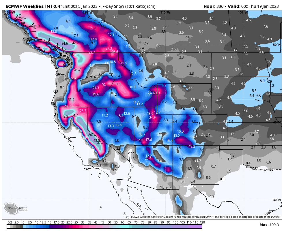
About average snowfall is likely for those resorts dotted along the Rockies that are exposed to the S-SW, but another slow period is instore for those on the eastern side, especially in Alberta.
Well, that’s all from me this week guys, see you next week.


