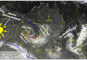
Australian Forecast – Mint Weather and Fresh Snow for Opening Weekend
Published early Wednesday, 3rd June 2026
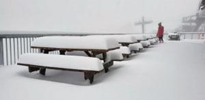
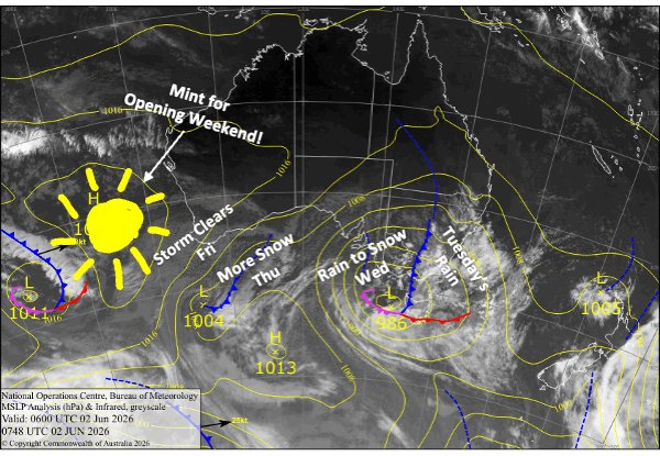
Only a few more sleeps till Opening Day, and the much-anticipated storm that is firmly upon us dropped around 15cm at Hotham, 10cm at Falls Creek, and 5cm on the New South Wales Monday night.
The storm turned wet and mild on Tuesday with 40mm of rain affecting this early snow, but we’re now entering the cold part of the storm. Temps will drop this morning and snow levels will gradually fall today, reaching the coldest point Thursday morning, before bouncing back up a little.
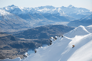
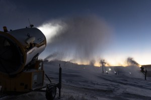
Come Friday, the storm clears up, and we should be looking at up to 30-45cm up high and 5-20cm about the lower slopes. With additional snowmaking, this may be enough to get us slippin’ and slidin’ on limited terrain under blue skies for Opening Weekend, which will be a fun one with plenty of après-ski activities on offer.
Wednesday 3rd June
We finally enter the colder phase of the storm as the low-pressure centre passes over Tasmania. Rain will gradually turn to snow as snow levels lower to around 1600-1700m during the morning, with accumulations of up to 15-25cm expected at these higher elevations for the day. Snow levels then fall to 1400-1500m at night, so we won’t see accumulations on the lower slopes until then.
Thursday 4th June
The storm reaches its coldest point during the morning as snowfall dips to 1300-1400m or lower for a time. Unfortunately, it’ll warm up again through the second half of the day, ironically as strong northwesterlies turn southwest, causing snowfall to gradually retreat to the upper slopes while rain dampens the mid-lower slopes. For the day, we should see around 5-15cm accumulate about the lower elevations, and up to 15-25cm up high.
Friday 5th June
The tail end of the storm will see remaining rain and upper-level snow clearing early, most likely before dawn, although snow showers could linger into the afternoon at Mt Baw Baw due to a direct hit from southwesterly winds. Only a dusting at most will be added to the storm tally. The atmosphere will then start to dry out, so clouds will part, and we’ll get some sunshine in before the day is done.
Saturday 6th June
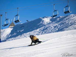
Opening Day is set to be a ripper with fresh snow after the storm and the resorts will be working hard to get at least some beginner terrain open. Reggae and his band of snow reporters will have the rundown on conditions and what lifts may open. The upper slopes will hold the most natural snow, while the runs down low will be bolstered by the man-made stuff. It’ll be nice and sunny for New South Wales resorts with light southwesterly breezes. The southwesterlies will be a touch stronger in Victoria and will push in some cloud amongst the sunshine.
Sunday 7th June
Day 2 of the season will be clear and sunny as light south-southwest breezes die out. It’ll be a warmer day, but the snowmakers will have added to the cover thanks to chilly overnight temperatures.
Extended Forecast
Skies will remain sunny for Monday’s holiday, topping off an excellent Opening Weekend. Temperatures will stay warm as northerly winds pick up.
From Tuesday, the 9th, we’ll have rain showers at times until a potential cold change arrives around the 12th-13th, with a shot of snow on the cards. Models aren’t aligned well on this, but they’re all trending colder through the middle of the month, so we can at least cross our fingers.
That’s all from me today, folks. I’m sending out these forecasts every Monday, Wednesday and Friday throughout the season. Have a great couple of days, and I’ll see you back here on Friday.
Grasshopper