SNOW HOLIDAY
ENQUIRY
The Grasshopper – The Latest Snow Forecast

The Grasshopper – The Latest Snow Forecast

Australian Forecast – A Wee Powder Boost for Perisher Before Spring Cranks Up the Sunshine


Published early Wednesday, 16th September 2026

The snow arrived right on cue yesterday evening, Tuesday, delivering a wee powder top-up of around 4cm on Perisher’s snow stake. It’s a little more than forecast, which is nice for a change, and the snowmakers made the most of the freezing temps, the snow guns adding an extra layer to it all.

Only Perisher remains open after Thredbo called it a season on Sunday. Morning cloud will clear for a mint afternoon today, Wednesday, before high pressure takes charge and dishes up a run of beautiful spring weather.

Thursday through Saturday will be mostly clear, sunny and increasingly warm, although there could be another couple of opportunities for the snow guns to fire up overnight. Sunday stays sunny, but strengthening hair-dryer northwesterlies will start nibbling away at Perisher’s already lean snowpack.

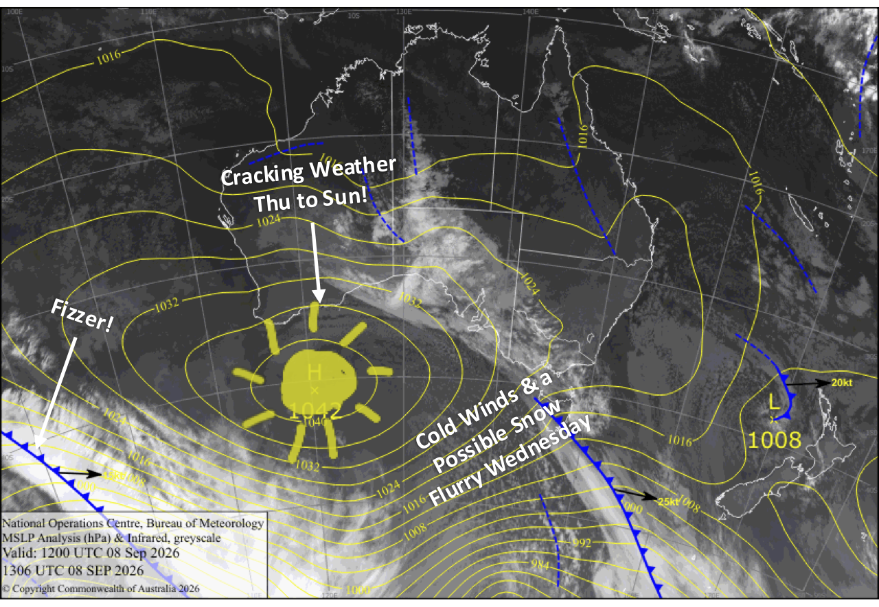
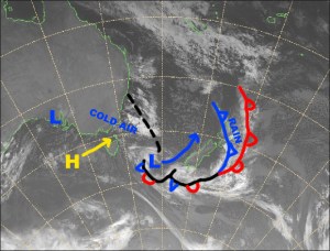
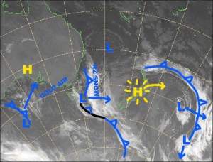
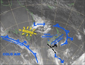
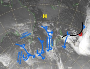
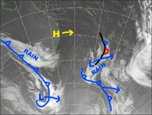
Latest pressure analysis and satellite image. Source: The BOM (vandalised by the Grasshopper)

Wednesday 15th September

Strong, cold southerlies will push in some morning cloud, but snow flurries to the south won’t quite reach Perisher. Skies will then clear for a mint afternoon as wind backs off. The snow guns will add even more man-made snow on top of last night’s natural powder early in the morning and again overnight.

Thursday 16th September

A blue dome corker as southerlies gradually die away. The snow guns may fire up again overnight with possible snowmaking conditions.

Friday 15th September

Another beautiful, warm, sunny day with a little high cloud as westerly breezes pick up. Possible snowmaking conditions again overnight.

Saturday 16th September

Nice, warm, and sunny with a brisk southwester about the upper slopes.

Sunday 17th September

Clear and sunny again with warm, hair-dryer northwesterlies strengthening, taking a wee nibble at the depleting snowpack.

Extended Forecast

High pressure drifting past will keep things fine and settled early next week, before a weak storm system likely brings rain showers on Thursday and Friday, the 24th and 25th September.

A stronger system could then deliver a more sizable bout of rain on the weekend of the 26th and 27th, along with strong hairdryer northwesterlies. There’s still plenty of uncertainty this far out, but if it comes off, it could deal a heavy blow to whatever’s left of Perisher’s snowpack.

That’s all from me today, folks. I’m firing out these forecasts every Monday, Wednesday and Friday for the rest of the season. Have a great couple of days, and I’ll see you back here Friday.

Grasshopper
New Zealand Forecast –  Clear Your Schedule, A Cracking Powder Day Coming Thursday!

Published early Wednesday, 16th September 2026

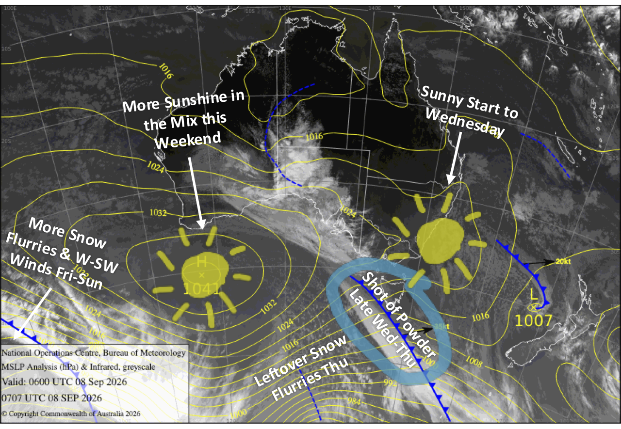
A juicy spring storm is lining up for the South Island, with a slow-moving front and cold southerly delivering widespread snowfall Wednesday into Thursday. Storm totals of 10-30cm are expected, with 40+cm possible at Treble Cone and Temple Basin, setting up a cracking powder day Thursday as skies gradually clear. Clear your schedule, pull some strings and get amongst it!

Things stay lively into the weekend. Friday will be quieter before another front barrels through early Saturday, followed by a cold southwest change after dark that’ll give the Southern Lakes a wee 2-5cm top-up overnight. Sunday then shapes up mint as skies clear across the South Island. Mt Ruapehu finally gets in on the powder action too, with the cold change whipping across the North Island and delivering 5-15cm before skies clear later in the day.

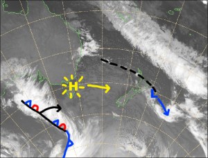
Latest pressure analysis and satellite image. Source: The BOM (vandalised by the Grasshopper)

Wednesday 16th September

A slow-moving front moves onto the lower South Island during the wee hours before dawn, spreading rain and mid-to-upper level snow over the Southern Lakes and up the Main Divide. A light but cold southerly then creeps over the Southern Lakes later in the morning/early afternoon, lowering snow to base levels where it’ll continue to fall for the rest of the day and into the night, keeping the slopes topped up with fresh powder.

In Canterbury, showers of rain and high-level snow will spill over from the Main Divide throughout the day, while strong northwesterlies back off during the afternoon as the cold change approaches from the south. The cold southerly pushes up the region after dark, bringing widespread snowfall down to low levels.

Another nice, sun-filled day for Mt Ruapehu as light westerlies turn northwest.

Thursday 17th September

South Island ski fields are in for a cracking powder day, with storm totals of 10-30cm expected once it all clears and 40+cm possible at Treble Cone and Temple Basin. Wax the powder skis because this is one powder day you won’t want to miss!

The snow clears the Southern Lakes early in the morning as southwesterlies develop, revealing clear, sunny skies. The clearing then gradually works its way north through Canterbury, from the Mackenzie area to Mt Hutt during the morning before pushing farther north in the afternoon.

Mt Ruapehu will be increasingly soggy and blustery, with drizzle gradually building into rain as the front from the south closes in and northwest winds strengthen.

Friday 18th September

Westerly winds will be strong in exposed parts of the Southern Lakes, with mostly cloudy skies and a few possible snow flurries.

Canterbury will be much nicer with mostly sunny skies as the westerlies gradually ease.

Rain clears Mt Ruapehu early morning as northwest winds die away, but showers will kick in from late morning as light southerlies develop.

Saturday 19th September

Northwesterlies crank up over the South Island before dawn, reaching gale force in exposed areas, especially in Canterbury where lift operations may be hampered. A front then zips over from the west early in the morning, bringing a spell of rain and high-level snow spilling over the Main Divide.

Skies then clear for a nice, long sunny spell through the afternoon before a strong, cold southwest change rips through after dark, giving the Southern Lakes a wee 2-5cm top-up and Canterbury just a skiff.

Mt Ruapehu will be nice first thing, but the front soon arrives from the south, bringing strong westerlies and rain through the rest of the day.

Sunday 20th September

Lingering light snow showers over the Southern Lakes and cloud in Canterbury clear during the morning as strong southwesterlies gradually ease, leaving clear, sunny skies for a mint afternoon.

Rain on Mt Ruapehu turns to snow before dawn as a cold south-to-southwest change whips across the North Island, delivering a fresh 5-15cm top-up before clearing in the evening.

Extended Forecast

A couple more cold fronts will scoot up the country early next week, bringing shots of powder to Kiwi ski fields from Monday the 21st through Wednesday the 23rd. Totals don’t look huge, but the Southern Lakes and Mt Ruapehu are well placed to cash in, with snow possibly lingering on Ruapehu into Thursday.

A short break should follow before active spring westerlies return later in the week, bringing more shots of shots, strong winds, and sunny spells. Classic four-seasons-in-a-day spring weather.

That’s all from me today, folks. I’m sending out NZ forecasts every Monday, Wednesday and Friday throughout the season. Have a great couple of days, and I’ll see you back here on Friday.

Grasshopper
Weekly Japan Forecast – A Better Week Ahead With More Snow & Colder Temps

Written late Wednesday, 4th March (Japan Standard Time)

Well folks, this will be my final forecast for the 2025–2026 Japanese snow season. It’s been a solid month of limited snowfall and unseasonably warm temperatures across Japan, with the past seven days in particular delivering very little fresh snow. After an epic January and early February, the Japow machine has largely switched off, and we’ve seen considerable snow loss as a result.

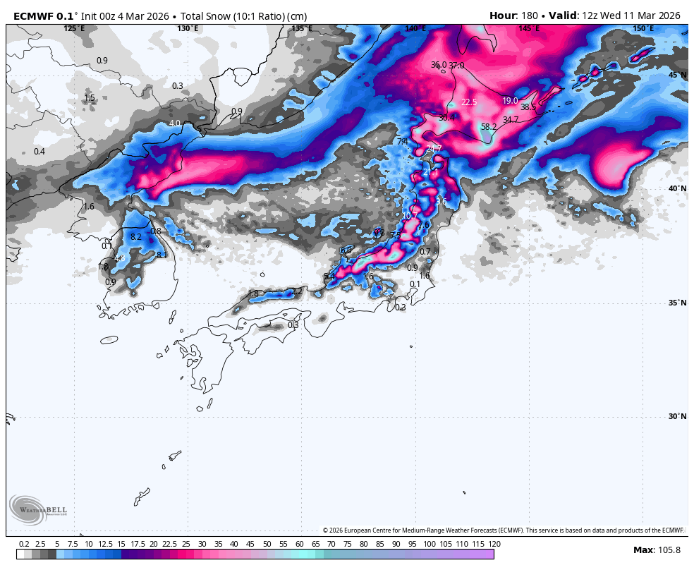
However, the next seven days look far more promising, with a few decent rounds of powder and cold temps on the way. Thursday, Sunday and Tuesday are shaping up as the standout days, with the bulk of the snowfall expected then. There are still a few weeks left in the season, and spring skiing brings warmer temperatures, longer days and more sunshine. It’s my personal favourite, so get amongst it! 

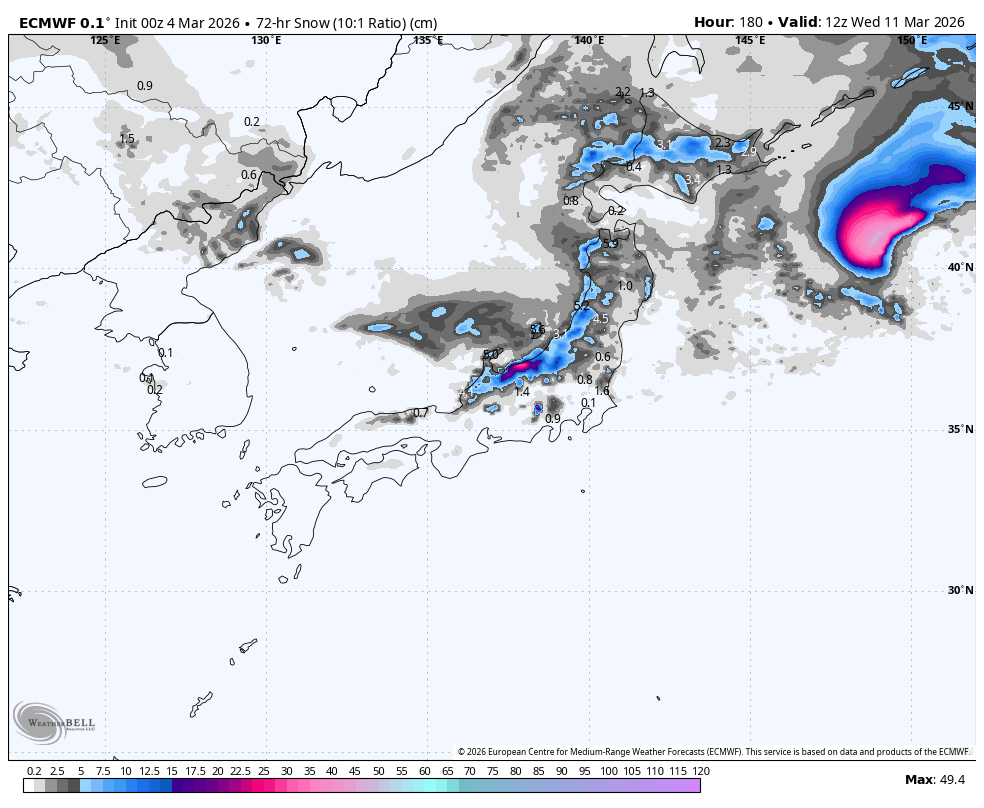
Weekly snowfall accumulation, from Wednesday morning, the 4th, to Wednesday, 11th March. Note that snow depths here are calculated using a 10:1 ratio, where 1mm of rain equals 1cm of snow. This can significantly underestimate things here in Japan, where 1mm of rain often equates to 1.5-2 cm of snow owing to its light n’ fluffy nature. Source: ECMWF, WeatherBell.com

Thursday 5th & Friday 6th March

Thursday will be a powder day of sorts as remaining snowfall across the country gradually dries up. This comes after a storm from the southwest arrived late Tuesday, bringing warm temperatures and rain at first. Temperatures were quick to drop over Northern Honshu and Hokkaido, so there was fresh snow in this Wednesday morning’s reports. However, it was not your usual “lake-effect” Japow; it was denser, maritime snow coming off the Pacific Ocean, akin to what we get in Australia and NZ. As I put pen to paper, snow levels over Central Honshu are also on their way down from the mid-slopes and will get nice and low this Wednesday night.

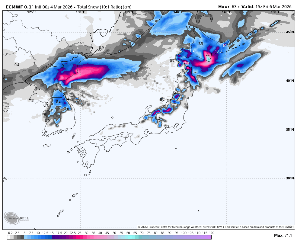
Friday will stay mostly dry, but there’ll be some isolated flurries lingering on Hokkaido. Temperatures will rocket back up on Honshu as warm southerlies develop ahead of the next storm approaching from the west in the Sea of Japan. Rain from this storm spreads across the country Friday night, falling as snow to fairly low levels on Hokkaido, where temperatures will be much colder.

Snowfall accumulation from Wednesday morning to Friday. Source: ECMWF, WeatherBELL.com

Saturday 7th February & Sunday 8th March

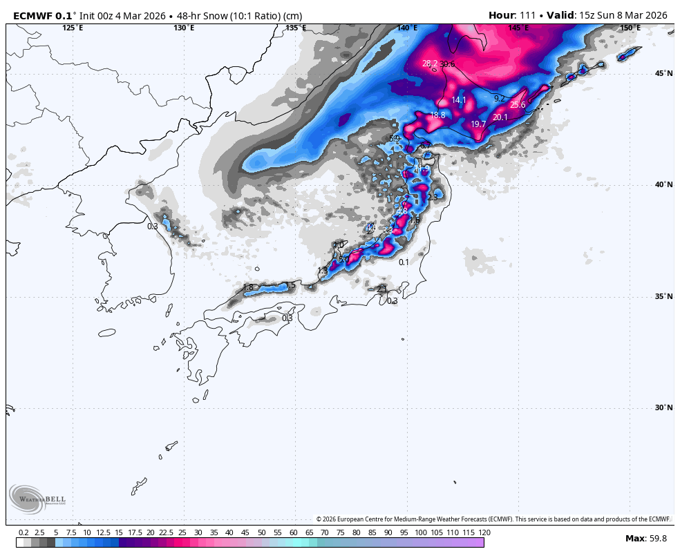
The storm will continue over the country throughout Saturday and Sunday morning, then gradually wind down during the latter half of Sunday. Snow levels about the mid-to-upper slopes of Honshu will gradually lower to base levels by late Saturday, while on Hokkaido, they’ll have to climb over a hill before a period of heavy snowfall to near sea level early Sunday.

Snowfall totals for the weekend are expected to be around 20-50+ cm, with resorts in Niigata and southwest Hokkaido favoured for the deepest totals.

Snowfall accumulation for Saturday & Sunday. Source: ECMWF, WeatherBELL.com

Monday 9th to Wednesday 11th March

Leftover snow showers over northern Honshu will clear up Monday morning, but will persist on Hokkaido.

Central Honshu will stay dry on Monday, but another low-pressure system passing on the Pacific side will pull in a fresh surge of cold air from Monday night, bringing another round of snow for a 10-30+ cm powder day on Tuesday. The passing low will also bring a dusting to northern Honshu and Hokkaido on Tuesday.

A ridge of high pressure will then bring dry, settled weather next Wednesday.

Snowfall accumulation for Monday to Wednesday. Source: ECMWF, WeatherBELL.com

That’s all from me today, and for the season. It’s been a real pleasure bringing you all the snowlights of the 2025-2026 season, which will go down in the history books as having one of the best runs of powder days from Jan through early Feb. See you in June when the Aussie and Kiwi seasons get underway.

Grasshopper

Weekly North America Forecast – Temps Fluctuate as Storms Favour the North

Written Wednesday, 5th March (Pacific Standard Time)

Well, guys and gals, this will be my final forecast for the 2025-2026 North American snow season. It’s been a funny ol’ season that saw some Canadian resorts cranking through December with near-endless snowfall, followed by a long, warm, dry spell, which US resorts in particular suffered from as high-pressure took over the West, while the East went into a storm-laden deep freeze.

Storms returned to the West mid Feb, and resorts have had a great few weeks as snowpacks have bounced back. At present, snowpacks in the northern half of the Rockies, from Canada and Alberta down to Wyoming and Idaho, are sitting at or above their long-term median, highlighting where conditions have been the best this season.

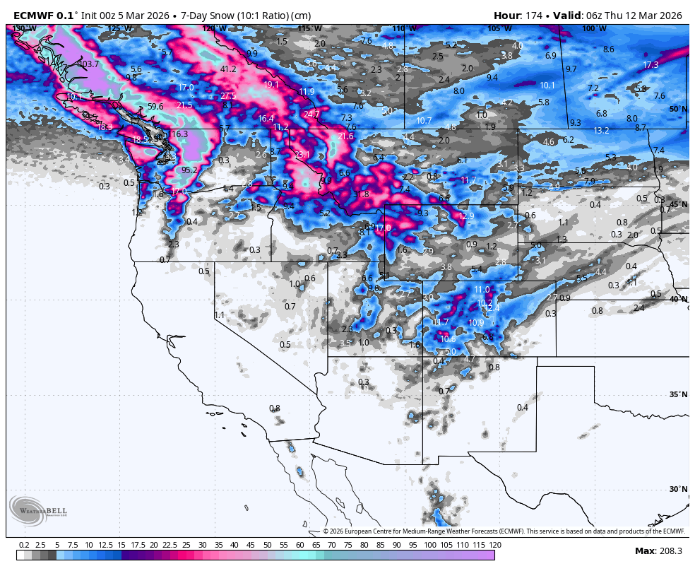
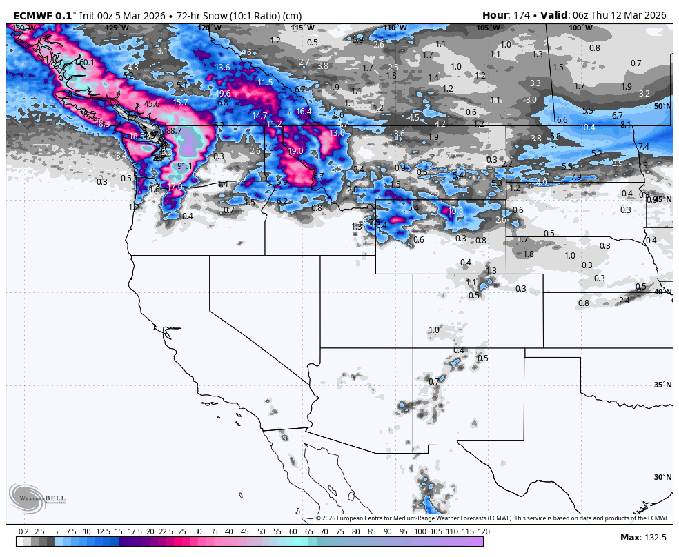
Storms will once again favour the north in the upcoming seven-day period, although snow quality and snow levels will fluctuate as warm and cold airmasses are dragged in with each storm system. The central and northern US Rockies will also receive a nice round of powder at the start of this period (Thursday and Friday), before settled high pressure then takes hold over the central and southern US.

7-Day snowfall accumulation. Note that snow depths here are calculated using a 10:1 ratio, where 1mm of rain equals 1cm of snow. This can significantly underestimate things here in North America, where 1 mm of rain often equates to 1.5-2 cm of snow, especially in the Rockies, where it can be really light n’ fluffy. Source: ECMWF, WeatherBELL.com

Thursday 5th & Friday 6th March

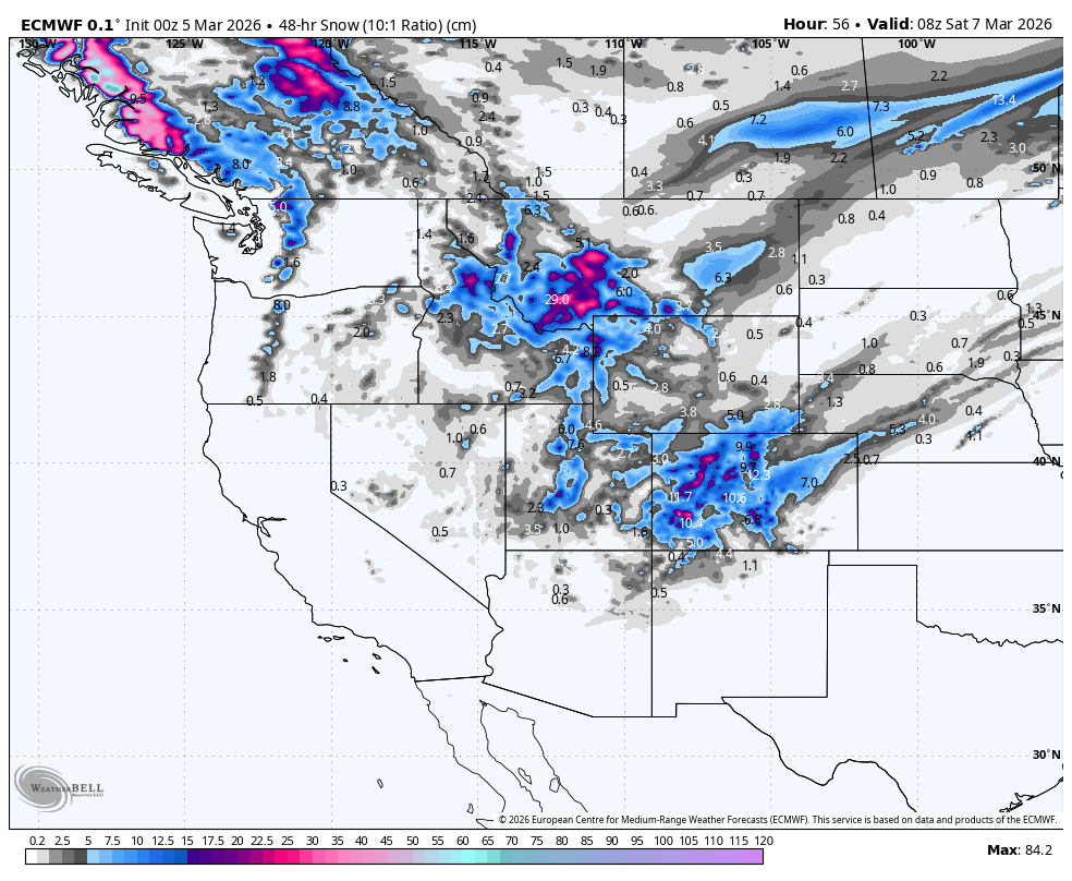
A storm that arrived in the northwest on Wednesday will continue tracking southeast through the US Rockies on Thursday before exiting late Friday. The storm, which started wet and warm, will see snow levels drop as a cold front now leads the charge. Snowfall will favour northern Idaho, Montana, Wyoming and Utah on Thursday and then Colorado on Friday. Totals will mostly range between 15-40cm in the central and northern US Rockies, with 40-50+cm possible in the most exposed terrain, particularly in Montana.

Leftover snow showers will give BC and the Cascades a further dusting before the storm exits the area on Thursday. But a new storm entering the northwest from late Thursday through Friday will bring a mix of rain and dense snow as a warm, humid air flows in from the Pacific. The bulk of this will fall in northern BC, with only light falls in southern BC, where most resorts are located.

Having received a few showers on Wednesday, Tahoe and the Sierra Nevada will stay dry for Thursday and Friday, while Arizona and New Mexico will only get a light dusting in their northern parts.

Snowfall accumulation for Thursday & Friday. Source: ECMWF, WeatherBELL.com

Saturday 7th & Sunday 8th March

This weekend, all the action will take place in the north. The warm storm that arrives here on Friday will become colder on Sunday as a cold front pushes down from the north. Once the cold front hits, snow levels will drop, and snow quality will improve.

Interior BC, the northern Cascades, and to a lesser extent, Alberta, will be favoured for the biggest accumulations of this quality powder during the latter half of Sunday, while Idaho, Montana and Wyoming will also see snow developing ahead of the cold front on the warm side of the storm.

Snowfall accumulation for Saturday & Sunday. Source: ECMWF, WeatherBELL.com

Monday 9th to Wednesday 11th March

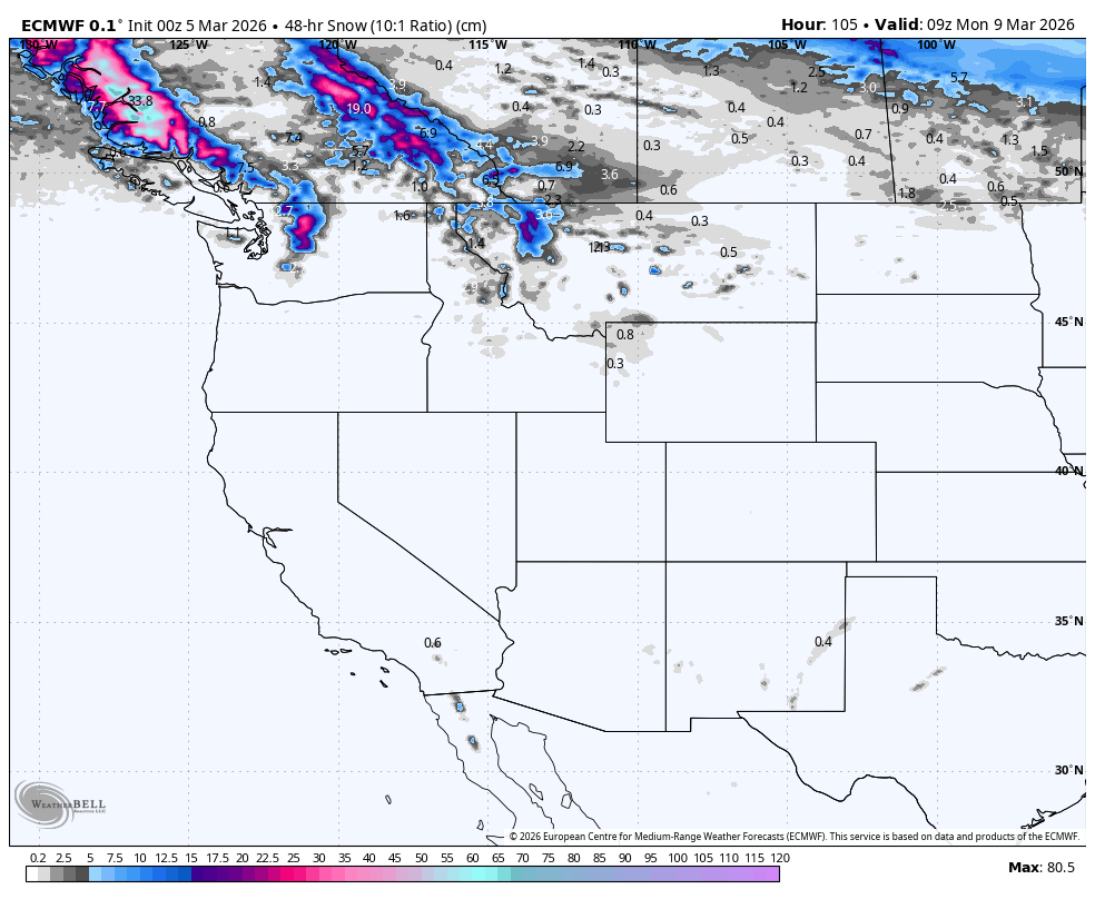
Most of the action continues in the north during this period, with the cold front pushing down into southern Idaho and Wyoming during Monday, where it’ll stall for a while. Areas north of this will be treated to light-to-moderate falls of smoky powder on Monday and Tuesday.

But on Wednesday, temperatures and snow levels will rocket up as a new, warmer storm enters the fray, bringing heavy low-to-mid-level rain and upper-level snow. The northern Cascades, in particular, are expected to get nailed. Thankfully, this injection of warm, humid air will be short-lived, and by the end of the day (Wednesday), temperatures will be hastily making their way down.

In the south, a weaker storm system will track over Arizona and New Mexico on Monday and Tuesday. Temperatures will be warm, so it’ll be a mix of rain and snow for resorts there. If we’re lucky, some resorts could see moderate accumulations on their upper slopes.

Snowfall accumulation for Monday to Wednesday. Source: ECMWF, WeatherBELL.com

That’s all from me today, and for the season. It’s been a blast and a pleasure being a part of it all. See you all in June when the Aussie and Kiwi seasons get underway.

Grasshopper

Latest Outlooks

1 59 60 61 62 63 68