Australian Forecast – More Freshies & a Fine Spell Before Major Storm Hits Sunday
Published early Wednesday, 5th August 2026
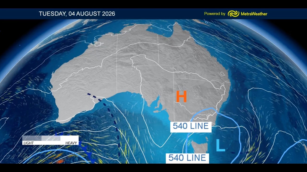
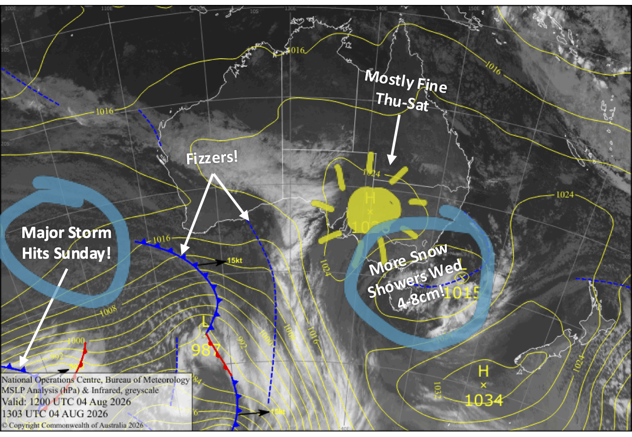
A storm system slowly sliding beneath us has brought a chilly, breezy start to the week with light snowfall keeping the slopes topped up with a thin layer of fresh powder on top of a firm snowpack. Resorts reported that 1-5cm had fallen by Tuesday morning, and another 5cm has built up on Perisher’s Snow Stake at the time of writing in these early hours of Wednesday. Snow is still coming down, and we should see another 4-8+ cm by the time it clears Wednesday night.
We’ll have great conditions from Thursday to Saturday as a high-pressure system swings past, bringing mostly settled, sunny skies. Make the most of it, because the weather turns nasty on Sunday as one of the more powerful storms of the season moves in with heavy rain and severe gales to boot.
However, snow will fall at high elevations with significant accumulations possible, and then an abrupt cold change Sunday night sees snow levels plummet with a burst of heavy snowfall to base levels. Snow showers continue through Monday, and by the end of the day, we could be looking at storm totals of between 15-40cm about the lower and mid elevations, and up to 50-70cm about the tops due to the high-level snow during Sunday. We’ll receive even more snow early next week as this season continues to build.
Wednesday 5th August
The slopes will be kept nice and dusty as snow showers, flurries and cold winds from the westerly quarter continue throughout the day. The snowfalls eventually peter out at night as the winds start to ease, leaving an extra 4-8cm layer of powder, although Mt Baw Baw could receive a few centimetres more.
Thursday 6th August
New South Wales will be mostly sunny, while Victoria will be mostly cloudy with a snow flurry or two, but it’ll brighten later in the afternoon as high pressure pushes in. Light west-to-northwest breezes, and cold snowmaking temps early morning and at night.
Friday 7th August
A gorgeous, bluebird day in New South Wales with little to no wind. There’ll be cloud in Victoria, especially in the west, but it’ll gradually break up and clear in the afternoon as west-to-southwest breezes ease. Cold snowmaking temps again early morning and at night.
Saturday 8th August
Fine with increasing high cloud as northerly winds pick up.
Sunday 9th August
A powerful storm moves in early, with heavy rain and high-level snow, and severe-gale north-to-northwesterlies developing. A late cold change will see snow levels plummet to, or below, base levels with heavy falls. It’ll be a super rough day, so expect resort closures and limited lift operations.
Monday 10th August
Snowfall backs off to snow showers early, providing fresh refills throughout the day. Strong, chilly west-to-northwest winds
Extended Forecast
We’ll continue to pile on the snow from Tuesday the 11th to Thursday the 13th of August as a couple more storm fronts cross. Conditions will be all-time through the back half of the week as high pressure moves in for a run of settled fine days.
That’s all from me today, folks. I’m firing out these forecasts every Monday, Wednesday and Friday throughout the season, and an extra update on Sundays during peak season. Have a great couple of days, and I’ll see you back here on Friday.
Grasshopper